
Strong eruption of Mount Soputan in Sulawesi after deadly M7.5 earthquake and tsunami, Indonesia
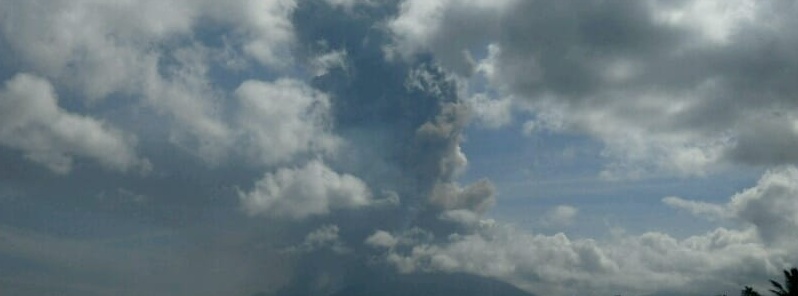
Featured image: Eruption of Mount Soputan on October 3, 2018. Credit: CVGHM
Mount Soputan in North Sulawesi erupted early Wednesday, October 3, 2018, producing volcanic ash column up to 6.8 km (22 000 feet) above sea level. Authorities have increased the Alert Level from 2 to 3 (of 4), warning residents not to approach within 4 – 6.5 km (2.5 – 4 miles) of the crater. The Aviation Color Code was raised to Red. The last eruption of this volcano took place in 2016 (VEI 3).
Increase in the number of seismic events at the volcano has been detected since the end of August 2018, Soputan Volcano Observatory reported 22:46 UTC on October 2, raising the Aviation Color Code from Green to Yellow.
The eruption started at 00:47 UTC (08:47 LT) on October 3, with the ash-cloud top up to 5 809 m (18 589 feet) a.s.l., the observatory reported, adding that it may be higher than can be observed clearly.
"Eruption and ash emission is continuing and ash-cloud is moving WNW," it said
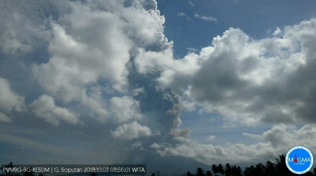
At 04:18 UTC, the ash-cloud top was estimated at around 6.8 km (21 789 feet) a.s.l. (possibly higher) and the observatory raised the Aviation Color Code to Red.
Seismic activity is characterized by the continuous volcanic tremor.
Ash is drifting to the west and northwest and it will not disrupt flights, authorities said, adding that Sam Ratulangi International Airport in Manado is still operating normally.
The Center for Volcanology and Geological Hazard Mitigation (CVGHM) has advised local residents not to approach within 4 km (2.5 miles) of the summit and as far as 6.5 km (4 miles) west-southwest from the summit to avoid the potential threat of lava and pyroclastic flows.
CVGHM advised residents to prepare face masks in case of ash fall and the North Sulawesi Disaster Mitigation Agency has started distributing them.
The community must be aware of the potential threat of lava flows that can occur during an eruption, especially in Ranowangko River, Lawian River, Popang River and Londola Kelewahu.
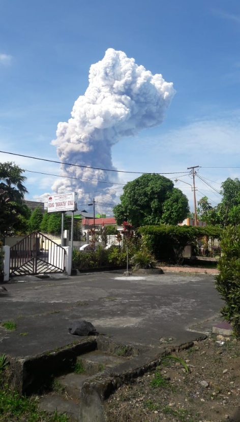
Image credit: BNPB
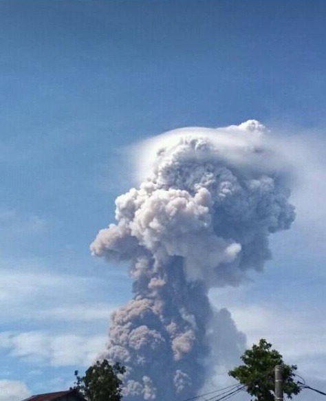
Image credit: BNPB
AVISO:
Entra en erupción el volcán #Soputan en #Sulawesi #Indonesia justo un día después del #terremoto y #tsunami
Columna de cenizas a 4km de altura.
Oct 3/2018
Créditos Omong Kosonghttps://t.co/q1lNBkf96F pic.twitter.com/fH4XP3DHTF— Geól. Sergio Almazán (@chematierra) October 3, 2018
Terjadi erupsi G. Soputan, Sulawesi Utara dengan ketinggian kolom abu 3000-4000 meter, mengarah ke arah Barat-Barat Laut. Zona bahaya radius 4km, dan sektoral arah barar-barat daya 6.5km. pic.twitter.com/x4swF8pS7I
— MAGMA Indonesia (@id_magma) October 3, 2018
Sejak pagi hingga malam Gunung Soputan meletus keluarkan abu vulkanik setinggi 4.000-6.000 meter keluarkan. Guguran lava dan awan panas mengarah ke barat-baratdaya. Status Siaga. Dilarang beraktivitas di dalam radius 4 km dan perluasan ke arah Barat-Baratdaya sejauh 6,5 km. pic.twitter.com/aK9uy4soTw
— Sutopo Purwo Nugroho (@Sutopo_PN) October 3, 2018
The last eruption of this volcano took place from January 2 to February 7, 2016. It had Volcanic Explosivity Index of 3. Previous eruptions were in 2015, 2012, 2011, 2008, 2007…
Geological summary
The small Soputan stratovolcano on the southern rim of the Quaternary Tondano caldera on the northern arm of Sulawesi Island is one of Sulawesi's most active volcanoes. The youthful, largely unvegetated volcano rises to 1 784 m ( 5 853 feet) and is located SW of Sempu volcano.
It was constructed at the southern end of a SSW-NNE trending line of vents. During historical time the locus of eruptions has included both the summit crater and Aeseput, a prominent NE-flank vent that formed in 1906 and was the source of intermittent major lava flows until 1924. (GVP)
I'm a dedicated researcher, journalist, and editor at The Watchers. With over 20 years of experience in the media industry, I specialize in hard science news, focusing on extreme weather, seismic and volcanic activity, space weather, and astronomy, including near-Earth objects and planetary defense strategies. You can reach me at teo /at/ watchers.news.
Commenting rules and guidelines
We value the thoughts and opinions of our readers and welcome healthy discussions on our website. In order to maintain a respectful and positive community, we ask that all commenters follow these rules.