
Tropical Storm “Trami” forms west of Guam, expected to become another super typhoon
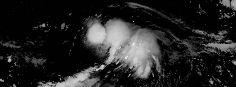
Featured image: Tropical Storm "Trami" at 17:20 UTC on September 21, 2018. Credit: JMA/Himawari-8, RAMMB, CIRA
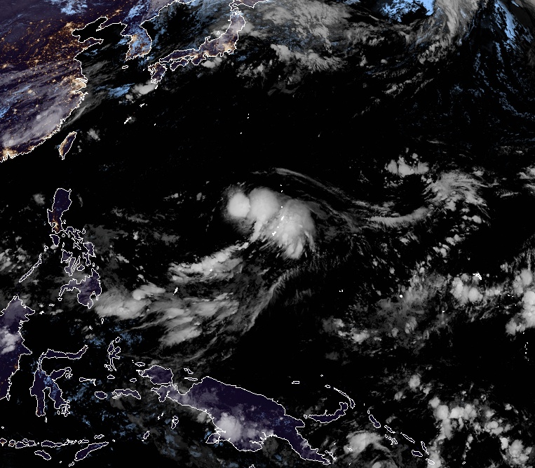
Tropical Storm "Trami" formed September 21, 2018 west of Guam as a 24th named storm of the 2018 Pacific typhoon season. This storm is expected to become a super typhoon around September 25. Take a look at the GFS model below to see its potential track.
At 15:00 UTC on September 21, the center of Tropical Storm "Trami" was located approximately 333 km (207 miles) northwest of Guam and has tracked WNW at 18 mph (11 mph) over the past 6 hours. The storm had maximum sustained winds of 75 km/h (45 mph).
The environmental analysis shows the system continues to experience favorable vertical wind shear and continues to have excellent radial outflow. Sea surface temperatures also remain favorable for continued development.
Tropical Storm "Trami" at 17:20 UTC on September 21, 2018. Credit: JMA/Himawari-8, RAMMB, CIRA
Rapid intensification is forecast and Trami is expected to quickly reach 157 km/h (98 mph) by 15:00 UTC, September 23 and 204 km/h (126 mph) by 15:00 UTC on September 24.
It's still too early to be sure, but Trami could become quasi-stationary after September 25.
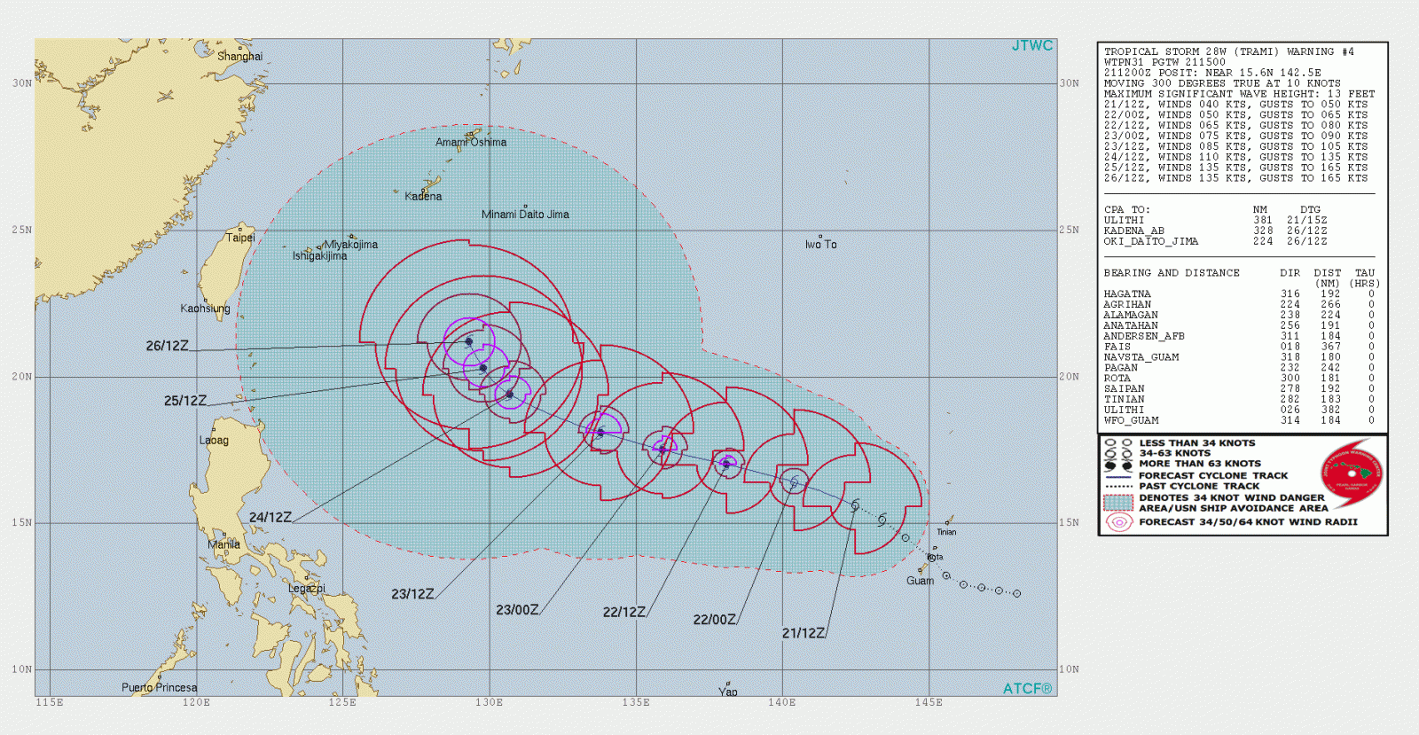
With favorable vertical wind shear and warm sea surface temperatures, Trami should reach an intensity of 250 km/h (155 mph) by 12:00 UTC on September 25 and up to 260 km/h (161 mph) between September 25 and 26.
I'm a dedicated researcher, journalist, and editor at The Watchers. With over 20 years of experience in the media industry, I specialize in hard science news, focusing on extreme weather, seismic and volcanic activity, space weather, and astronomy, including near-Earth objects and planetary defense strategies. You can reach me at teo /at/ watchers.news.
Commenting rules and guidelines
We value the thoughts and opinions of our readers and welcome healthy discussions on our website. In order to maintain a respectful and positive community, we ask that all commenters follow these rules.