
Over 200 000 without power as severe thunderstorms hit parts of US
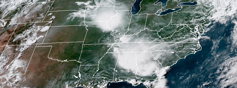
Image credit: NASA/GOES-East. Acquired 21:30 UTC, June 28, 2018.
More than 200 000 homes and businesses were left without power after severe thunderstorms swept through parts of the United States on Thursday, June 28, 2018. One man was killed in a storm-related accident in Lineville, Alabama.
Strong winds and heavy rain affected areas from mid-Mississippi Valley to the Gulf Coast on Thursday, downing trees and power lines and leaving over 200 000 people without power.
As of 13:00 UTC on June 29, more than 56 000 customers were still without power in Alabama, 42 000 in Illinois, 24 000 in Missouri, 13 000 in Minnesota and 9 600 in Oregon, according to PowerOutage.us.
Almost all of Thursday's outages were in Alabama where a 70-year-old woman from Huntsville was struck by lightning. State emergency officials confirm that they transported her to the Huntsville Hospital Trauma Unit.
Witnesses say a seawall is being constructed in the neighborhood, adding that the victim was outside to inspect the project and standing under a tree. A construction worker said they saw lightning strike the house, bounce off and hit the tree, before striking the victim.
Five people have been struck and killed by lightning by June 20 in the United States, with all five of the deaths occurring in the South. This is one more than this time last year, a year that ended up setting an all-time record low for lightning deaths in recorded history, AccuWeather meteorologists said.
A 29-year-old man was killed in a storm-related accident in Lineville, Alabama on Thursday afternoon when the car he was driving collided with a fallen tree.
A very brief yet strong EF-1 tornado with estimated peak winds of 177 km/h (110 mph) was reported in Hickman County, Tennessee. The tornado formed at the apex of the bowing segment that moved through much of western middle Tennessee midday on Thursday.
This brief tornado began on buck branch road knocking down several trees and breaking several large limbs, NWS office in Nashville said. In addition, roof damage occurred to a home on this road with several outbuildings getting destroyed.
As the tornado moved southeast, two homes were struck on Mobley Ridge Road. One house was completely destroyed as the foundation shifted 2.4 – 3 m (8 – 10 feet) southeast with the majority of the house falling into the basement. Unfortunately, the house was only metal strapped (and not nailed or bolted/screwed) in a few places to the outer wall. One house occupant survived without injury while trying to get in the shelter.
The home next door sustained roof damage along with a garage and outbuilding getting destroyed. Eyewitness account stated he saw a skinny rope like tornado touch down in this area.
Several more trees were uprooted or had the tops snapped off in this area as well. The tornado continued southeast and weakened before knocking more trees down on Dunlap Road.
This house was destroyed as storms blew through Hickman County today- @NWSNashville is currently surveying the damage. #tnwx @nc5 pic.twitter.com/aVfDATVlbU
— Bree Smith (@NC5_BreeSmith) June 28, 2018
View from the Mobile Bayway tonight as a line of thunderstorms approaches. #ALwx @spann @NWSMobile pic.twitter.com/l0tLncN2KW
— Josh Emerson (@JoshEmersonWX) June 29, 2018
@spann @NWSMobile #ALWX #oba #mesoscalelinearconvective @Susie_in2arts #Helicopter getting out of dodge pic.twitter.com/y1XyuerKiR
— Michael Davis (@3111davi) June 29, 2018
Incredible capture of a shelf cloud that rolled through #NWFL Thursday evening. This was taken on Pensacola Beach by Sean Rogan! #flwx #alwx @StormHour pic.twitter.com/fomBpqY4nm
— Kaitlin Wright (@wxkaitlin) June 29, 2018
Here's a look at this evening's complex of storms from roughly 22,000 miles above the earth. This is the GOES 16 IR loop showing the cold cloud tops associated with the strong storm updrafts. pic.twitter.com/y7nnhqQLDs
— NWS Memphis (@NWSMemphis) June 29, 2018
Fallen tree at Avondale Park following yesterday’s storms. @spann #alwx pic.twitter.com/QmLtGHxpkG
— Craig Williams (@CraigWilliamsPR) June 29, 2018
"Every day when I come open my basement this is in my mind: He died right here in my yard."
Victim's girlfriend, neighbors remember man killed in storm-related crash in Lineville, Alabama Thursday #alwx #WVTM13 @ErinWVTM13 https://t.co/RoBqHEDvtx pic.twitter.com/Aqy1UoS1GQ
— #WVTM13 (@WVTM13) June 29, 2018
A large & ominous looking shelf cloud arriving over Daphne at Jubilee Square around 8 PM #alwx https://t.co/mSJNRZOOBD pic.twitter.com/7caUvYZk4O
— NBC 15 (@mynbc15) June 29, 2018
Severe thunderstorms and flash flooding is possible from the Upper Mississippi Valley to the Central Plains Friday and Saturday, June 29 and 30, the National Weather Service warns.
Showers and thunderstorms will continue to develop today near a surface low and along an attendant cold front as it pushes eastward through the north-central U.S. and into the upper Midwest by this weekend.
Some of the storms may contain severe weather and heavy to excessive rainfall, given plenty of moisture and instability present along the cold front.
The Storm Prediction Center has highlighted areas from the upper Mississippi Valley to the northern/central Plains on Friday within a slight risk for severe thunderstorms, with the slight risk area shifting eastward into parts of the upper Midwest/middle Mississippi Valley on Saturday.
Most of these storms should be fairly progressive, but heavy rainfall within some storms may be enough to produce isolated flash flooding, particularly across portions of the upper Midwest on Saturday.
Accordingly, WPC has placed this region within a slight risk for excessive rainfall/flash flooding.
I'm a dedicated researcher, journalist, and editor at The Watchers. With over 20 years of experience in the media industry, I specialize in hard science news, focusing on extreme weather, seismic and volcanic activity, space weather, and astronomy, including near-Earth objects and planetary defense strategies. You can reach me at teo /at/ watchers.news.
Commenting rules and guidelines
We value the thoughts and opinions of our readers and welcome healthy discussions on our website. In order to maintain a respectful and positive community, we ask that all commenters follow these rules.