
Europe lofts first Copernicus environmental satellite
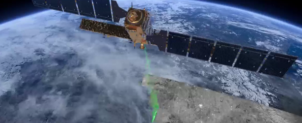
Image credit: TW
European Space Agency (ESA) launched Sentinel-1A satellite on April 3rd which opens a new page in the implementation of Copernicus, the second EU flagship space initiative, after the Galileo positioning system. The ability of European citizens, policymakers and service providers to access key environmental data on a routine basis has now taken a major step forward.
The mission is the first of six families of dedicated missions that will make up the core of Europe’s Copernicus environmental monitoring network. Copernicus will provide operational information on the world’s land surfaces, oceans and atmosphere to support environmental and security policymaking and the needs of individual citizens and service providers.
Designed as a two-satellite constellation – Sentinel-1A and -1B – the C‑band radar mission will provide all-weather day-and-night imagery of land and ocean surfaces of Europe, Canada and the polar regions in near‑real time.
In crisis situations, it will be used for rapid response to disasters such as floods and earthquakes. Its radar will routinely monitor shipping zones, map sea ice and provide information on winds and waves for marine traffic, track changes in the way land is being used, and monitor subsidence.
Equipped with a powerful ‘synthetic aperture radar’, it will ensure continuity with the European Envisat satellite, which stopped working in 2012 after 10 years of service. The technology is based on a long heritage of radar satellites, starting with ERS-1 23 years ago.
Video copyright ESA
“The launch of the first Sentinel-1 satellite marks a change in philosophy for our Earth observation programmes,” said Volker Liebig, ESA’s Director of Earth Observation Programmes. “In meteorology, satellites have been providing reliable data for weather forecasts for over 35 years.
“With the Copernicus programme, we will now have a similar information source for environmental services as well as for applications in the security and disaster management domain.”
In addition to transmitting data to a number of ground stations around the world for rapid dissemination, Sentinel-1 is also equipped with a laser terminal to transmit data via European Data Relay System satellites in geostationary orbit for continual data delivery.
The satellite’s solar panels and antenna are now being deployed in a complex sequence expected to take around 11 hours. The completion of deployment will be announced at www.esa.int/sentinel-1 and via Twitter @ESA_EO
After the initial ‘launch and early orbit phase’, the satellite will go into the commissioning phase, when all instruments will be checked and calibrated. The mission is expected to begin operations within three months.
Data from the Sentinel satellites will be provided on a free and open basis. Raw data will be analysed and processed by public and private sector service providers.
Featured image copyright: ESA
The Watchers team and our contributors bring the latest on extreme weather, earthquakes, volcanic eruptions, space weather, and all things science. We're all about making sense of the natural world and keeping you informed on what’s happening. Got a tip or a question? Hit us up using the form at newstips!
Commenting rules and guidelines
We value the thoughts and opinions of our readers and welcome healthy discussions on our website. In order to maintain a respectful and positive community, we ask that all commenters follow these rules.