
Tropical Storm Michael became Category 3 hurricane in less than 12 hours
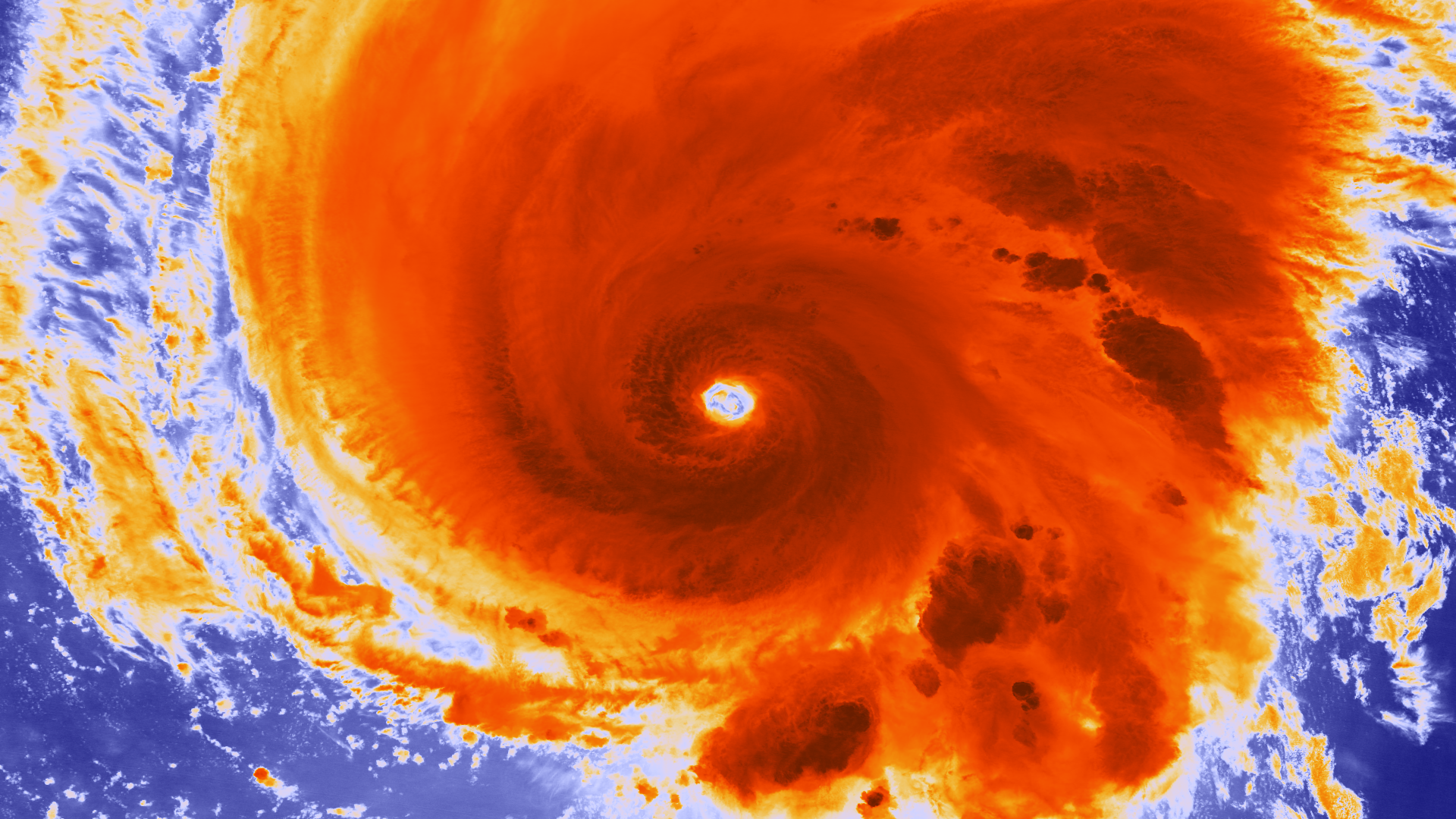
Image credit: The storm in high resolution infrared imagery from the NOAA/NASA Suomi NPP satellite taken on September 6, 2012 at 04:22 UTC
Michael became the first major hurricane of the season early this morning as it moved northeastward. Rapid intensification from a tropical storm to a Category 3 hurricane occurred in less than 12 hours as Michael entered a very favorable environment.
Michael is the 13th named storm of the 2012 Atlantic hurricane season.

At 15:00 UTC, the center of Hurricane Michael was located near latitude 30.1 north and longitude 41.3 west, about 980 miles (1580 km) WSW of the Azores. Michael is moving toward the northeast near 7 mph (11 km/h). A turn to the north and north-northwest with a decrease in forward speed is expected during the next 24 to 36 hours with a turn toward the northwest anticipated on Saturday.

Maximum sustained winds are near 115 mph (185 km/h) with higher gusts. Michael is a category three hurricane on the Saffir-Simpson hurricane wind scale. Little change in strength is forecast today with some gradual weakening commencing around Friday.
Hurricane force winds extend outward up to 15 miles (30 km) from the center and tropical storm force winds extend outward up to 70 miles (110 km).

Estimated minimum central pressure is 964 mB.
There are no coastal watches or warnings in effect.
There is a relatively small window of opportunity for the cyclone to strengthen a bit more before the upper-level wind environment becomes less favorable. Gradual weakening will be either due to a mid- to upper-level mid-latitude trough approaching from the northwest or the rather large outflow associated with Hurricane Leslie.

Satellite Animations
- Storm-Centered Infrared (GOES 13; NOAA/SSD)
- Storm-Centered Infrared (Aviation Color Enhancement) (GOES 13; NOAA/SSD)
- Storm-Centered Water Vapor (GOES 13; NOAA/SSD)
- Storm-Centered Visible (GOES 13; NOAA/SSD)
- Storm-Centered Visible (Colorized) (GOES 13; NOAA/SSD)
- Northeast Atlantic Infrared (Meteosat 9; NOAA/SSD)
- Northeast Atlantic Infrared (Aviation Color Enhancement) (Meteosat 9; NOAA/SSD)
- Northeast Atlantic Water Vapor (Meteosat 9; NOAA/SSD)
- Northeast Atlantic Visible (Meteosat 9; NOAA/SSD)
- Northeast Atlantic Visible (Colorized) (Meteosat 9; NOAA/SSD)
Commenting rules and guidelines
We value the thoughts and opinions of our readers and welcome healthy discussions on our website. In order to maintain a respectful and positive community, we ask that all commenters follow these rules.