
Powerful Typhoon Vicente making landfall in Guangdong, China
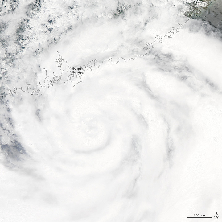
Image credit: The Moderate Resolution Imaging Spectroradiometer (MODIS) on NASA’s Aqua satellite captured this natural-color image of Vicente on July 23, 2012, as the storm clouds extended over Hong Kong and the surrounding region.
Powerful Typhoon Vicente is making landfall in Guangdong, China, just to the southwest of Hong Kong. Vicente strengthened rapidly over the past 12 hours and now is moving in near Macau and Pinghsa, China with maximum sustained winds equivalent to a Category 3 to 4 hurricane. Macau was in the eye wall and in the strongest part of the typhoon early Tuesday, which is the northeastern quadrant of the storm.
According to latest report by Joint Typhoon Warning Center (JTWC), Typhoon Vicente is located roughly 60 nautical miles southwest of Hong Kong. The storm has maximum sustained winds of 120 knots (220 km/h) with gusts up to 145 knots (270 km/h). The system is moving northwestward at speed of 10 knots.

Portions of Guangdong, China, is forecasted to receive up to 10-20 inches of rainfall which can produce severe flooding and mudslides. The heavy rain is expected to affect most of Guangdong and Guangxi, as well as Hainan Island, eastern Fujian, southern Yunnan, southern Jiangxi, and southern Hunan.

“Hot Towers” are an indication that tropical cyclones are likely to intensify within 6 to 9 hours, and NASA’s Tropical Rainfall Measuring Mission (TRMM) satellite spotted some in Tropical Storm Vicente’s southern eyewall when it passed overhead on July 22. A “hot tower” is a tall cumulonimbus cloud that reaches at least to the top of the troposphere, the lowest layer of the atmosphere. It extends approximately nine miles (14.5 km) high in the tropics. The hot tower in Vicente was over 9.3 miles (15 km) high. These towers are called “hot” because they rise to such altitude due to the large amount of latent heat. Water vapor releases this latent heat as it condenses into liquid.

Vicente formed as a tropical depression over the western Pacific Ocean on July 20, 2012, and strengthened to a tropical storm the following day. On July 23, Vicente strengthened to a typhoon.
As of July 23, the U.S. Navy’s Joint Typhoon Warning Center (JTWC) storm track forecast showed Vicente moving primarily westward across southeastern China and northern Vietnam over the next few days (see image bellow).

By the time Vicente approached the China coast, it had already caused substantial damage in the Philippines. Known there as Ferdie, the storm was blamed for two deaths, several people missing, impassable roads, and evacuations.
Sources: TRMM, MODIS, JTWC, China Meteorological News Press, Hong Kong Observatory
Commenting rules and guidelines
We value the thoughts and opinions of our readers and welcome healthy discussions on our website. In order to maintain a respectful and positive community, we ask that all commenters follow these rules.