
Iota expected to strike Central America as a major hurricane
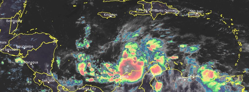
Featured image: Tropical Storm "Iota" at 09:00 UTC on November 14, 2020. Credit: NOAA/GOES-East, RAMMB/CIRA
Tropical Storm "Iota" formed in the Central Caribbean at 21:00 UTC on November 13, 2020, as the 30th named storm of the 2020 Atlantic hurricane season. Iota is expected to strengthen into a major hurricane before it makes landfall in Central America. The same region that saw major floods and landslides caused by Hurricane "Eta" — in which nearly 300 people lost their lives — will experience another round of heavy rain and strong winds. Landfall is expected early Tuesday, November 17. The time to prepare is now.
"2020 continues to add to the Atlantic named storm record," Dr. Philip Klotzbach, a meteorologist at the CSU, said. "The old Atlantic single-season named storm record was 28 named storms set in 2005."
"2020 is now tied with 1931, 1961, 2001 and 2005 for the most Atlantic named storm on record to form in November."
Iota is also the 5th Caribbean named storm formation since October 1, along with Gamma, Delta, Zeta, and Eta.
"The 2020 Atlantic hurricane season is now tied with 2005 for the most Caribbean named storm formations after October 1 on record," Klotzbach added.
If the current forecast verifies, Iota will intensify into a major hurricane before it makes landfall in Central America — this would make it the 2nd major hurricane to form this month. Eta was the first.
"Zero Atlantic hurricane seasons on record have had two major hurricane formations in November."
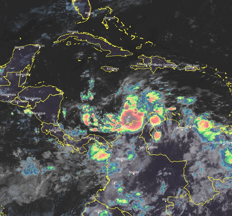
Tropical Storm "Iota" at 09:00 UTC on November 14, 2020. Credit: NOAA/GOES-East, RAMMB/CIRA
The Atlantic currently has two named storms simultaneously — Theta and Iota. This is the latest in the calendar year that the Atlantic hurricane season has had two named storms simultaneously since 1887.
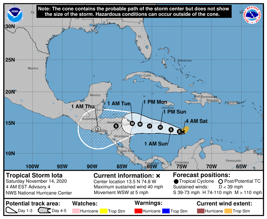
At 09:00 UTC on November 14, the center of Tropical Storm "Iota" was located about 545 km (340 miles) SSE of Kingston, Jamaica, and about 920 km (570 miles) E of Cabo Gracias a Dios on the Nicaragua/Honduras border.
Iota's maximum sustained winds were 65 km/h (40 mph) and minimum central pressure 1 005 hPa. It was moving WSW at 7 km/h (5 mph).
There are currently no coastal watches or warnings in effect but interests in Nicaragua and Honduras should monitor the progress of the storm. "Hurricane Watch will likely be issued later today for portions of these countries," NHC forecasters said. "Interests in San Andres and Providencia should also monitor the progress of this system."
A westward motion with some increase in forward speed is expected to begin later today and continue through Monday, November 16.
On the forecast track, Iota will move across the central Caribbean Sea during the next day or so, and approach the coasts of Nicaragua and northeastern Honduras on Monday.
Steady to rapid strengthening is likely over the weekend, and Iota is forecast to be a major hurricane before it makes landfall.
Honduras, northern Nicaragua, eastern Guatemala, and southern Belize could get 200 to 400 mm (8 to 16 inches) of rain from this system. Isolated maximum totals of 500 to 750 mm (20 – 30 inches) will be possible, especially from northeast Nicaragua into northern Honduras.
Costa Rica, Panama, and northern Colombia expect 100 to 200 mm (4 to 8 inches), with isolated maximum totals of 300 mm (12 inches). This rainfall would lead to significant, life-threatening flash flooding and river flooding, along with mudslides in areas of higher terrain.
El Salvador and southern Nicaragua are forecast to receive 50 to 100 mm (2 to 4 inches), with isolated maximum totals of 150 mm (6 inches). Jamaica 25 to 75 mm (1 to 3 inches).
Swells generated by Iota will affect portions of the coast of Colombia, and the southern coasts of Hispaniola and Jamaica during the next day or two. Swells will begin to reach the coasts of Nicaragua and Honduras on Monday.
These swells are likely to cause life-threatening surf and rip current conditions.
Parts of Central America were ravaged by Hurricane "Eta" after it made landfall as Category 4 hurricane on November 3.
Eta left nearly 300 people dead before it dissipated off the coast of North Carolina, U.S. on November 13.
Forecast models
I'm a dedicated researcher, journalist, and editor at The Watchers. With over 20 years of experience in the media industry, I specialize in hard science news, focusing on extreme weather, seismic and volcanic activity, space weather, and astronomy, including near-Earth objects and planetary defense strategies. You can reach me at teo /at/ watchers.news.
Please pray for the people of Central America as Iota will be the second natural disaster to hit there in 3 weeks.