• Tornado Watch issued for parts of Texas as storms move through Dallas-Fort Worth

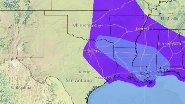
    A Tornado Watch remains in effect on Tuesday, March 4, 2025, for areas east of the Dallas-Fort Worth metroplex in Texas as a line of strong storms moves across the region. The storms are expected to clear the area by midday, after which a Red Flag Warning will take effect for Killeen in Central Texas. Strong, dry winds following the system—forecast to reach 40—55 km/h (25—35 mph) with gusts up to 80 km/h (50 mph)—will increase fire weather risks, shifting the primary hazard from severe storms to the potential for rapid fire spread.
  • Red Flag Warning issued for all of South Texas

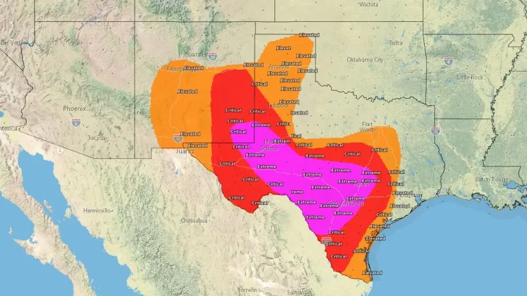
    A Red Flag Warning is in effect for South Texas from San Antonio to Port Mansfield, along with a Wind Advisory, both of which will remain in effect through much of Tuesday, March 4, 2025. Dry winds following a passing cold front will create dry conditions conducive to critical fire weather over the region.

  • Dust storm triggers 23-car pileup near Roswell, New Mexico

    A severe dust storm caused multiple crashes near Roswell, New Mexico, on Monday, March 3, 2025, including a 23-vehicle pileup on southbound Highway 285. Reports indicate at least 2 people have been severely injured and transported to a nearby health care center.

  • Two storm systems to hit California with rain and snow

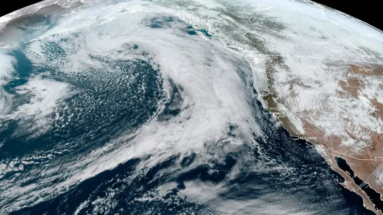
    Multiple mid-level shortwave troughs are expected to bring heavy rain and mountain snow to Central and Southern California from March 5 to 7, 2025. Forecasters warn of localized flash flooding and significant winter storm impacts, particularly in higher elevations.

  • Severe weather outbreak expected March 4 in Lower Mississippi Valley and Mid-South

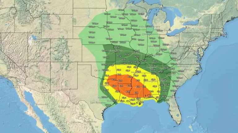
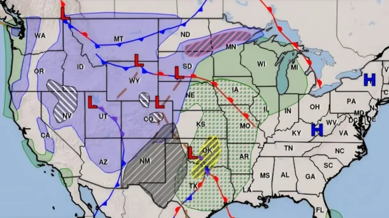
    A powerful storm is forecast to sweep through the central U.S., bringing in severe weather through mid-week as it moves from the Southern and Central Plains to the Great Lakes Region from Monday through Wednesday, March 3–6, 2025. A more significant severe weather outbreak is expected on Tuesday, March 4, in the Lower Mississippi Valley and Mid-South, with threats of strong winds, large hail, and possible tornadoes. The Storm Prediction Center has issued a Slight Risk (level 2 of 5) for parts of the Southern Plains today, while an Enhanced Risk (level 3 of 5) is in place for Tuesday and Wednesday across the Lower Mississippi Valley.