8 dead after multi-vehicle crash on the I-70 in Sherman County, Kansas
Eight fatalities were reported after a crash involving 71 vehicles occurred on the I-70 near milepost 28 in Sherman County on Friday, March 14, 2025.


Eight fatalities were reported after a crash involving 71 vehicles occurred on the I-70 near milepost 28 in Sherman County on Friday, March 14, 2025.

The multi-day severe weather outbreak has left at least 33 people dead across six U.S. states as storms and tornadoes continue to cause destruction. Missouri has reported the highest death toll with 12 fatalities, while Kansas, Mississippi, Texas, Arkansas, and Oklahoma have also suffered casualties.

A powerful dust storm swept across western Kansas on March 14, 2025, leading to multiple vehicle crashes and the closure of several highways.
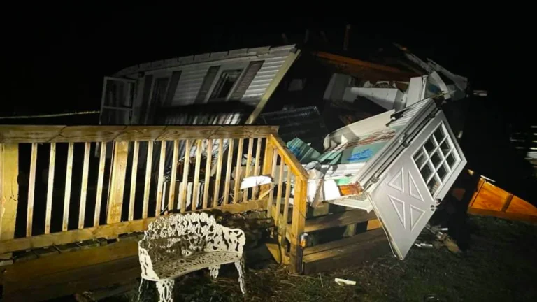
Multiple tornadoes have been reported in Missouri ripping through businesses, and homes, downing trees toppling vehicles along their paths on Friday, March 14, 2025.
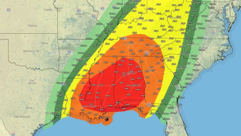
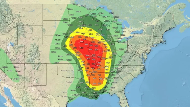
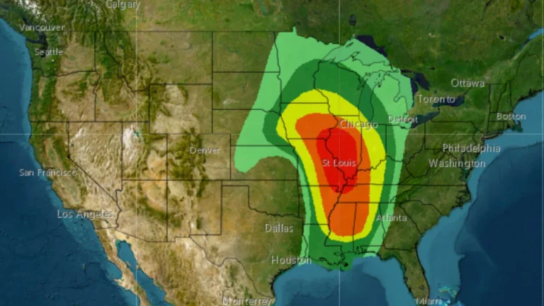
Severe storms will develop Friday, March 14, 2025, across the Central and Southern Plains into the Middle and Lower Mississippi Valley, where the SPC has issued a Moderate Risk (level 4/5) through Saturday morning. By Saturday, the threat shifts east, with a Moderate Risk in parts of the Tennessee Valley, Lower Mississippi Valley, and Southeast through Sunday morning. These storms may produce damaging winds exceeding 120 km/h (75 mph), hail larger than 5 cm (2 inches), and strong tornadoes rated EF-2 to EF-5.

At least 6 people were rescued on Thursday, March 13, 2025, after mudslides trapped multiple vehicles in San Jacinto City, California’s Riverside County, following two days of heavy rain.
A powerful surface low, forecast to reach pressures in the 970s hPa range, will move from the central Great Plains to the upper Midwest on Friday, March 14, 2025. This system will intensify the low-level jet, with wind speeds approaching hurricane force, drawing warm, moist air northward. By sunset, dew points near 16°C (60°F) are…
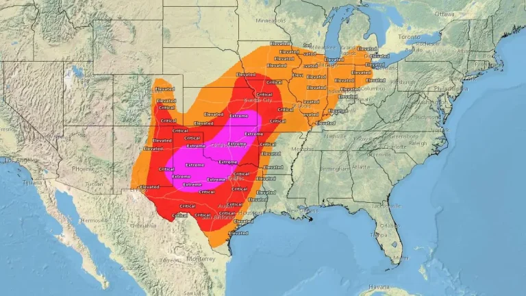
Extremely critical fire weather conditions are forecast for Friday, March 14, 2025, across parts of the southern Plains and Midwest due to historically strong winds and low humidity. A wildfire outbreak is possible in the southern Plains, with fast-moving and uncontrollable fires likely. Wind gusts between 95–130 km/h (60–80 mph) may cause rapid fire spread and significant danger to affected areas.

A rare EF-0 touched down in Pico Rivera, California at around 03:15 PST (10:15 UTC) on Thursday, March 13, 2025, damaging multiple structures and uprooting trees along its path.
Millions are bracing for a major storm system forecast to bring severe weather across the U.S., including damaging winds, heavy snowfall, and the threat of tornadoes. The system is set to bring blizzard conditions to the West, severe thunderstorms to the Midwest, and critical fire weather to the Southern Plains, impacting millions through the weekend.