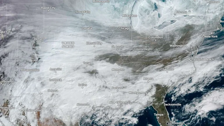
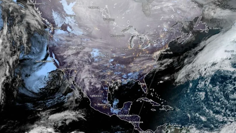
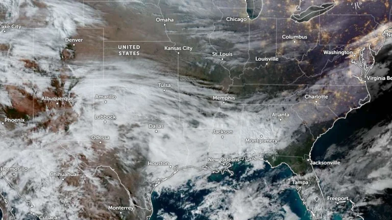
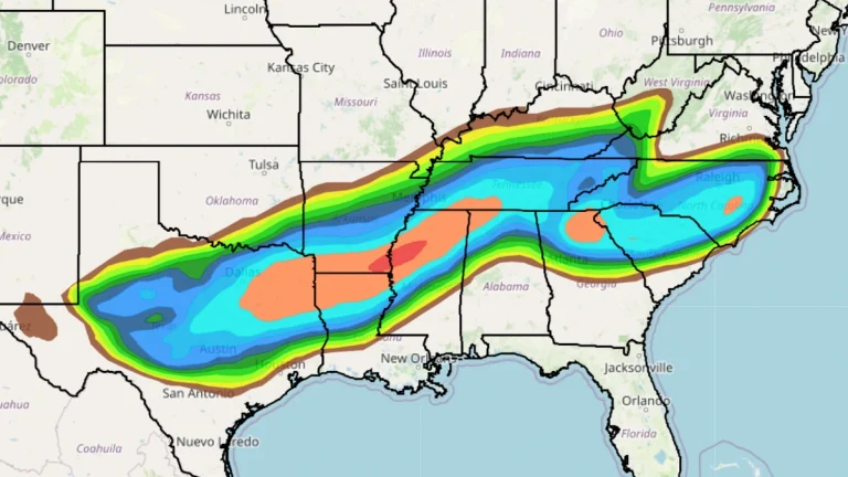
• Blizzard conditions and destructive winds forecast for the northern Plains and northern Rockies, U.S.

    A fast-moving winter storm is forecast to bring widespread blizzard conditions and destructive winds across parts of Montana, North Dakota, and Minnesota through Wednesday night into Thursday, December 17 into 18, 2025. The system, driven a deep low-pressure trough, is generating gusts up to 110 km/h (70 mph) and localized peaks over 130 km/h (80 mph) in leeward mountain areas, potentially leading to whiteout conditions, road closures, and power outages across the region.

  • Above-normal atmospheric river activity forecast for Northern and Central California in late December

    The Center for Western Weather and Water Extremes (CW3E) at UC San Diego forecasts above-normal precipitation for Northern and Central California between late December 2025 and early January 2026. The latest subseasonal outlook, issued on December 16, indicates high confidence in enhanced atmospheric river (AR) activity and persistent Pacific Ridge conditions during the period from December 22 to January 11, 2026.

  • Weak La Niña to end as ocean warming signals new El Niño phase in 2026

    Forecast models suggest that El Niño conditions are likely to develop during 2026, marking a shift from the ongoing weak La Niña. The transition is expected to influence jet stream patterns and temperature anomalies across the United States, Canada, and Europe, potentially reshaping rainfall distribution and winter storm activity in the Northern Hemisphere.

  • Powerful winter storm leaves over 1.5 million people without power across Washington, Oregon, and Idaho

    A powerful winter storm hit the Pacific Northwest and parts of the inland Northwest on December 17, 2025, causing widespread power outages across Washington, Oregon, and Idaho. At least 596 830 electricity customers were left without power, an impact estimated to affect approximately 1.4–1.6 million people across the region, as strong winds damaged power infrastructure and disrupted services.

  • Washington state in the middle of a historic crisis as flooding impacts continue

    Historic flooding in December 2025 placed Washington state in the middle of a statewide crisis, with impacts ongoing and damage assessments still underway as of December 17. Prolonged heavy rainfall has inundated communities, damaged levees and transportation infrastructure, and forced large-scale evacuations across multiple counties. At least one person died after driving into deep floodwaters.

  • High Wind Warnings issued for the Rockies, Plains, and Pacific Northwest, U.S.

    High Wind Warnings have been issued across much of the western and central United States, effective from early Wednesday, December 17, 2025, through Thursday morning, December 18. Forecasts indicate a rapidly deepening low-pressure system developing east of the Canadian Rockies, producing winds of over 130 km/h (80 mph) in some areas. Power outages, tree damage, and hazardous travel conditions are expected from the Intermountain West to the Great Plains.

  • Back-to-back atmospheric rivers forecast to impact the U.S. West Coast through December 20

    Two atmospheric rivers are forecast to bring prolonged heavy rain and mountain snow to the Pacific Northwest and northern California through December 20, 2025. The Weather Prediction Center (WPC) forecasts 100–150 mm (4–6 inches) of precipitation across western Washington and 100–200 mm (4–8 inches) across western Oregon, with locally higher totals in the Cascades and coastal ranges.

  • Freeze warnings in effect across parts of Florida, Georgia, Louisiana, and Texas

    Freeze warnings were issued by the National Weather Service (NWS) for parts of Florida, Georgia, Alabama, Louisiana, and Texas early on December 15, 2025, lasting through December 16. Temperatures dropped as low as 21°F (−6°C) in central Louisiana and 24°F (−4°C) in northern Florida, with wind chills reaching 14°F (−10°C).