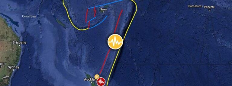
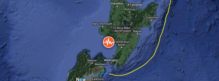
• National state of emergency declared as Cyclone Gabrielle causes widespread destruction across New Zealand’s North Island

    New Zealand’s North Island has been severely impacted by Cyclone Gabrielle over the past couple of days, with floods, landslides, and ocean swells leaving many people stranded on rooftops. The storm, which caused extensive damage to homes and infrastructure, also closed numerous roads, canceled hundreds of flights, and left about 225 000 people without power. At least 4 people have been killed.

  • Deep M6.1 earthquake hits Kermadec Islands

    A deep earthquake registered by the USGS as M6.1 hit Kermadec Islands, New Zealand at 09:18 UTC on February 13, 2023. The agency is reporting a depth of 374 km (232 miles). EMSC is reporting the same magnitude and depth.

  • Thousands of buildings in Auckland unsafe for living after worst rains in 170 years, New Zealand

    Thousands of buildings in New Zealand’s Auckland area are currently unsafe for living after the region was hit by extreme rainfall and severe flooding at the end of January. The amount of rain that fell in a matter of days made January 2023 Auckland’s wettest month in at least the last 170 years. The flooding has put the public’s focus on nature-based alternatives to traditional stormwater systems.

  • Tropical Cyclone “Gabrielle” forms in the Coral Sea, forecast to rapidly intensify before moving toward New Zealand

    Tropical Cyclone “Gabrielle” has formed in the Coral Sea as the 3rd named storm of the 2023 Australian region cyclone season. The forecast track takes it near Norfolk Island as a severe category 3 before moving toward New Zealand. The cyclone could bring more rounds of heavy rain to parts of North Island, New Zealand, particularly the Auckland area where extremely heavy and record-breaking rainfall amounts were registered recently.

  • Rising temperature at Ruapehu’s Crater Lake, New Zealand

    Recent activity at New Zealand’s Ruapehu volcano has shown an increase in the temperature of the summit Crater Lake, known as Te Wai ā-moe, rising to more than 30 °C (86 °F) and consistent with heat flow into the lake of about 150-200 MW. Despite this, the level of volcanic unrest activity remains low, with monitoring indicators remaining within the normal range for this type of activity. The Volcanic Alert Level remains at Level 1 and the Aviation Color Code remains Green, indicating a low risk of eruption.