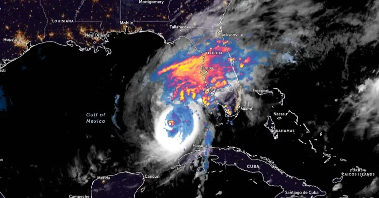
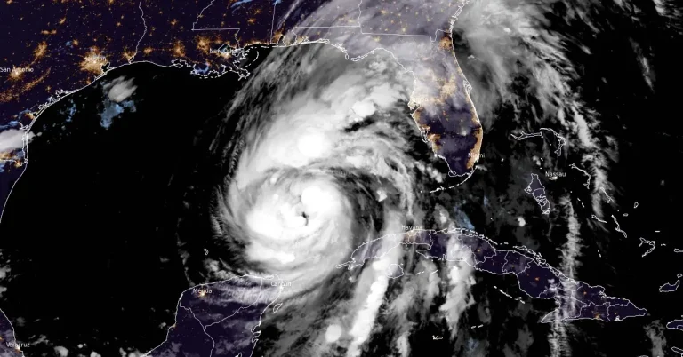
Rare EF-3 tornado hits Palm Beach Gardens, Florida
A rare EF-3 tornado tore through the Avenir community in Palm Beach Gardens, Florida on October 9, 2024, as Hurricane “Milton” unleashed a tornado outbreak across Florida.

A rare EF-3 tornado tore through the Avenir community in Palm Beach Gardens, Florida on October 9, 2024, as Hurricane “Milton” unleashed a tornado outbreak across Florida.

Hurricane “Milton” made landfall near Siesta Key in Sarasota County along the west coast of Florida at 00:30 UTC on October 10, 2024, with maximum sustained winds of 205 km/h (120 mph) and a minimum central pressure of 954 hPa, making it a Category 3 hurricane.

Meteorologists at the National Weather Service in Miami have confirmed the 7th tornado linked to Hurricane “Milton” just hours before its expected landfall in Florida. As of 14:40 LT, 39 Tornado Warnings have been issued, with more tornadoes possible through the night. Tropical-storm-force winds have begun impacting Florida’s west coast, while rising water levels at the Naples Pier indicate the start of Milton’s storm surge across southwestern coastal areas. Multiple warnings remain in effect across the Florida peninsula.

Category 5 Hurricane “Milton” is moving NE toward Florida, U.S. at 22 km/h (14 mph) with maximum sustained winds of 260 km/h (160 mph). Milton is forecast to make landfall late tonight or early Thursday along the Florida Gulf Coast, threatening large area with severe storm surges, destructive winds, and heavy rainfall.

Hurricane “Milton” rapidly intensified on Monday, October 7, 2024, and is now a major category 4 hurricane on the Saffir-Simpson Hurricane Wind Scale. The National Hurricane Center (NHC) expects Milton to become a Category 5 hurricane today, making it the strongest Gulf of Mexico hurricane this late in the calendar year in the satellite era (since 1966). Milton is forecast to move near or just north of the Yucatán Peninsula today and Tuesday, then cross the eastern Gulf of Mexico and approach the west coast of the Florida Peninsula by Wednesday.

Tropical Storm “Milton” formed in the Gulf of Mexico at 17:25 UTC on October 5, 2024, as the 13th named storm of the 2024 Atlantic hurricane season. The current forecast track takes it right toward Florida, strengthening into a hurricane before making landfall.

Category 4 Hurricane “Helene” made landfall near Perry in the Taylor County, Big Bend region of Florida on September 28, 2024, bringing a destructive storm surge and powerful winds. Keaton Beach, a Taylor County seaside village, that has had three storms in the last 13 months, has been devastated by Helene, with 60% to 75% of dwellings destroyed.

Hurricane “Helene” made landfall near Perry in the Big Bend region of Florida at 23:10 local time (LT) on Thursday, September 26, 2024, as a Category 4 hurricane with record-breaking winds of 220 km/h (140 mph). It created massive life-threatening storm surges of up to 6.1 m (20 feet). Multiple extreme wind warnings have been issued across several counties in the Big Bend region before the arrival of the eye of the storm.

Hurricane “Helene” is expected to rapidly intensify to a Category 4 major hurricane before making landfall on Florida’s Big Bend coast on Thursday, September 26, 2024. Catastrophic storm surge, potentially reaching 6 m (20 feet) above ground, along with destructive winds and life-threatening flash flooding, pose serious risks to the region. Residents in affected areas are urged to follow evacuation orders and complete preparations immediately.

Tropical Storm “Helene” is expected to rapidly intensify and become a major hurricane by Thursday, September 26, 2024, as it moves toward the Gulf Coast. Forecasts predict that the storm will bring dangerous flooding and strong winds to western Cuba, the Yucatan Peninsula, and the southeastern U.S. as early as Thursday.