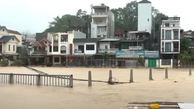
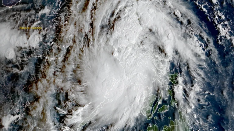
• NHC monitoring two tropical waves in the Atlantic basin

    A tropical wave over the northeastern Caribbean Sea is producing showers, thunderstorms, and gusty winds across the Windward and Leeward Islands on September 24, 2025. The National Hurricane Center (NHC) said the disturbance will spread heavy rainfall and gusty winds into Puerto Rico and the Virgin Islands later today and into the Dominican Republic tonight, with conditions becoming more favorable for development later this week near the Bahamas. Another wave, located about 1 125 km (700 miles) east of the Leeward Islands, also has a high chance of becoming a tropical depression in the coming days.

  • Hurricane Gabrielle forecast to approach Azores on Thursday, September 25

    A Hurricane Watch was issued for all islands of the Azores at 11:00 AST (15:00 UTC) on Tuesday, September 23, 2025, as Category 4 Hurricane Gabrielle moves east-northeastward over the North Atlantic. The system is forecast to approach the archipelago late Thursday, bringing the risk of hurricane-force winds, storm surge, and 75–125 mm (3–5 inches) of rainfall to the central and western islands. Swells are already affecting Bermuda, the U.S. East Coast, and Atlantic Canada.

  • Hurricane Narda forms in the eastern Pacific

    Hurricane Narda formed at 15:00 UTC on September 23, 2025, as the 8th hurricane of the 2025 eastern Pacific hurricane season. While it is expected to strengthen further, it is nor forecast to cause any hazards on land.

  • Typhoon Ragasa to make landfall in China’s Guangdong on September 24

    Hong Kong has shut down, and Shenzhen is evacuating of 400 000 people as Typhoon Ragasa (known in the Phillippines as Nando) moves towards China. Its earlier landfall in northern Philippines on September 22, has already claimed at least 3 lives and displaced thousands, and now it threatens to wreak havoc in southern China. Ragasa is expected to make landfall in the coastal area between Shenzhen City and Xuwen County in Guangdong Province on September 24.

  • Gabrielle becomes second hurricane of 2025 Atlantic season, swells affecting Bermuda, U.S. East Coast, and Atlantic Canada

    Tropical Storm Gabrielle intensified into a hurricane on September 21, 2025, becoming the second hurricane of the 2025 Atlantic hurricane season after Erin. The storm is forecast to undergo rapid strengthening and could become a major hurricane early this week as it passes east of Bermuda. Swells and rip currents are already affecting Bermuda, the U.S. East Coast, and Atlantic Canada.

  • Eye of Super Typhoon Ragasa moves over Calayan Island, Cagayan, Philippines

    Super Typhoon Ragasa, locally named Nando, began crossing Calayan Island in Cagayan province, northern Philippines, at around 03:00 UTC (11:00 LT) on September 22, 2025, bringing destructive winds, extreme seas, and life-threatening storm surge. The Philippine weather bureau reported maximum 10-minute sustained winds of 215 km/h (134 mph) and gusts up to 295 km/h (183 mph).

  • Super Typhoon Ragasa moving toward Philippines, China and Vietnam

    Typhoon Ragasa, known locally as Nando, intensified into a super typhoon 00:00 UTC (08:00 LT) on September 21, 2025, east of Cagayan, Philippines. By 09:00 UTC, its center was located 450 km (280 miles) east of Aparri with sustained winds of 185 km/h (115 mph) and gusts up to 230 km/h (145 mph). The system is moving west-northwest toward Batanes and the Babuyan Islands, bringing life-threatening storm surges exceeding 3 m (10 feet), destructive winds, and very rough seas.

  • Tropical Storm Gabrielle forecast to become a hurricane by Sunday

    Tropical Storm Gabrielle is expected to become the second hurricane of the 2025 Atlantic hurricane season by Sunday, September 21. While no landfall is forecast for the storm, it will move east of Bermuda, possibly causing rip currents and other marine hazards.