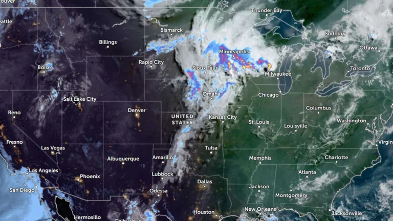
• Enhanced Risk issued for severe thunderstorms across Midwest and Upper Great Lakes

    Severe thunderstorms will affect portions of the Upper Midwest and Great Lakes through Wednesday, July 1, 2026, with damaging wind gusts of up to 130 km/h (80 mph), isolated large to very large hail and a few tornadoes possible. Parts of the region have been put under an Enhanced Risk of severe thunderstorms through Wednesday, while a Slight Risk extends across portions of the central High Plains and the Northeast.
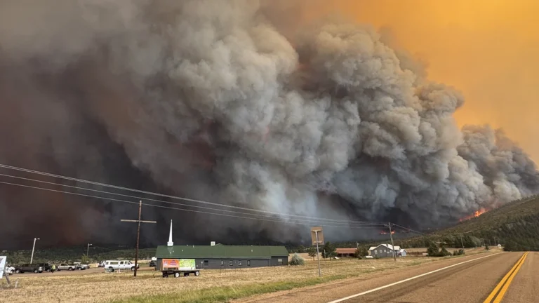

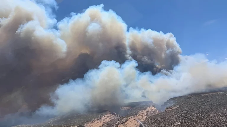
  • Aspen Acres Fire destroys 155 structures, three Colorado wildfires burn over 25 000 ha (62 000 acres)

    The Aspen Acres Fire destroyed at least 155 structures in Pueblo and Custer counties. This fire, together with Ferris and Gold Mountain fires burned a combined 25 077 ha (61 969 acres) across Colorado by late June 30, 2026. Critical fire weather conditions are forecast to continue supporting rapid fire growth through at least July 3.

  • Preliminary 211 km/h (131 mph) gust in South Dakota among the strongest thunderstorm winds in U.S.

    A wind gust of 211 km/h (131 mph) measured near Holabird, South Dakota, during severe thunderstorms on June 29, 2026, would rank as the 15th-strongest thunderstorm wind gust ever recorded in the United States if confirmed. The storms damaged grain bins, metal buildings, trees and other infrastructure across several counties with straight-line winds extending from south-southwest of Andover into the town.

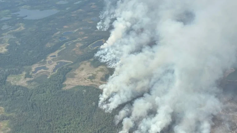
  • Out-of-control wildfires force evacuations in Wrigley and Fort Simpson, Northwest Territories, Canada

    Wildfires burning in Canada’s Northwest Territories prompted evacuation orders for the communities of Wrigley and Fort Simpson on June 28 and 29, 2026, as two lightning-caused fires remained out of control. The blaze threatening Fort Simpson had expanded to more than 8 900 ha (21 992 acres) by June 29, while more than 62 000 ha (153 209 acres) had burned across the territory.

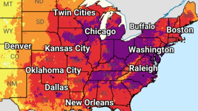
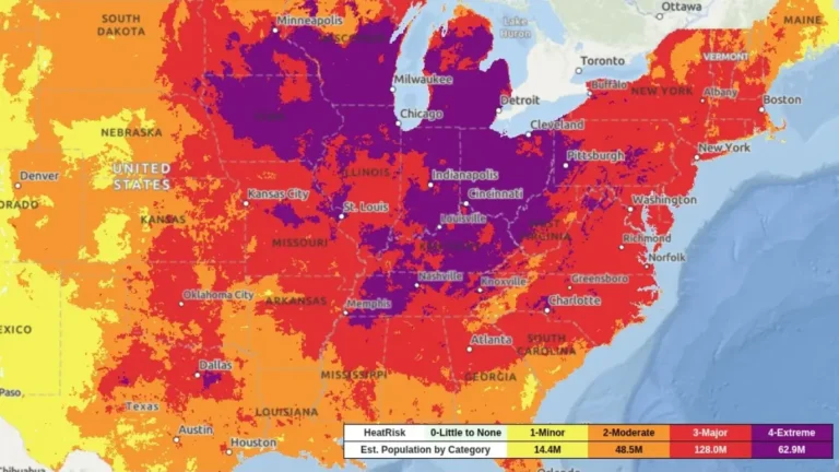
  • Extreme heat alerts cover portions of 31 U.S. states, heat index up to 46°C (115°F)

    Extreme Heat Warnings, Extreme Heat Watches, and Heat Advisories are in effect across 31 U.S. states after the National Weather Service (NWS) issued a series of heat alerts on June 29, 2026. Peak heat index values are forecast to reach 46°C (115°F), with dangerous heat and humidity expected to persist into early July across parts of the Midwest, Northeast, Southeast, and central United States.

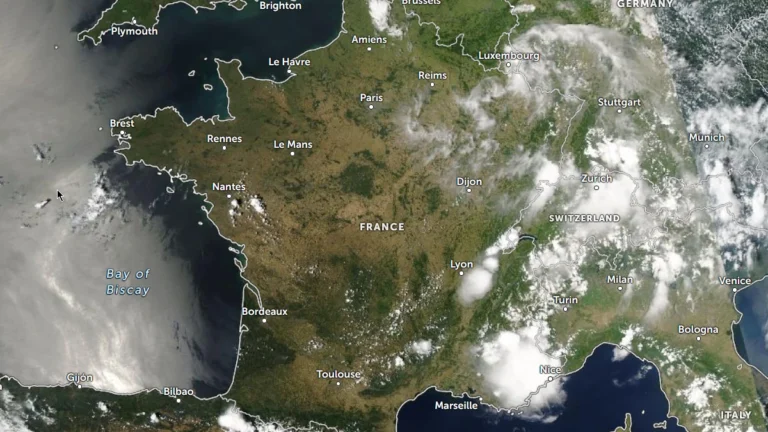
  • Around 1 000 excess deaths linked to record-breaking heatwave in France

    France has recorded around 1 000 excess deaths since June 24, 2026 as an exceptional heatwave swept across the country, with 85% of the deaths involving people aged 65 and older, according to preliminary figures released by France’s Public Health Agency (SPF). The agency warned the data remain preliminary and are expected to increase as additional mortality reports are received.

  • Floods claim 4 lives in Madison and Jackson counties, statewide emergency declared for Kentucky

    At least four fatalities were reported in Madison and Jackson counties as deadly flash floods swept across Kentucky on June 27, 2026. Governor Andy Beshear declared a statewide emergency as forecasts called for additional heavy rain and emergency crews responded to rescues, flooded homes, and damaged infrastructure. Five counties had also declared local States of Emergency.

  • Extreme Heat Watches and Heat Advisories issued across Illinois, Missouri, Kansas, Iowa, Nebraska, and South Dakota

    Heat Advisories and Extreme Heat Watches have been issued across parts of Illinois, Missouri, Kansas, Iowa, Nebraska and South Dakota ahead of intensifying heatwave beginning Sunday, June 28, 2026. Heat index values are forecast to exceed 38°C (100°F) across much of the region, with some areas expected to reach 41 to 43°C (105 to 110°F) through Tuesday or Thursday, depending on location.