
Tropical Storm “Hilary” forecast to rapidly strengthen on its way toward Baja California and the United States
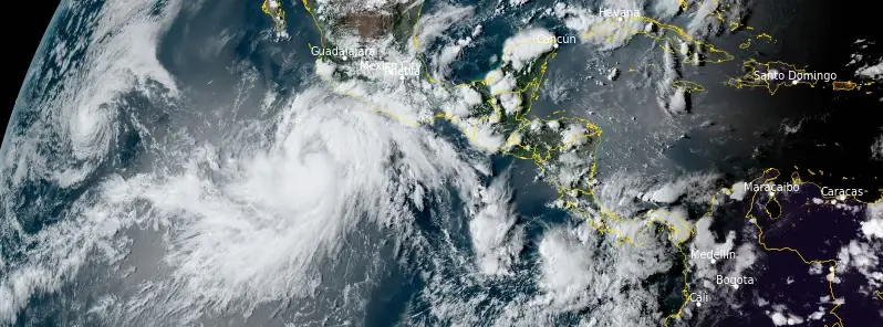
Featured image: Tropical Storm "Hilary" at 22:30 UTC on August 16, 2023. Credit: NOAA/GOES-East, RAMMB/CIRA, The Watchers
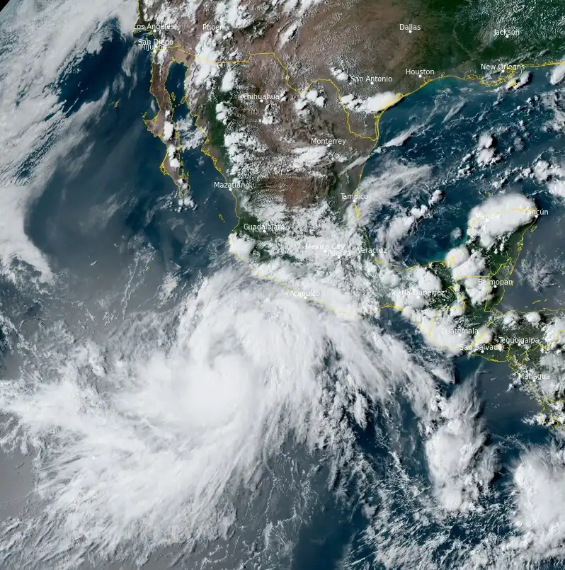
Tropical Storm “Hilary” formed at 15:00 UTC on August 16, 2023, as the 8th named storm of the 2023 Pacific hurricane season. The system is strengthening and is expected to become a hurricane on August 17, on its way toward the Baja California Peninsula and the United States.
- The storm is expected to impact the Baja Peninsula and Southern California, with Tropical Storm force winds likely to reach the Baja sometime late Friday, August 18 to early Saturday (LT) and reach Southern California mid to late Sunday per the most recent NHC forecast.
- There is potential for heavy precipitation accompanying the high winds across much of Southern California as a result of the elevated moisture levels.
At 03:00 UTC on August 17, the center of Tropical Storm “Hilary” was located about 630 km (390 miles) S of Manzanillo, Mexico, and about 1 170 km (725 miles) SSE of Cabo San Lucas, Mexico.
Hilary had maximum sustained winds of 85 km/h (50 mph) and a minimum central pressure of 996 hPa.
Tropical-storm-force winds extend outward up to 334 km (205 miles) from the center.
The system was moving toward the WNW near 19 km/h (12 mph) and this general motion is expected to continue for the next day or so, followed by a turn NW on Friday, August 18, and NNW on August 19.
Rapid intensification is forecast over the next 24 – 36 hours, and Hilary is forecast to become a major hurricane by the end of the week.
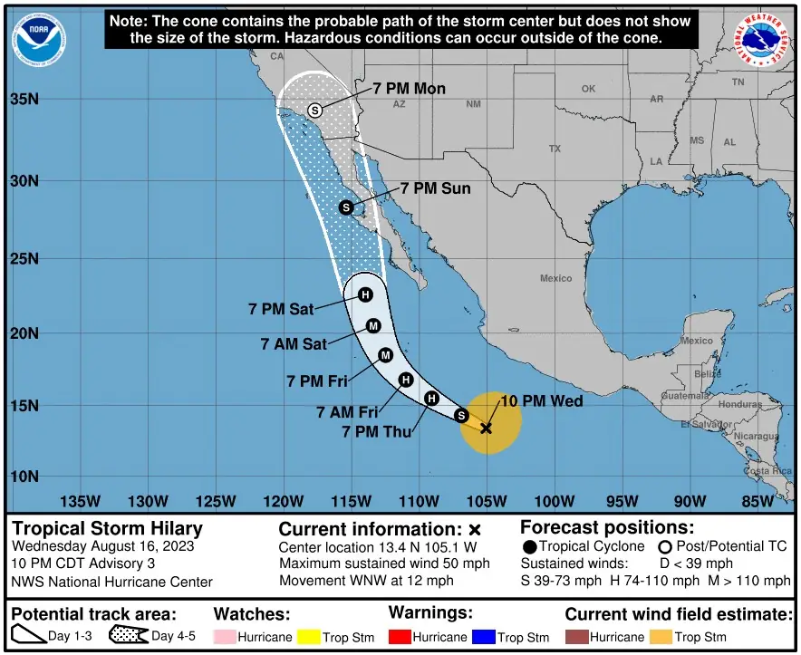
There are currently no coastal watches or warnings in effect. However, interests in Baja California Sur should closely monitor the progress of this system, the National Hurricane Center (NHC) warns. Watches will likely be required for a portion of that area as soon as tomorrow morning (LT).
“This evening, Hilary appears to be getting its act together, with its structure quickly improving,” NHC forecaster Papin noted at 22:00 CDT on August 16 (03:00 UTC, August 17).
“Satellite imagery shows a well-defined curved band wrapping around the storm’s southern semicircle, with deep convection blossoming near the estimated center. Earlier microwave imagery also suggested that a tighter center might have reformed a bit further to the south, more embedded in the deep convection… Assuming the storm is in the initial stages of developing an inner core, Hilary appears poised to intensify, likely rapidly, over the next couple of days”
Hilary has the potential to bring impacts to the Baja California Peninsula and portions of the southwestern United States this weekend, NHC said in its key messages for the system.
Although it is too soon to determine the location and magnitude of rainfall and wind impacts, interests in these areas should monitor the progress of Hilary and updates to the forecast.
Large swells from Hilary will spread northward along the coast of southwestern Mexico and the Baja California Peninsula during the next several days.
“There is potential for heavy precipitation accompanying the high winds across much of Southern California as a result of the elevated moisture levels forecasted to be brought into the region by Hilary,” according to the Center for Western Weather and Water Extremes (CW3E).
CW3E forecasters also noted that a predecessor rain event is forecast to occur north of Hilary on Saturday into Sunday, bringing heavy rainfall to the southwestern US, fed by tropical moisture from Hilary.
Stay alert to official NWS forecasts, watches, and warnings from the National Hurricane Center at nhc.noaa.gov, information from local NWS weather forecast offices at weather.gov, and follow guidance from local emergency management officials.
References:
1 Tropical Storm Hilary – Advisory Number 3 – NWS National Hurricane Center Miami FL EP092023 – 1000 PM CDT Wed Aug 16 2023
2 CW3E Analysis – Tropical Storm Hilary: 16 August 2023
I'm a dedicated researcher, journalist, and editor at The Watchers. With over 20 years of experience in the media industry, I specialize in hard science news, focusing on extreme weather, seismic and volcanic activity, space weather, and astronomy, including near-Earth objects and planetary defense strategies. You can reach me at teo /at/ watchers.news.
Unless the global SRM (Solar Radiation Management) operations, cloud seeding, weather modification operations, spraying of aerosolized nanoparticles into troposphere including: calcium carbonate, aluminum, barium, strontium, sodium iodide, etc. to alter, control, modify or augment weather systems is considered and included in discussions about global climate, this is all meaningless and irrelevant propaganda intended to advance the false narrative of AGW and climate change. US Military, private and government contractors, governments across the globe are involved in weather manipulation. The patents for weather technologies to desiccate the atmosphere, ground, and foliage, to cause ice nucleation, cloud seeding, to erase radar signature, to cause flooding, earthquakes, tsunamis, refraction of the sun, electromagnetic steering of charged aerosolized particles in tandem with satellites, ground transmitters, HAARP, etc. are well documented, as are the “weather warfare” and weaponization of these technologies.