
Tornadoes and high winds cause damage and widespread power outages across Texas and Louisiana
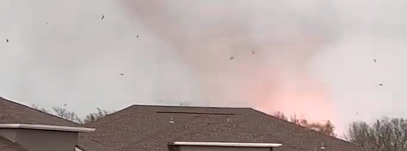
Image credit: Jamey Bradshaw (stillshot)
Tornadoes and high winds caused damage and widespread power outages Thursday, March 2, 2023, in Texas and Louisiana, including Dallas-Fort Worth and Shreveport. At the height of the storm, there were more than 350 000 customers without power in Texas, with more than half of them in the Dallas-Fort Worth area where winds up to 130 km/h (80 mph) were recorded.
A large tornado swept through a residential neighborhood in Northlake and Winnsboro, Texas, leaving residents shocked as the twister rolled through. Tornado warnings were also issued for the Dallas-Fort Worth area, trapping travelers at the Dallas Love Field Airport in a storm bunker.
Another large tornado hit the city of Jefferson around 17:25 CST (23:25 UTC). This tornado caused significant damage, including dozens of downed trees that fell over mobile homes, power lines, and roads. The damage was so extensive that two lines of trees that had previously flanked a private driveway were completely uprooted and blocked the road.
Another tornado touched down near Linden, TX. While there were no immediate reports of damage, the event was captured in a video shot by a drone:
Wind gusts exceeding 128 km/h (80 mph) were observed in Texas, with a peak gust of 130 km/h (81 mph) recorded in Comstock, located in southwestern Val Verde County. A gust of 128 km/h (80 mph) was also recorded in North Fort Worth, closer to Dallas.
As a result of the strong winds, power outages quickly surged across the state, reaching over 323 000 by 19:25 CST (01:25 UTC on March 3). The majority of these outages were concentrated in North and southwest Texas, with Tarrant and Dallas counties recording over 100 000 customers experiencing power outages. As of 04:00 CST (10:00 UTC) on March 3, approximately 120 600 customers in Texas and 8 500 in Louisiana were still without power.
According to MedStar medics, severe weather caused at least 21 motor vehicle crashes in the Fort Worth area on Thursday, with three involving rollovers, including one that affected an 18-wheeler. Four individuals required hospitalization due to the crashes. The storms coincided with rush hour, as people were returning home from work. During this time, the National Weather Service had issued a severe thunderstorm warning for the area, indicating “destructive storms” and classifying the situation as “life-threatening.” The alert encompassed over 2 million people.
In addition to tornadoes and strong winds, severe hail reports inundated Texas throughout the day. Hail stones up to 4.4 cm (1.75 inches) in diameter — equivalent to the size of a golf ball — were prevalent in several areas of North Texas, including Sherman and Tioga. Hail of the same size also hit places located to the south, such as Smithson Valley and San Marcos, which are positioned between San Antonio and Austin.
All the schools in the Weatherford School District – near Fort Worth – will be closed on Friday due to power outage, debris, and damage to school grounds.
Following the tornadic storm that passed through the area, reports indicated that tornado damage was also present in south Shreveport, Louisiana. At 17:37 CST (23:17 UTC), a video of a tornado near LSU-Shreveport was posted and verified by the National Weather Service. According to the Shreveport Times, the storm resulted in damage to the intersection of Youree Dr. and Sophia Lane, as well as the Twelve Oaks neighborhood, a gas station, and a grocery store. A video captured near the LSU-Shreveport campus exhibited a severely damaged home with missing roof panels and blown-out windows.
The danger of severe weather continued through the night and into Friday, March 3.
According to the National Weather Service, a powerful winter storm is expected to generate a broad area of heavy snow from the Upper Midwest to New England on Friday and Saturday. There is a chance of significant sleet and freezing rain to occur just south of the heaviest snow. Additionally, severe thunderstorms could bring destructive winds and tornadoes to the Southeastern United States, while heavy rainfall may result in flooding in the Ohio Valley. High winds are also anticipated in the Tennessee Valley.
“A potent system is forecast to produce a multitude of weather hazards throughout the eastern third of the country over the next 24 hours as the storm rapidly deepens and approaches all-time record low sea level pressure values for portions of the Ohio and Missouri valleys,” NWS forecaster Russel noted at 02:57 EST (07:57 UTC) on March 3.
The ongoing severe weather and flash flood risk associated with the system will continue through the early Friday morning hours across the Lower Mississippi Valley, with the threat shifting northeastward throughout the day as the strengthening low lifts northward into the Ohio Valley.
Thunderstorms developing ahead of the eastward progressing cold front will have the potential to produce damaging wind gusts, small hail, and isolated tornadoes on Friday, resulting in the Storm Prediction Center issuing an Enhanced Risk of Severe Thunderstorms for eastern portions of the Tennessee Valley.
Prolonged heavy rainfall rates associated with training showers and thunderstorms may also lead to flash flooding throughout much of the Mid-Mississippi and Ohio Valleys stretching eastward into the Mid-Atlantic, with a Moderate Risk of Excessive Rainfall covering portions of northeastern Arkansas, southeastern Missouri, southern Illinois, and southern Indiana. Furthermore, strong synoptic wind gusts will also be likely as a result of the deepening system, with expansive Wind Advisories and High Wind Warnings covering a large swath of the region.
References:
1 LIVE: Tornadic thunderstorms continue eastward trek – AccuWeather – March 3, 2023
2 Severe Weather: Dallas-Fort Worth Power Outages Widespread, Tornado Damage In Shreveport – TWC – March 3, 2023
3 Short Range Forecast Discussion – NWS Weather Prediction Center College Park MD – 257 AM EST Fri Mar 03 2023
The Watchers team and our contributors bring the latest on extreme weather, earthquakes, volcanic eruptions, space weather, and all things science. We're all about making sense of the natural world and keeping you informed on what’s happening. Got a tip or a question? Hit us up using the form at newstips!
Commenting rules and guidelines
We value the thoughts and opinions of our readers and welcome healthy discussions on our website. In order to maintain a respectful and positive community, we ask that all commenters follow these rules.