
Mud domes discovered on islands near Kabawa mud volcano after M7.5 earthquake, Indonesia
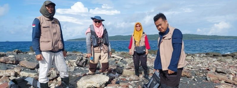
Image credit: Geological Agency of Indonesia (BG – KESDM)
Following a powerful M7.5 earthquake that struck the Tanimbar Islands in Indonesia’s Maluku Province on January 10, 2023, researchers have discovered new dome-shaped mud eruption mounds on two small islands near the large Kabawa mud volcano. These mounds reach up to 3 m (9.8 feet) in height and cover areas of up to approximately 700 m2 (7 534 feet2).
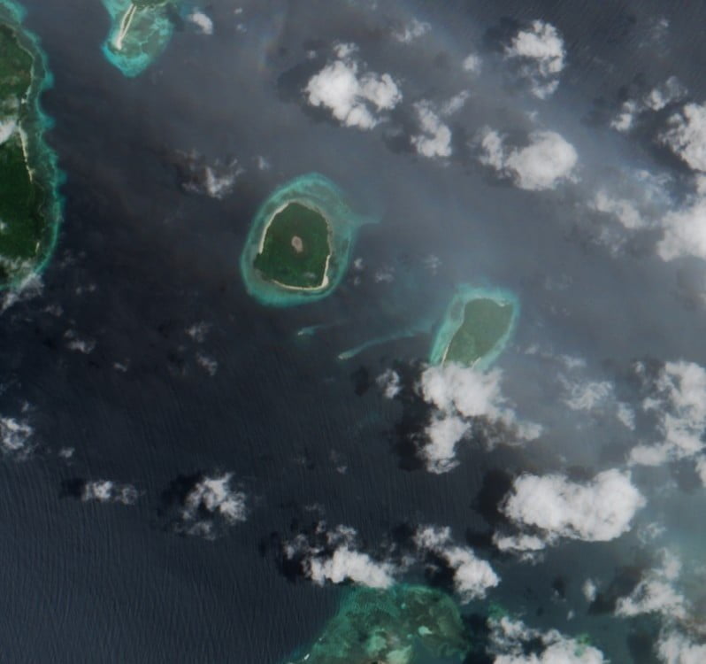
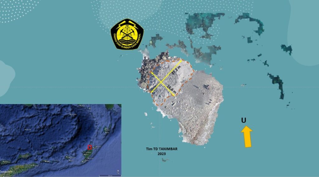
The islands are located near the island of Yamdena, around 1 km (0.6 miles) south of the Kabawa mud volcano.
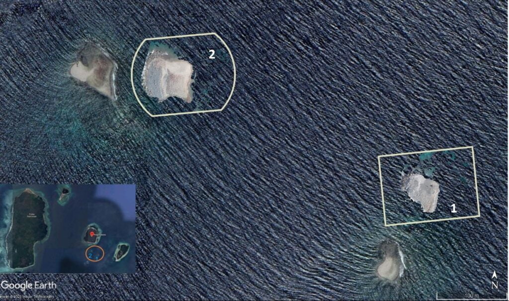
The first island is characterized by a stretch of coarse blackish-gray sandstone on top of which scattered gravel-sized rocks with angular to angular shapes are found. The mud outcrop is situated on the west side of the island and is still soft and not yet compact, with a height of about 3 m (9.8 feet) and a dome shape.
Above the mud, there are boulders and cobbles that are the same as the material scattered around it. The dimensions of the mud from the results of drone shooting are 27.2 m (89 feet) long and 16.6 m (54.5 feet) wide. The mud is gray, very fine-grained, soft, and strongly cohesive, with no sulfur smell and no coarse material.
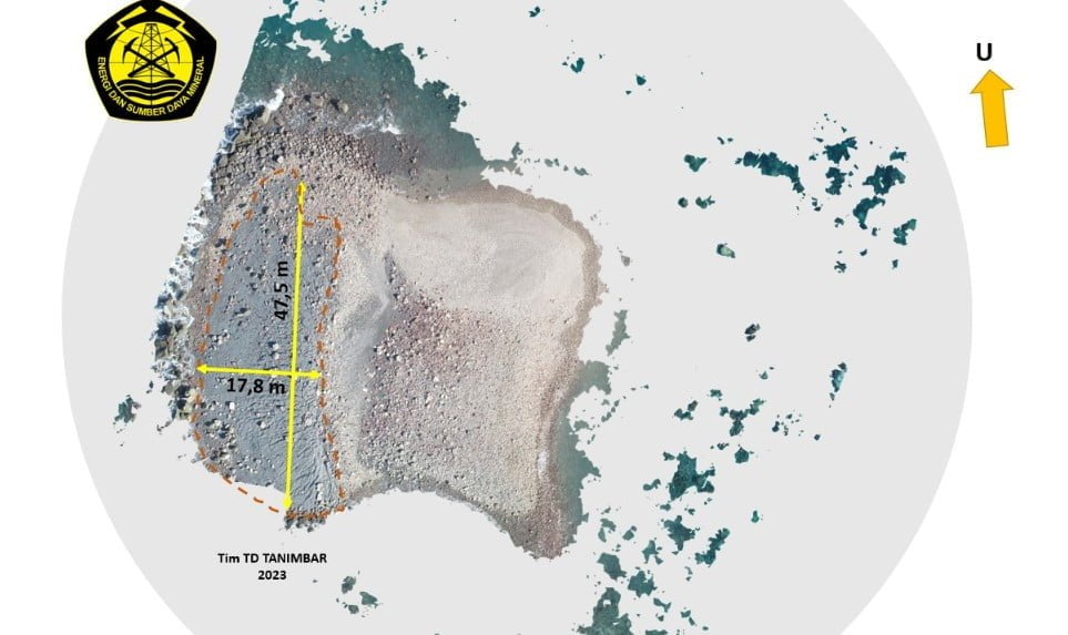
On the second island, the characteristics of the mud are similar to the first island, with dimensions of 47.5 m (156 feet) in length and 17.8 m (58.4 feet) in width.
The island is composed of coarse sandstones overlaid by gravel-sized rock fragments with angular to spherical shapes, and the dominant cobblestone is flat. When compared to the first island, the fragments scattered on this island are smaller, and the rock type is almost the same.
According to data from the Regional Disaster Management Agency (BPBD) of Maluku Province, the earthquake caused moderate to severe damage to 523 residents’ houses, and damage to 131 public facilities, including public facilities, facilities, and infrastructure.
The USGS reported the quake as M7.6 at a depth of 105 km (65 miles).
The Watchers team and our contributors bring the latest on extreme weather, earthquakes, volcanic eruptions, space weather, and all things science. We're all about making sense of the natural world and keeping you informed on what’s happening. Got a tip or a question? Hit us up using the form at newstips!
Commenting rules and guidelines
We value the thoughts and opinions of our readers and welcome healthy discussions on our website. In order to maintain a respectful and positive community, we ask that all commenters follow these rules.