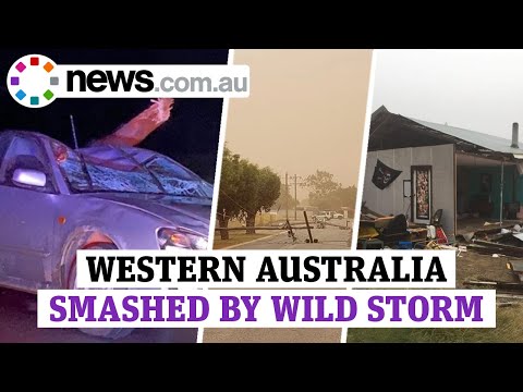
Extreme ‘once-in-a-decade’ storm brings destructive winds and rain to Western Australia

An extreme weather event described as a "once-in-a-decade" brought destructive winds and rain to a wide stretch of Western Australia on May 24 and 25, 2020.
Wind speed of up to 132 km/h (82 mph) was recorded at Cape Leeuwin, the state's strongest May gust in 15 years. In Perth, the wind gusted at more than 90 km/h (56 mph) overnight.
The highest rainfall totals in a 24-hour period to Monday were 60 mm (2.4 inches) at Learmonth Airport and 54 mm (2.1 inches) in Margaret River. Several areas in the Pilbara region received up to 50 mm (2 inches), while up to 20 mm (0.8 inches) soaked agricultural lands.
More than 60 000 homes lost electricity, most of which in the main city of Perth. In an update at 09:00 UTC (17:00 LT) on Monday, Western Power reported that around 4 400 properties remain off supply in the metropolitan area.

In the northern part of the network extending to Geraldton and the Mid West, the number of disrupted homes has been reduced to 1 000, from a peak of 13 000 on Sunday, May 24.
"Our teams have responded to 1 500 incidents over the past 24 hours, with 650 in the metropolitan area alone and nearly 500 hazards identified and assessed," it stated.
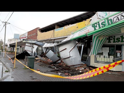
Geraldton was hit particularly bad, with debris scattered on streets, windscreens smashed, and several buildings demolished.


Bureau of Meteorology (BOM) manager Neil Bennett said the weather system stretched some 1 200 km (746 miles), also causing some flooding and beach erosion.
"It was really right up and down the coast, including the Perth area, but particularly that southwest area of Western Australia really caught the brunt of this one."
The Canal Rocks walk bridge was reportedly badly damaged by heavy swells and high tides. The area has since been closed to the public.
Pilbara Ports Authority said that while port operations had not been impacted, elevated swell led to some minor changes in the shipping schedule at the Port of Dampier.
Jon Broomhall, Assistant Acting Commissioner of the Department of Fire and Emergency Services, dubbed the storm system a "once-in-a-decade" type.
The situation was caused by the remnants of Ex-Tropical Cyclone "Mangga" that hit a cold front. "This is a rare event for WA particularly due to the extent of the area affected and the possibility of multiple areas of dangerous weather," said BOM.
The strong winds through #Perth last night whipped up large waves and higher than normal tides causing significant beach erosion along the west coast. A Severe Weather Warning is still current for much of the southwest. https://t.co/FVgcXPDvRT pic.twitter.com/m9rj1H7pUl
— Bureau of Meteorology, Western Australia (@BOM_WA) May 25, 2020
by the one and only Chris White ⛈ She a bit angry today at North Beach #perthstorm #perth https://t.co/ecbYPK6KDk pic.twitter.com/l542gxlhfS
— Tracy Vo (@Tracy_Vo) May 25, 2020
While strong wind gusts may still be felt in the Perth metro area, they are no longer expected to be severe or above 90 km/h (56 mph), the weather bureau noted.
A severe weather warning for damaging winds and abnormally high tides is in force for South Coastal, South East Coastal, and parts of South West and Great Southern districts. Marine wind warnings are also in place for some areas, while a severe fire danger warning is forecast for Eucla.
Featured image credit: The Telegraph/YouTube

Commenting rules and guidelines
We value the thoughts and opinions of our readers and welcome healthy discussions on our website. In order to maintain a respectful and positive community, we ask that all commenters follow these rules.