
Lava dome growing at Nishinoshima volcano, coastline expanding due to constant lava flows, Japan

Image credit: JCG
The Japan Coast Guard (JCG) has presented InSAR results from November 17, 2019, to February 28, 2020, showing a growth of Nishinoshima's central cone as well as changes to the island's surface, with the coastline expanding due to lava flows. Moreover, the crew confirmed that the volcano emitted a gray plume that reached an altitude of about 1 000 m (3 280 feet) on March 9.
During an overflight on February 17, the team observed continuous activity from the central vent, including emission of ash plume up to 600 m (1 968 feet).
According to GVP, the emitted material landed near the cone's base. The lava flowed into the ocean at the northern and eastern coasts, causing a rising steam plume.
Discolored water was also reported in February in an area 9 km (6 miles) south of the island, but was not observed due to weather conditions. The marine exclusion zone is a radius of around 2.6 km (1.6 miles) from the island, GVP added.
【海上保安新聞】つづき
西之島噴火の様子の動画をもう一本ご紹介!#海上保安庁 #海保 #海猿 #トッキュー #巡視船 #巡視艇 #飛行機 #ヘリコプター #潜水士 #パイロット #調査 #研究 pic.twitter.com/SemkzdBsQD
— (公財)海上保安協会【公式】 (@JCGF_umimaru) March 11, 2020
![]()
Nishinoshima volcano on February 27, 2020. Image credit: USGS/Landsat-8, Antonio Vecoli
During an overflight on March 9, the crew confirmed that the gray plume emitted reached about 1 000 m (3 280 feet) high. The lava flowed on the northeast flank of the crater to the northern shore, before flowing into the sea where a plume of gas and vapor was evident. Thermal anomalies were noted.
The volcano showed continuous steam explosions in January, with lava flows spotted reaching the sea. Gray emissions were seen rising from the crater of the pyroclastic cone up to 1 800 m (5 905 feet). The lava traveled northeast, reaching the ocean which generated steam plumes near the coastline.
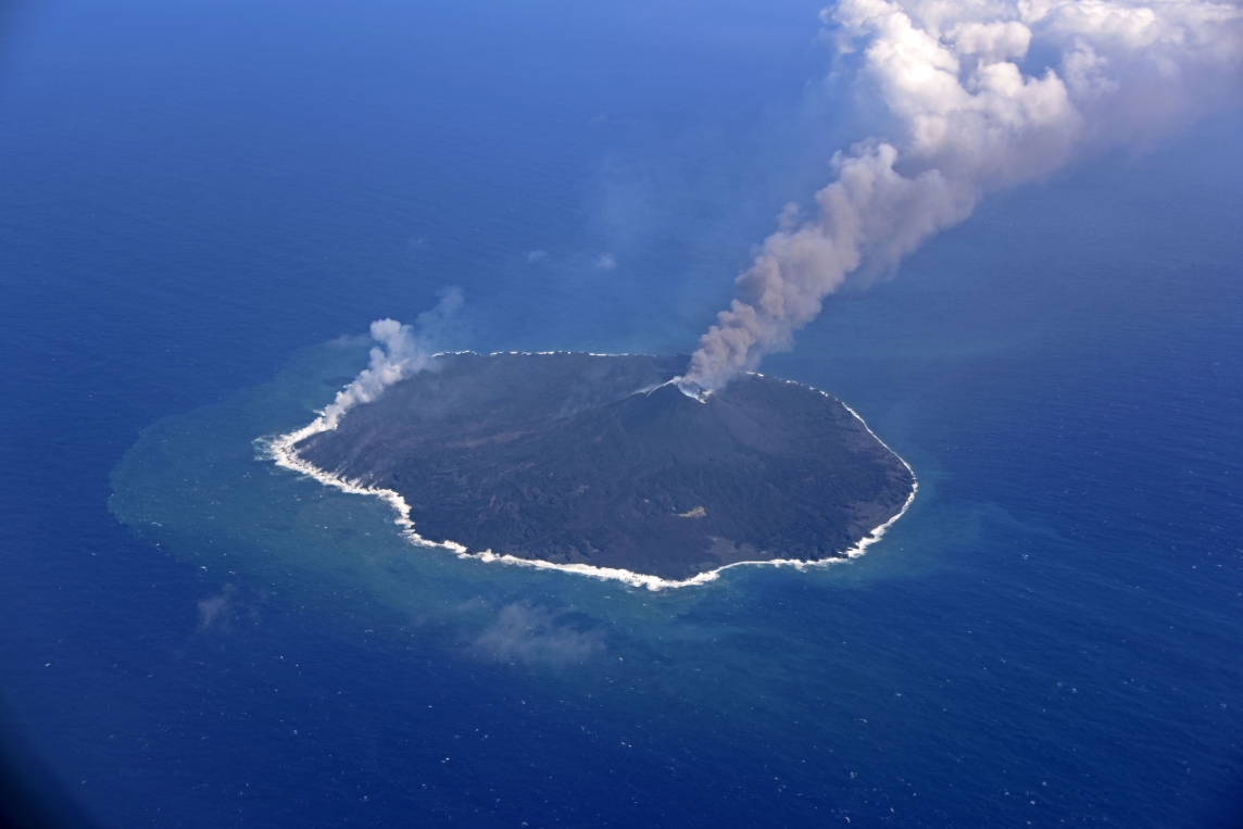
Image credit JCG
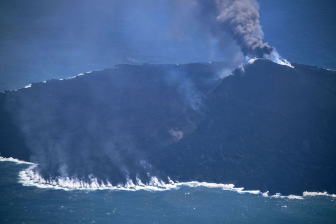
Image credit: JCG
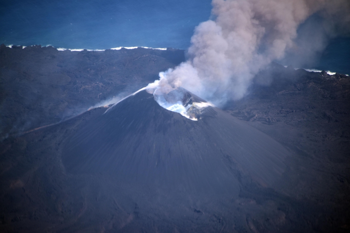
Image credit: JCG
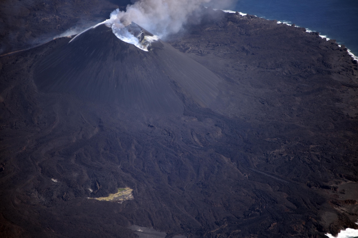
Image credit: JCG
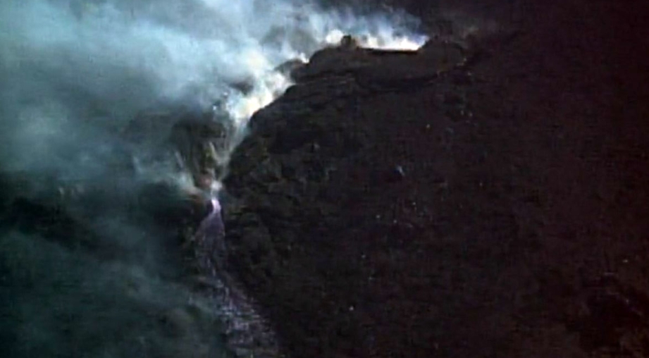
Image credit: JCG
Geological summary
The small island of Nishinoshima was enlarged when several new islands coalesced during an eruption in 1973-74. Another eruption that began offshore in 2013 completely covered the previously exposed surface and enlarged the island again. Water discoloration has been observed on several occasions since.
The island is the summit of a massive submarine volcano that has prominent satellitic peaks to the S, W, and NE. The summit of the southern cone rises to within 214 m (702 feet) of the sea surface 9 km (5.6 miles) SSE. (GVP)
Commenting rules and guidelines
We value the thoughts and opinions of our readers and welcome healthy discussions on our website. In order to maintain a respectful and positive community, we ask that all commenters follow these rules.