
Impressive rapid intensification of Tropical Cyclone “Ambali” in South Indian Ocean
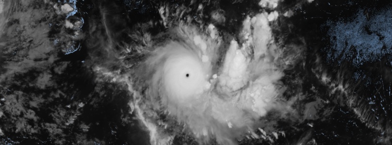
Featured image: Tropical Cyclone "Ambali" at 19:30 UTC on December 5, 2019. Credit: Meteosat-8
An impressive rapid intensification of Tropical Cyclone "Ambali" is currently in progress in the South Indian Ocean.
This is the second named storm of the 2019/20 Southwest Indian Ocean cyclone season, forming just days after Belna, the first named storm of the season. This is also the first major hurricane strength cyclone of the 2019/20 Southern Hemisphere season to date.
Ambali was seen quickly organizing and attaining formative rainbands around a coalescing center of circulation on December 3. Quick organization continued on December 4 and into December 5 when the storm was finally named Ambali.
Due to its location in a highly favorable environment, a phase of rapid intensification ensued, accompanied by the formation of an eye.
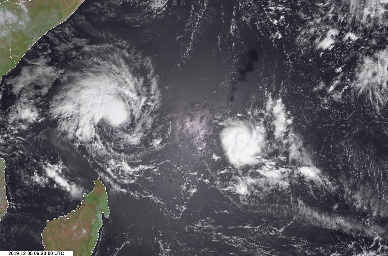
Tropical Cyclone 02S (left) and Tropical Cyclone "Ambali" (right) at 06:30 UTC on December 5, 2019
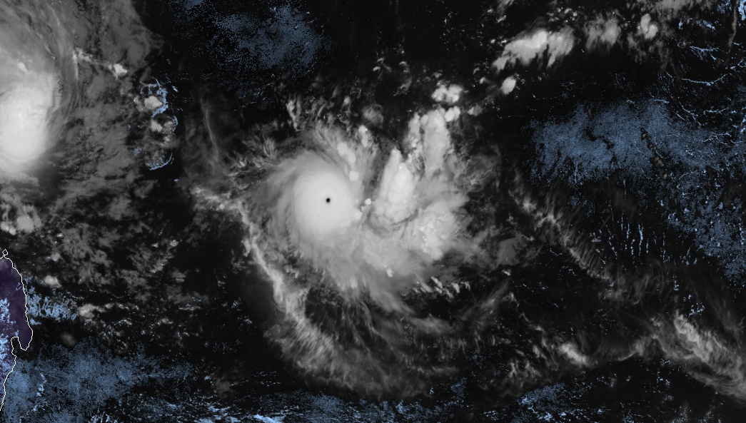
Tropical Cyclone "Ambali" at 19:30 UTC on December 5, 2019. Credit: Meteosat-8
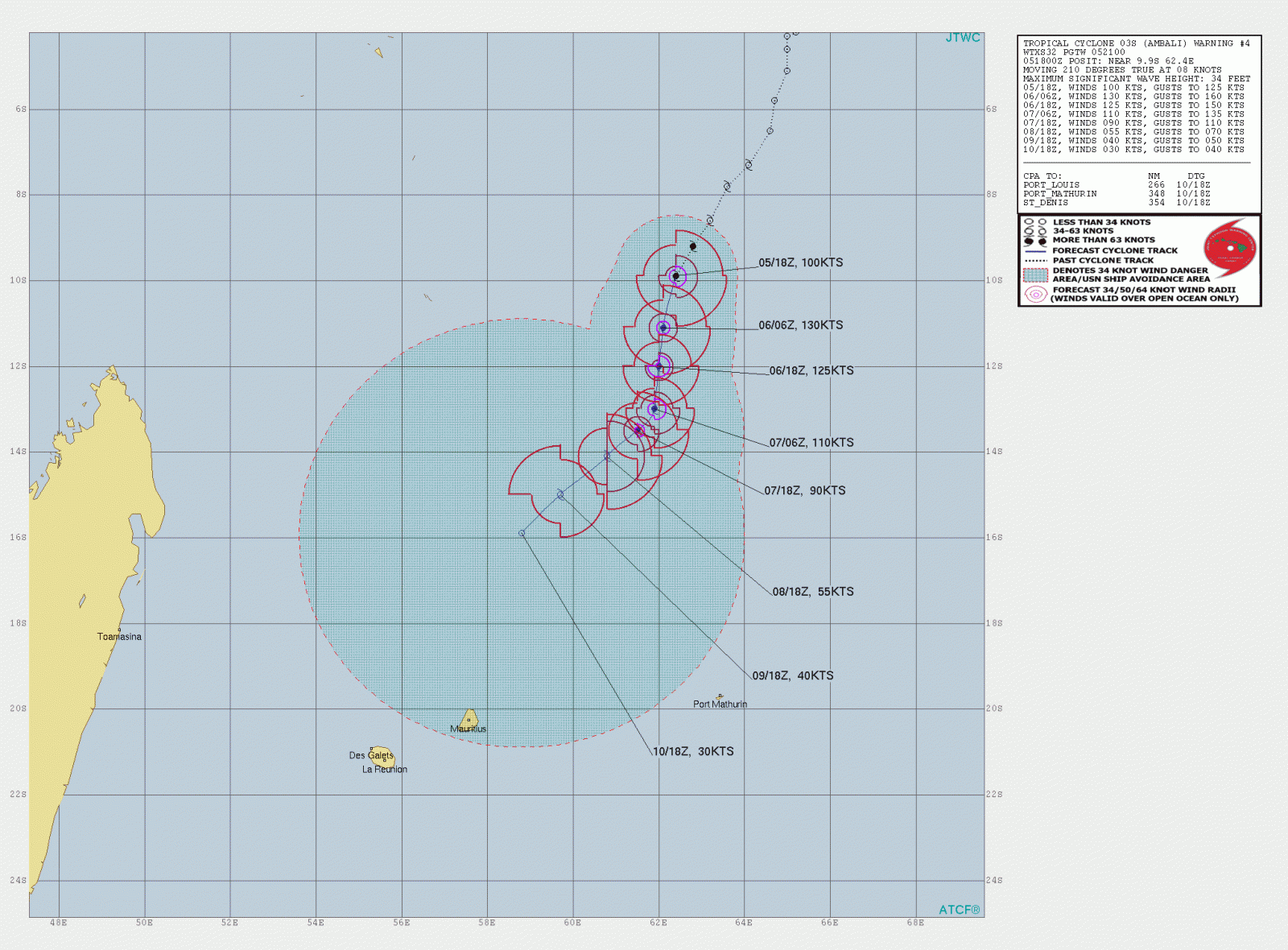
At 18:00 UTC, Meteo France upgraded Ambali to an intense tropical cyclone, following a 75 km/h (47 mph) increase in storm's winds in just three hours.
The intensification could continue this night. However, from tomorrow and beyond, due to an approaching upper levels trough, a westerly shear constraint appears in the mid-levels, then in the upper levels quickly after, associated with mid-levels dry air intrusion.
A rather rapid weakening is suggested by the available intensity guidance, RSMC La Reunion said.
The intensity forecast for such a small system remains challenging and associated with a greater than usual uncertainty, it added.
JTWC's current forecast calls for Ambali to peak at 240 km/h (150 mph) over the next 12 hours (by 06:00 UTC on December 6).
I'm a dedicated researcher, journalist, and editor at The Watchers. With over 20 years of experience in the media industry, I specialize in hard science news, focusing on extreme weather, seismic and volcanic activity, space weather, and astronomy, including near-Earth objects and planetary defense strategies. You can reach me at teo /at/ watchers.news.
Commenting rules and guidelines
We value the thoughts and opinions of our readers and welcome healthy discussions on our website. In order to maintain a respectful and positive community, we ask that all commenters follow these rules.