
New winter storms invade Pacific Northwest, northern tier of the United States
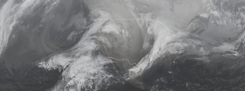
Image credit: UW-CIMSS, TW
Snow is falling across the Pacific Northwest and the northern Rockies as a cyclone invades from the Pacific Ocean, the Weather Prediction Center (WPC) reports.
Winter Storm Watches are in effect for the Sierra Nevada of eastern California. Winter storm warnings and advisories extend across all of Washington, northern and western Oregon, northern Idaho, northwest Montana and northernmost California. Flood watches are in effect for portions of central California and northwest Oregon.
At 02:00 UTC on February 12 (18:00 PST, February 11), the center of the system was located about 290 km (180 miles) WSW of Quillayute, Washington.
Its cold front is about to make landfall along the coast of the Pacific Northwest per the most recent surface analysis. Ahead of the system, National Weather Service Doppler Radar and surface observations depict snow across much of Washington, northern Oregon, northern Idaho, and westernmost Montana at this time, heaviest in the vicinity of Puget Sound.
As the system slides down the coast, heavy snowfall will follow suit. Between now and Thursday, February 14, 60 – 90 cm (2 – 3 feet) of new snowfall is expected across the Cascades of Washington and Oregon as well as the higher elevations of Idaho and northwest Wyoming and the Shasta and Siskiyou ranges of northern Califonia.
The Sierra Nevada of eastern California is expected to receive 90 to 1.5 m (3 – 5 feet) of new snowfall from this system.
Such significant snowfall carries an avalanche risk and threatens to close major roadways and interstate routes in the area once heavy snow begins to pile up.
At lower elevations, western Oregon and California's coastal ranges are expected to receive 51 – 127 mm (2 – 5 inches) of rainfall into Thursday afternoon, which could lead to flooding.
Meanwhile, a developing winter storm will bring widespread moderate to heavy snow to much of the Great Lakes through Tuesday, and then reaching the Northeast by Tuesday night and early Wednesday, February 13.
The potential exists for 150 to 300 mm (6 to 12 inches) of snow from northern Wisconsin to northern Michigan, and even higher amounts across upstate New York and northern New England with 300 to 460 mm (12 to 18 inches) possible, NWS forecaster Hamrick notes.
A corridor of freezing rain is likely to the south of the heavy snow axis, extending from the central Appalachians to southern New England, and also across southern Michigan.
Significant travel impacts are anticipated through Wednesday, and some power disruptions are also possible.
Winter Storm Warnings and Watches and Winter Weather Advisories stretch from the Central/Northern Plains through the Upper Midwest, Great Lakes, Central/Northern Appalachians, and Northeast.
Ice Storm Warnings are in effect across southeast Michigan and far northwest Ohio.
Flood and Flash Flood Warnings and Watches are in effect across the Middle/Lower Mississippi Valley and into the Tennessee and Ohio Valleys.
I'm a dedicated researcher, journalist, and editor at The Watchers. With over 20 years of experience in the media industry, I specialize in hard science news, focusing on extreme weather, seismic and volcanic activity, space weather, and astronomy, including near-Earth objects and planetary defense strategies. You can reach me at teo /at/ watchers.news.
Commenting rules and guidelines
We value the thoughts and opinions of our readers and welcome healthy discussions on our website. In order to maintain a respectful and positive community, we ask that all commenters follow these rules.