
Tropical Storm “Isaac” to be at or near hurricane strength when it approaches the Leeward Islands on September 13
Featured image: Tropical Storm "Isaac" at 10:15 UTC on September 11, 2018. Credit: NOAA/GOES-East
Tropical "Storm" Isac remains a strong tropical storm over the central tropical Atlantic Ocean and is expected to be near or at hurricane strength when it approaches the Leeward Islands on September 13, 2018. Interests in the Lesser Antilles should monitor the progress of this storm.
At 09:00 UTC on September 11, the center of Tropical Storm "Isaac" was located about 1 420 km (880 miles) east of the Lesser Antilles. Its maximum sustained winds were 110 km/h (70 mph) and the system was moving west at 22 km/h (14 mph) with minimum central pressure of 997 hPa.
This general motion is expected to continue through the end of the week.
On the forecast track, Isaac should move across the Lesser Antilles and into the eastern Caribbean on Thursday, September 13.
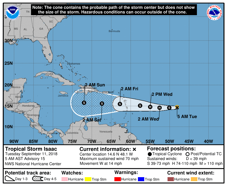
Little change in strength is forecast during the next few days, but Isaac is forecast to be at or near hurricane strength as it approaches the Lesser Antilles.
There are currently no coastal watches or warnings in effect, but interests in the Lesser Antilles should monitor the progress of Isaac.
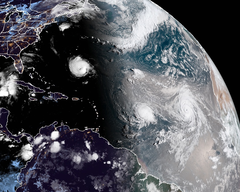
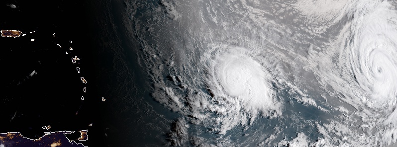
Hurricane "Florence" (left), Tropical Storm "Isaac" (center) and Hurricane "Helene" at 10:15 UTC on September 11, 2018. Credit: NOAA/GOES-East
The storm is expected to produce total rainfall accumulations of 51 to 102 mm (2 to 4 inches) with isolated amounts near 152 mm (6 inches) across the Leeward Islands late this week, with 25.4 to 51 mm (1 to 2 inches) anticipated across the Windward Islands.
I'm a dedicated researcher, journalist, and editor at The Watchers. With over 20 years of experience in the media industry, I specialize in hard science news, focusing on extreme weather, seismic and volcanic activity, space weather, and astronomy, including near-Earth objects and planetary defense strategies. You can reach me at teo /at/ watchers.news.
Commenting rules and guidelines
We value the thoughts and opinions of our readers and welcome healthy discussions on our website. In order to maintain a respectful and positive community, we ask that all commenters follow these rules.