
First big cold front of the season hits Perth, Western Australia
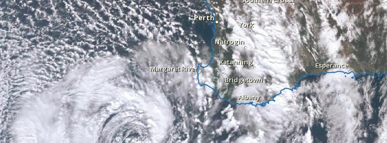
Image credit: BOM, JMA
The first big cold front of the year hit Perth, capital of Western Australia, with powerful winds and heavy rain, leaving nearly 10 000 homes without power and causing floods
The front crossed the coastal regions late Thursday, May 24, 2018, with wind gust up to 113 km/h (70 mph) recorded at Gnowangerup and Cape Naturaliste, and heavy rain.
79 mm (3.1 inches) of rain was recorded in Vasse and more than 69 mm (2.7 inches) at nearby Busselton. Perth recorded 29.2 mm (1.1 inches) of rain to 09:00 local time May 25, Swanbourned 41.4 mm (1.6 inches) and Rottnest Island 44 mm (1.73 inches).
The storm downed trees and threw debris into power lines, leaving 9 500 homes without power. SES received more than 90 calls for help overnight for minor storm-related incidents, with 580 homes affected, WA Today reports.
"Our crews are continuing to attend these hazards and make the area safe as a priority before we begin any attempts to restore power to customers," a Western Power spokesperson said.
Two people narrowly escaped death after their car was struck by a massive falling eucalyptus tree as they were traveling along Pearson Streed in Churchlands. The couple, both aged in their 70s, were taken to a hospital after emergency services rescued them. Their injuries are not life-threatening.
Satellite imagery shows amazing details at times, and this loop of the low pressure system to the SW of #WA is no exception. The clockwise rotation of the low is clearly shown, as is the stream of showery cloud onto the west coast. pic.twitter.com/laWMvTfaNH
— Bureau of Meteorology, Western Australia (@BOM_WA) May 25, 2018
Map of rainfall totals across WA for the 24 hours to 9am this morning shows heaviest falls near west coast. pic.twitter.com/IFh161KUiY
— Bureau of Meteorology, Western Australia (@BOM_WA) May 25, 2018
.
In the wake of the strong front, conditions have temporarily eased. Showers & winds will increase again during the afternoon as a deep low passes south of the state. Severe Weather Warning continues for Damaging Winds & Abnormally High Tides. https://t.co/NikaX4QRKr @dfes_wa pic.twitter.com/9m0dhoap13
— Bureau of Meteorology, Western Australia (@BOM_WA) May 25, 2018
One from Last nights Storm #PerthWeather, #waweather, #storm, #perth, #PerthStorm pic.twitter.com/PTFt4C7qyx
— Mark Gray (@markagray1) May 24, 2018
Well this scared the s$%t out of me when it came down unannounced out back! #storms #Perth pic.twitter.com/15BRX9fIij
— Connor McDonald (@connor_mc_d) May 25, 2018
#Perth is significantly lacking in street drainage. This is what happens when it rains. Makes for very dangerous road conditions. #weather pic.twitter.com/E3UevV7s96
— Melanie OBrien (@DrMelOB) May 25, 2018
Wild weather is expected to continue on Friday, May 25 as deep low pressure system approaches parts of the South West and strong cold front lies east of Ravensthorpe.
Bureau of Meteorology duty forecaster Neil Bennet said conditions should ease after local midnight.
"There is a period of weather now from this evening right through to midnight when we are expecting to see the winds continue to blow quite strongly — there is the potential for gusts up around the 90 km/h (56 mph) mark again for the South West," Bennett said.
"Rainfall will still be quite heavy but not as heavy as last night, although there will still be the potential for some falls of 20 – 30 mm (up to 1.2 inches).
"Once we get through the midnight period there will be an easing trend for the west coast, but along the south coast, conditions are going to become and stay rather windy.
"Also there'll be a lot of showers and there could be some thunderstorms across the south coast as well."
I'm a dedicated researcher, journalist, and editor at The Watchers. With over 20 years of experience in the media industry, I specialize in hard science news, focusing on extreme weather, seismic and volcanic activity, space weather, and astronomy, including near-Earth objects and planetary defense strategies. You can reach me at teo /at/ watchers.news.
Commenting rules and guidelines
We value the thoughts and opinions of our readers and welcome healthy discussions on our website. In order to maintain a respectful and positive community, we ask that all commenters follow these rules.