
Nearly 50 000 evacuated around Agung amid fears of eruption, Bali
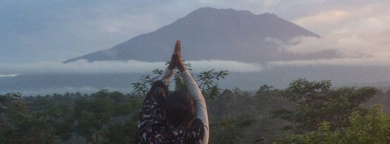
Featured image: Mount Agung on September 24, 2017. Credit: Sutopo Purwo Nugrosho / BNPB
Nearly 50 000 people living near Agung volcano in Bali, Indonesia have been evacuated following an increasing unrest detected since August 10, 2017.
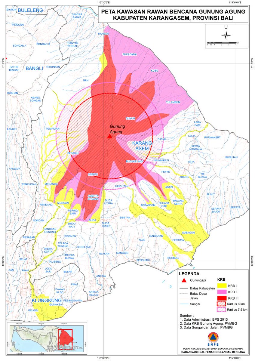
Evacuations have taken place in an area of up to 12 km (7.4 miles) around the volcano. According to the ARISTOTLE emergency report, the increasing unrest does not necessarily mean that an eruption will take place, nor it can give precise indications on when/if this would happen. However, historical data shows that the eruptions of this volcano were of a big magnitude.
As of September 24, nearly 35 000 people have been evacuated from their homes and dispersed across 238 locations in seven districts in Bali.
Indonesia's disaster management agency (BNPB) said Monday morning, September 25 that the number has increased to 48 540, adding that they expected it to rise because more than 60 000 people lived in the danger zone.
"There are still people who don't want to be evacuated," Sutopo Purwo Nugroho, BNPB spokesman said at Monday's press conference. "The reason is firstly, the mountain hasn't erupted yet. Secondly, they are worried about their livestock."
Gunung Agung pagi ini 24/9/2017. Belum meletus. Tidak ada abu vulkanik. Status Awas. Radius 9km dan sektor 12km daerah berbahaya. pic.twitter.com/7Y7t6uNptT
— Sutopo Purwo Nugroho (@Sutopo_BNPB) September 23, 2017
On September 24, BNPB sent 14 tons of assistance to the island and is providing over IDR 1 billion (US$ 75,000) to Karangasem District to operationalize the Command Post there and is preparing ready-to-use budget for emergency response activities.
PVMBG first raised the alert level to 2 on September 14 and to 3 on September 18.
The last eruption of this volcano started in February 1963 and ended in January 1964. This was one of the world's largest eruptions of the 20th century (VEI 5). It produced voluminous ashfall along with devastating pyroclastic flows and lahars that caused extensive damage and some 1 100 fatalities.
Geological summary
Symmetrical Agung stratovolcano, Bali's highest and most sacred mountain, towers over the eastern end of the island. The volcano, whose name means "Paramount," rises above the SE caldera rim of neighboring Batur volcano, and the northern and southern flanks of Agung extend to the coast.
The 3142-m-high (10 308 feet) summit contains a steep-walled, 500-m-wide (1 640 feet), 200-m-deep (656 feet) crater. The flank cone Pawon is located low on the SE side.
Only a few eruptions dating back to the early 19th century have been recorded in historical time. The 1963-64 eruption, one of the world's largest of the 20th century, produced voluminous ashfall along with devastating pyroclastic flows and lahars that caused extensive damage and many fatalities. (GVP)
I'm a dedicated researcher, journalist, and editor at The Watchers. With over 20 years of experience in the media industry, I specialize in hard science news, focusing on extreme weather, seismic and volcanic activity, space weather, and astronomy, including near-Earth objects and planetary defense strategies. You can reach me at teo /at/ watchers.news.
Commenting rules and guidelines
We value the thoughts and opinions of our readers and welcome healthy discussions on our website. In order to maintain a respectful and positive community, we ask that all commenters follow these rules.