
Slow moving tropical low makes landfall in Queensland, Australia
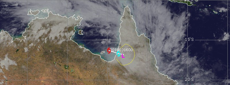
Featured image: Tropical Cyclone 16P position and forecast track at 06:30 UTC on March 16. Credit: UW-CIMSS
A tropical low that formed in the Gulf of Carpentaria late March 15 (TC 16P/JTWC) has moved rapidly eastward and made landfall on the western coast of Cape York Peninsula, Queensland, Australia around 06:00 UTC on March 16. The main impact of this system is widespread rainfall with the potential for flooding.
Australian Bureau of Meteorology (BOM) said at 05:00 UTC today that the tropical low has sustained winds near the center of 55 km/h (34 mph) with wind gusts to 85 km/h (53 mph) and is moving east at 15 km/h (9.3 mph). At the time, its center was 135 km (83 miles) SSW of Kowanyama and 105 km (64 miles) NNE of Karumba. The system's central pressure at 06:34 UTC was 999 hPa.
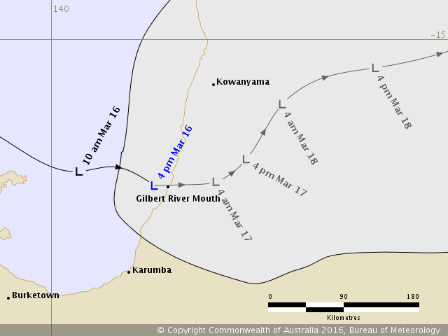
Forecast track issued by BOM at 16:00 AEDT (05:00 UTC) on March 16, 2016.
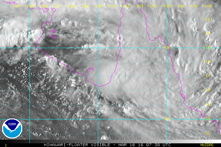
Tropical cyclone 16P at 07:30 UTC on March 16, 2016. Credit: NOAA / JMA Himawari
In their Tropical Cyclone Warning #1 for this system (TC 16P) issued 03:00 UTC today, JTWC warned there is a possibility for the remnants of TC 16P to re-emerge over the Gulf of Carpentaria or continue east to the Coral Sea in the coming days.
In this scenario, there is a small potential for a significant tropical cyclone to redevelop following the anticipated near-term dissipation over the Cape York Peninsula.
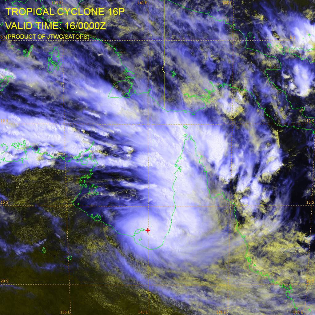
Tropical Cyclone 16P at 03:00 UTC on March 16, 2016. Image credit: JTWC/SATOPS
The main impacts of this system are likely to be widespread rainfall and storms with the potential for flooding, BOM warned.
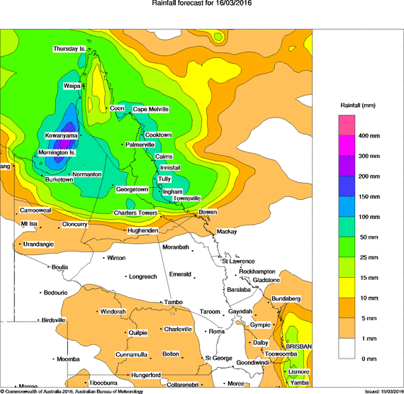
Image credit: BOM
Daily rainfall totals of 100 – 150 mm (3.9 – 5.9 inches) are expected, with localised falls up to 200 mm (7.9 inches) possible.
As the system moves east toward the Coral Sea, Queensland's tropical coast can also expect significant falls from Cooktown to south to Port Douglas, Cairns, Innisfail, Mission Beach, Cardwell and Ingham with Townsville on the southern fringe.
The Bureau has issued a Flood Watch. See www.bom.gov.au/qld/warnings to view the current flood warnings for Queensland.
I'm a dedicated researcher, journalist, and editor at The Watchers. With over 20 years of experience in the media industry, I specialize in hard science news, focusing on extreme weather, seismic and volcanic activity, space weather, and astronomy, including near-Earth objects and planetary defense strategies. You can reach me at teo /at/ watchers.news.
Commenting rules and guidelines
We value the thoughts and opinions of our readers and welcome healthy discussions on our website. In order to maintain a respectful and positive community, we ask that all commenters follow these rules.