
Hurricane “Pali” becomes record-breaking
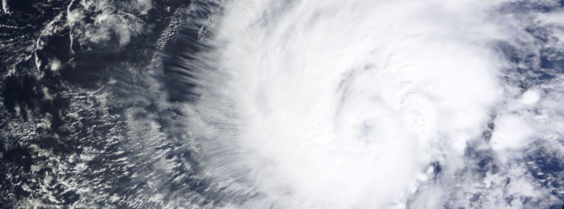
Featured image: Hurricane "Pali" on January 11, 2016. Image credit: NASA Terra/MODIS.
At 03:00 UTC on January 12, Tropical Storm "Pali", which formed on January 8, reached hurricane strength and thus became the earliest hurricane on record in the central Pacific basin, far to the southwest of Hawaii.
"After exhibiting a rather well-defined eye through the evening, a recent burst of deep convection the center of Hurricane 'Pali' has caused the eye to become cloud-filled. Likely due to southwesterly vertical wind shear of around 28 km/h (17.3 mph)," NOAA's Central Pacific Hurricane Center said.
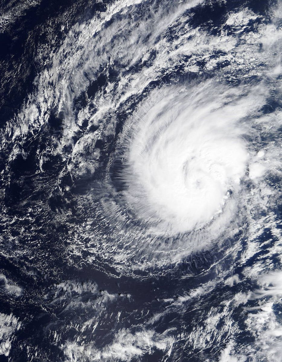
Hurricane "Pali" January 11, 2016. Image credit: NASA Terra/MODIS
According to JTWC, Pali's maximum sustained winds were 148 km/h (92 mph) at 12:00 UTC today. Maximum significant wave height was 7 meters (23 feet). At 16:00 UTC, the system was located approximately 1 089 km (677 miles) and has tracked south-southwestward at 13 km/h (8 mph) over the past six hours. Estimated minimum central pressure was 989 hPa.
Hurricane force winds extend outward up to 35 km (25 miles) from the center, and tropical storm force winds extend outward up to 165 km (105 miles), CPHC said.
Although Pali will remain over warm sea surface temperatures of 28 to 29 °C (82.4 to 84.2 °Fahrenheit) along the forecast track. Ships indicate a modest Increase in wind shear that could produce some weakening during the next couple of days.
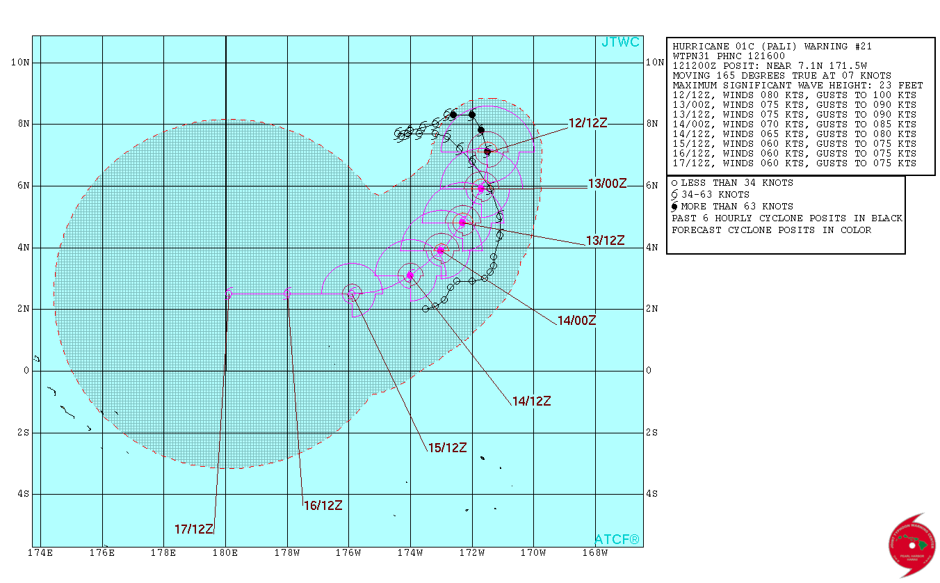
Hurricane "Pali" forecast track by JTWC on January 12, 2016.
With Pali moving closer to the equator, uncertainty in the forecast track beyond the next couple of days is higher than normal.
The Watchers team and our contributors bring the latest on extreme weather, earthquakes, volcanic eruptions, space weather, and all things science. We're all about making sense of the natural world and keeping you informed on what’s happening. Got a tip or a question? Hit us up using the form at newstips!
Commenting rules and guidelines
We value the thoughts and opinions of our readers and welcome healthy discussions on our website. In order to maintain a respectful and positive community, we ask that all commenters follow these rules.