
Two rapidly deepening Atlantic storms to affect UK

Image credit: TW
Two rapidly deepening Atlatic storms are set to pass just north of the UK by the end of the week bringing some very unsettled weather over the next few days, UK Met Office warned today.
Northern Scotland is likely to see the strongest winds as the storms pass by on Friday and Saturday, January 9 and 10, with gusts of up to 144 km/h (90 mph) or more possible in the most exposed regions.
The Met Office has issued severe weather warnings for northern parts of the UK. Although it will be very windy for most areas, winds will be less strong in southern areas.
The jet stream, a narrow band of fast-moving winds high up in the atmosphere, is playing a role in the development of the storms. Frank Saunders, Chief Meteorologist at the Met Office, said: "The jet stream is going to be particularly strong later this week and this effectively fuels the low pressure systems moving across the Atlantic, causing them to deepen rapidly as they pass to the north of the UK.
"This will bring some very strong winds across the UK, but they will most likely be strongest in northern Scotland – which is expected to see the greatest impacts from the weather. This is likely to cause disruption in places and people should stay up to date with our forecasts and warnings to get the latest information as we move closer to the end of the week."
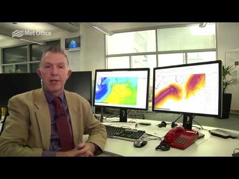
Video courtesy of UK Met Office
The low will move quickly eastwards on Friday afternoon, but there will be little respite before another rapidly deepening low brings further strong winds later on Friday and through the day on Saturday.
Featured image and source: UK Met Office

Teo Blašković founded The Watchers in 2011 and edited it until 2026, covering seismic and volcanic activity, extreme weather, space weather and near-Earth objects. Articles on this page are his archive.
Published in the last 24 hours
- A broad low over southeastern Florida and the northwestern Bahamas has a 30 percent chance of subtropical or tropical development within 48 hours and a 50 percent chance within 7 days, the National Hurricane Center says
- High Risk of excessive rainfall covers Florida’s Space Coast as St. Johns River near Cocoa reaches 5.67 m
- Asteroid 2026 WJ to pass Earth at 1.7 lunar distances at 04:20 UTC on November 22, with 2026 WD following at 4.4 lunar distances on November 23
- Cyclone Akvan crossed the north Andhra Pradesh and south Odisha coasts close to Gopalpur on November 20 with 70-80 km/h winds gusting to 90, and has weakened into a deep depression

Commenting rules and guidelines
We value the thoughts and opinions of our readers and welcome healthy discussions on our website. In order to maintain a respectful and positive community, we ask that all commenters follow these rules.