
Northern Europe prepares for powerful storm system
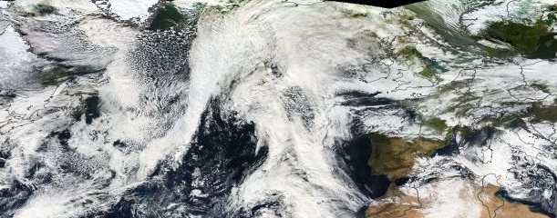
Image credit: NASA Terra/MODIS. Image taken December 1, 2013.
Northern Europe is bracing for powerful storm system expected to reach land by the middle and end of the week. The system will begin to organize on Tuesday, December 3, near southern Greenland and move eastward toward Scotland, Scandinavia and northern mainland Europe.
Storm-force winds in excess of 100 km/h, rain and snow are expected from Wednesday to Friday.
This system will have a more northern track than the severe storm which struck southern UK on October 27th.
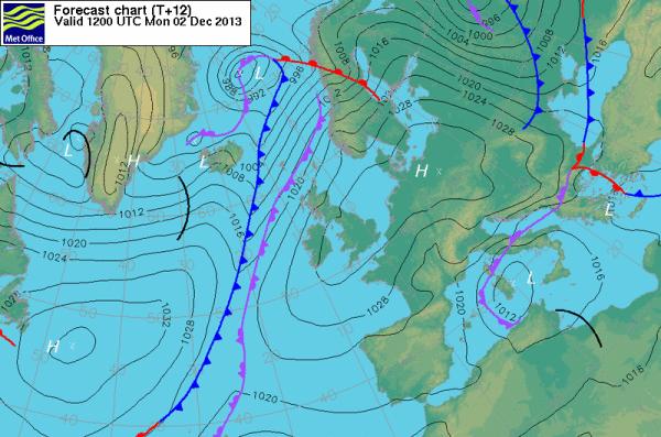
Surface pressure chart. Image credit: MetOffice
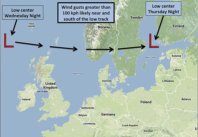
The above graphic, prepared by an AccuWeather.com meteorologist using Google Maps, shows the expected track of the low pressure from Wednesday night through Thursday night of this week. The strongest winds are likely to occur near and to the south of the low track. Image credit: Google Maps/AccuWeather
If the storm achieves its full potential, scattered power outages as well as some wind damage are likely in the regions that experience the strongest winds, AccuWeather reports.
I'm a dedicated researcher, journalist, and editor at The Watchers. With over 20 years of experience in the media industry, I specialize in hard science news, focusing on extreme weather, seismic and volcanic activity, space weather, and astronomy, including near-Earth objects and planetary defense strategies. You can reach me at teo /at/ watchers.news.
Storm Power….
My prayers are with all of you. Now is the time to believe.