
Haze along the Himalaya
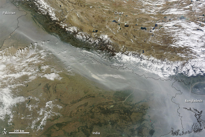
Image credit: TW
Haze hugged the southern slopes of the Himalaya in early November 2011. At about 10:45 a.m. on November 3, 2011, the Moderate Resolution Imaging Spectroradiometer (MODIS) on NASA’s Terra satellite captured this natural-color image of haze stretching from Pakistan southeastward to Bangladesh.
Haze is common at this time of year when farmers in northwestern India set fires to clear their fields of excess vegetation. MODIS detects areas of high surface temperatures associated with fires, but fires burn more intensely in the afternoon, and few blazes appear as hotspots (red dots) in this morning scene. The haze may result from additional factors besides agricultural fires, including urban and industrial pollution.
Commenting rules and guidelines
We value the thoughts and opinions of our readers and welcome healthy discussions on our website. In order to maintain a respectful and positive community, we ask that all commenters follow these rules.