
Tectonic plates converging – new land emerged in Sea of Azov
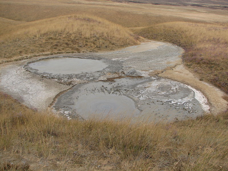
Image credit: TW
The plot of the seabed up to the surface in the vicinity of the Taman Peninsula. The new land emerged from the shift of tectonic plates.
Amazing natural phenomenon has been documented in recent days in the vicinity of the Taman Peninsula in Sea of Azov. Huge beds of clay and stone rose by about 5 meters above the Sea of Azov in the Temryuk district of Krasnodar region, forming a peninsula. Scientists suggest that the cause of the “new lands” could be awakened mud volcanoes. Seismologists have carefully calculate the probability of earthquakes, arguing that the population has no reason to panic.
The huge strip of land length 800 and width 50 meters literally grew up on the very spot where, just a week ago, lapped the Sea of Azov. Thus, the area of Russia increased by 4 hectares at once.

Discovery was made by local residents who immediately called the SSC FGUGP “Yuzhmorgeologiya” and told the geologists of the new land.
Seismologists believe that under the influence of yet unknown force tectonic plates began to converge and squeeze out a layer of clay. Pressure, which could set in motion a volume of soil, according to conservative estimates, was equal to 24 million tons. However, it remains unclear why such a powerful underground processes have not been fixed special equipment, leading continuous monitoring of crustal movement.

– Usually accompanied by tectonic disturbances increased levels of radon – told chief seismogeodynamic monitoring “Yuzhmorgeologiya” Vladimir Fomenko. – However, in this case, radon are normal. Therefore, we can not yet say with certainty what really happened.
Currently, scientists are closely watching for any changes in indications and devices continue to seek an answer to the question of what caused the seabed to the surface. (LifeNewsOnline)
The Taman Peninsula is a peninsula in the present-day Krasnodar Krai of Russia. It is bounded on the north by the Sea of Azov, on the west by the Strait of Kerch and on the south by the Black Sea.
The Sea of Azov is largely affected by the inflow of numerous rivers, which bring sand, silt, and shells, forming numerous bays, limans, and narrow sandbanks called spits. Because of these deposits, the sea bottom is relatively smooth and flat with the depth gradually increasing toward the sea centre.
The Sea of Azov is the shallowest sea in the world with an average depth of 7 metres (23 ft) and maximum depth of 14 metres (46 ft); in the bays, where silt has built up, the average depth is about 1 metre (3 ft). The sea bottom is also relatively flat with the depth gradually increasing from the coast to the centre. The Sea of Azov is an internal sea with the passage to the Atlantic Ocean going through the Black, Marmara, Aegean and Mediterranean seas. It is connected to the Black Sea with the Strait of Kerch, which has a smallest width of 4 kilometres (2.5 mi) and a maximum depth of 15 metres (49 ft). The narrowness of the Kerch Strait limits the water exchange with the Black Sea. As a result, the salinity of the Sea of Azov is low; in the open sea it is 10–12 psu, that is about one third of the salinity the oceans, and is even lower (2–7 psu) in the Taganrog Bay. The long-term variations of salinity are within a few psu and are mostly caused by the changes in air humidity and precipitation.
The depth of Azov Sea is decreasing, mostly due to the river-induced deposits. Whereas the past hydrological expeditions recorded depths up to of 16 metres, more recent ones could not find places deeper than 13.5–14 metres. This might explain the variation in the maximum depths among different sources. The water level fluctuates by some 20 cm over the year due to the snow melts in spring.
The Taman Peninsula has about 25 mud volcanoes, most of which are active. Their eruptions are usually quiet, spilling out mud, and such gases as methane, carbon dioxide and hydrogen sulfide, but is sometimes violent and resembles regular volcanic eruptions. Some of those volcanoes are under water, near the shores of the peninsula. A major eruption on 6 September 1799, near stanitsa Golubitskaya, lasted about 2 hours and formed a mud island 100 metres in diameter and 2 metres in height; the island was then washed away by the sea. Similar eruptions occurred in 1862, 1906, 1924, 1950 and 1952. (Wikipedia)
SEA OF AZOV INFO
| Primary sources | Don and Kuban |
| Max length | 360 km (220 mi) <1 > |
| Max width | 180 km (110 mi) <1 > |
| Surface area | 39,000 km2 (15,000 sq mi) <1 > |
| Average depth | 7 metres (23 ft) <1 > |
| Max depth | 14 m (46 ft) <1 > |
| Water volume | 290 km3 <1 > |
The straits near Taman are actually being pulled in three directions. First southeast along the Eurasian Plate border, then a bounce back to the northwest when the tug releases, then a tug to the southwest when the African Plate tends to drop and move slightly to the west during the African roll, which has already started to a slight degree. Pull a piece of cloth with a hole in the center over some dough, and pull alternately in three different directions, and see what the dough does. As the cloth is pulled in one direction, the cloth is pressed down, and the dough moves away from that spot to the obvious outlet, the hole in the center of the cloth. Likewise for the other directions, so the dough at the center gradually squeezes out. The strait at Taman is clearly a weak point in the crust, equivalent to the hole in the cloth. (EOZT)
The Black Sea deluge theory dates the genesis of the Sea of Azov to 5600 BC, and there are traces of Neolithic settlement in the area now covered by it. In antiquity, it was known as Lake Mæotis, the Maeotian Lake or the Maeotian Sea, after the tribe of Maeotae which inhabited the Maeotian marshes to the east from the sea. In the antique epoch, locals called the sea Temerinds. In medieval times, Russians named it Surozh Sea, after the Crimean city of Surozh (now Sudak).
In 1997, William Ryan and Walter Pitman from Columbia University published a theory that a massive flood through the Bosporus occurred in ancient times. They claim that the Black and Caspian Seas were vast freshwater lakes, but then about 5600 BC, the Mediterranean spilled over a rocky sill at the Bosporus, creating the current communication between the Black and Mediterranean Seas. Subsequent work has been done both to support and to discredit this theory, and archaeologists still debate it. This has led some to associate this catastrophe with prehistoric flood myths.
There is also one theory that Atlantis sank beneath Sea of Azov.
Here is to Al Gore & Co: ┌∩┐(◕_◕)┌∩┐!!!