
Updates on Yellowstone activity
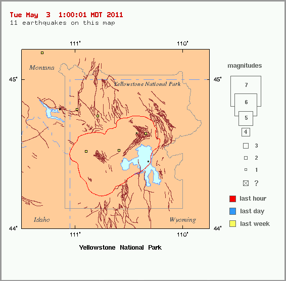
Image credit: YVO
During the month of April 2011, 91 earthquakes were located in the Yellowstone National Park region. The largest was a magnitude 2.2 event on April 13 at 7:11 AM MDT, located about 15 miles southeast of West Thumb, YNP. A small swarm of 24 earthquakes was recorded on April 14, located about 5 miles east of West Thumb, YNP, with magnitudes ranging from M 2.0 to M -0.1.
The period of caldera uplift that began in 2004 ended about one year ago. Since then, the caldera has been subsiding, though seasonal deformation from ground water changes may temporarily mask the trend. (USGS)
Map of GPS stations in the Yellowstone vicinity
Graph of daily GPS positions at White Lake, within the Yellowstone caldera.

Earlier reporting
Nothing on Watchers was published in the last 24 hours. These are older articles.
- M6.6 earthquake hits the Banda Sea 148 km west-southwest of Tual, Indonesia, at 68 km depth, USGS issues Green alert
- On October 22, 2017, a single flash of lightning stretched 515 miles from eastern Texas to near Kansas City, a distance that takes eight hours to drive, and nobody realized how far it had gone until scientists went back through the satellite data years later Epicenter
- CPC posts a slight risk of heavy rain from the Gulf Coast to the Northeast urban corridor November 25-29, and a moderate risk of West Coast wind and Sierra snow on November 25
- Florida's east coast faces a moderate flash flood risk Wednesday through Friday, with 4 to 8 inches of rain forecast and the St. Johns River near Cocoa already in major flood at 17.13 feet
