
Cyclone Bingiza hits Madgascar
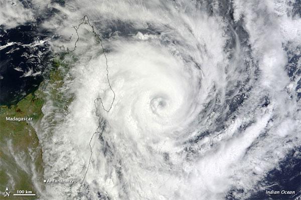
Image credit: NASA Terra / MODIS (Earth Observatory)
The U.S. Navy's Joint Typhoon Warning Center (JTWC) reported that, as of about noon Madagascar time on Feb. 14, Bingiza had maximum sustained winds of 98 mph (155 kilometers per hour) and gusts up to 120 mph (195 kph).
Image credit: NASA Terra/MODIS (EO)
NASA's Terra satellite captured this image of Bingiza at 10:00 a.m. local time on Feb. 13, 2011. In the image, Bingiza's eye approaches northern Madagascar, and a spiral arm grazes Antananarivo.
Although Bingiza would weaken somewhat over land, the storm was expected to re-strengthen after passing over northern Madagascar, thanks to high sea surface temperatures, according to a NASA statement. The JTWC forecast that, on the western side of Madagascar, the storm would travel southward, roughly tracing the island’s west coast.
Commenting rules and guidelines
We value the thoughts and opinions of our readers and welcome healthy discussions on our website. In order to maintain a respectful and positive community, we ask that all commenters follow these rules.