
Major snowstorm, waves of chilly air to affect northern and central Rockies, US
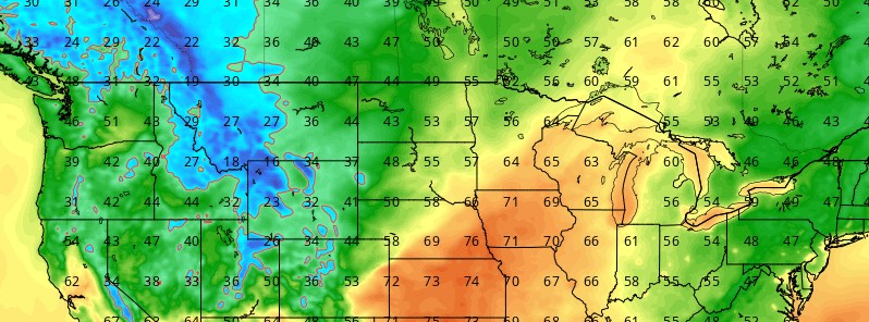
Featured image: 2-m air temperature - October 3, 2017. Credit: GFS/TropicalTidbits.com
Temperatures will plummet across the northwestern United States as chilly storms roll across the region into the first week of October. The chill may come as a shock for some residents given the recent stretch of unseasonably warm conditions, AccuWeather meteorologists say.
“As cold air in the upper atmosphere moves into the region, temperatures will go from well above normal and, in some cases record-breaking, to below normal this weekend,” AccuWeather Meteorologist Ryan Adamson said.
Highs in the 40s (~4.4 °C), 50s (~10 °C) and 60s (~15 °C) will settle in over the weekend and into the first days of October following several days in the 70s and 80s (20 – 27 °C) this week.
Waves of chilly air will rotate counterclockwise from Canada around the main storm over the Northwest. Bouts of rain and snow showers will push inland with each wave.
“Anyone planning on heading to Yellowstone National Park will need to be prepared for winter-like conditions,” Adamson said.
An even more potent wave of cold air will rotate in early next week, potentially leading to a more significant rain and snow event for the northern Rockies and Plains on Monday and Tuesday, October 2 and 3.
This chilly wave will also reach far to the south, knocking temperatures 5 – 10 °F (2.7 – 5.5 °C) below normal in Redding, Fresno, Sacramento and Los Angeles, California, as well as Las Vegas.
"The big snowstorm will evolve Sunday night and Monday over the northern Rockies and just north of the Canada border of Montana," according to AccuWeather Senior Meteorologist Brett Anderson.
Snowfall will range from a few inches to a couple of feet from central and western Montana to western and southern Wyoming, northwestern Colorado and part of eastern Utah. Heavy snow will also fall on southwestern Saskatchewan and southern Alberta.
Meanwhile, periods of heavy rainfall will be possible this weekend across South Florida and portions of the Gulf Coast as an upper level low slowly tracks eastward over the state.
In turn, a surface trough will help focus thunderstorm activity as deep tropical moisture is being tapped. The National Hurricane Center is watching this feature as it has been becoming more favorable for development.
I'm a dedicated researcher, journalist, and editor at The Watchers. With over 20 years of experience in the media industry, I specialize in hard science news, focusing on extreme weather, seismic and volcanic activity, space weather, and astronomy, including near-Earth objects and planetary defense strategies. You can reach me at teo /at/ watchers.news.
The Watchers indeed.