• Ollera Creek Bridge collapse cuts key transport route in Queensland’s worst floods in 60 years, Australia

    The Ollera Creek Bridge, a critical section of the Bruce Highway, was destroyed over the weekend, severing a key transport link in Queensland amid the state’s worst flooding in 60 years. The floods have claimed the life of at least one person after a rescue boat capsized and have inundated thousands of homes and numerous roads across the region.

  • Major flooding underway in northern Queensland after extreme rainfall, Australia

    A major flood event is underway in northern Queensland, Australia, on Sunday, February 2, 2025, after parts of the region received between 500 and 1 000 mm (19.7 – 39.4 inches) of rain in the 48 hours leading up to 09:00 LT today. At least one person has drowned in floodwaters after an SES boat capsized. The region is forecast to receive additional heavy rainfall, with some areas expected to see up to 500 mm (19.7 inches) of additional rain over the next 24 hours.

  • Major atmospheric river to impact California coast this weekend

    Forecast confidence in a high-impact atmospheric river (AR) event has steadily increased since January 27, 2025, and CW3E is now warning about a major AR event expected to begin this Friday, January 31 along the U.S. West Coast, and potentially continue into early next week. The most recent forecast from the NCEP Global Ensemble Forecast System (GEFS) is showing >50% probability of an AR 4 or greater over along the California coast between Santa Cruz and Mendocino Counties.

  • Florida breaks all-time snowfall record as historic winter storm sweeps through the Southeast

    A historic winter storm swept through the southeastern United States this week, bringing heavy snowfall across nine states and claiming 10 lives. In Florida, Pensacola experienced unprecedented snowfall, with reports of 13 – 30 cm (5 – 12 inches) on January 21 surpassing the state’s all-time snowfall record of 10 cm (4 inches) set in Milton in 1954.

  • Red alerts issued as extremely dangerous Storm Éowyn approaches Ireland and UK

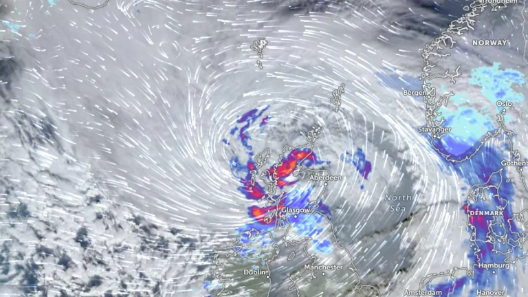
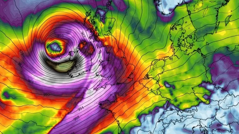
    Met Éireann, Ireland’s national meteorological service, has issued Red Level wind warnings for multiple counties as Storm Éowyn approaches the country on January 23, 2025. Éowyn is forecast to produce destructive gusts exceeding 130 km/h (81 mph), potentially causing widespread power outages, structural damage, dangerous travel conditions, and coastal flooding. Authorities have urged the public to shelter in place under Red warnings and avoid non-essential travel under Orange warnings. Schools nationwide will close, and disruptions to public transport and essential services are anticipated.

  • 56 000 homes destroyed or damaged by Tropical Cyclone Dikeledi in Mozambique

    Tropical Cyclone Dikeledi made landfall in Mozambique on January 13, 2025, bringing destructive winds and intense rainfall that have devastated Nampula Province. The cyclone has caused the deaths of at least 11 people, destroyed or damaged more than 55 000 homes, caused severe damage to critical infrastructure, and left over 230 000 people affected.