
Deep learning identifies six structurally complex regions at Earth’s core-mantle boundary
Researchers analyzing more than 2 million seismic waveforms identified six previously undersampled regions of strong structural heterogeneity near Earth’s core-mantle boundary, improving the global picture of one of the planet’s least accessible internal regions. The findings may help researchers investigate how ancient subducted material, partial melting and other deep-mantle processes influence the structure and evolution of the lowermost mantle.
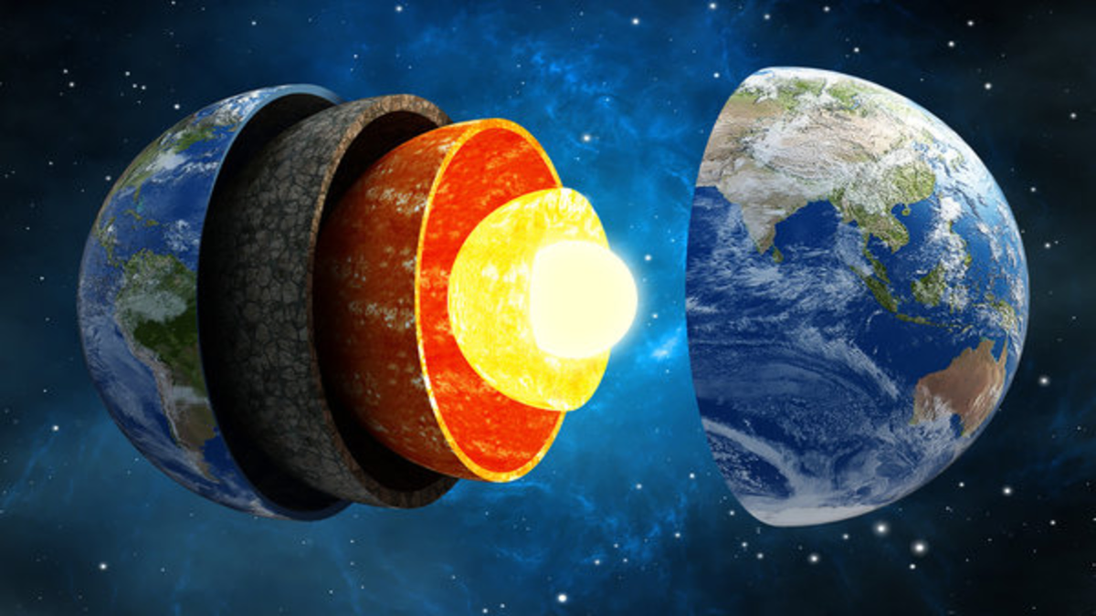
Image credit: Adobe Stock
The core-mantle boundary (CMB) lies about 2 900 km (1 800 miles) beneath Earth’s surface, where the solid mantle meets the liquid outer core. Researchers cannot sample this region directly and instead use seismic waves to constrain its structure. PKIKP is a compressional seismic-wave branch that travels through the mantle, outer core and inner core before returning toward the surface; weaker PKP precursor arrivals that precede it can be generated when seismic energy scatters from small-scale heterogeneities near the CMB.
The newly identified regions matter because small-scale heterogeneity near the CMB can preserve evidence of processes operating deep inside Earth, including the accumulation of ancient subducted material, partial melting and mineral phase changes. Mapping where these structures are concentrated gives researchers new targets for investigating mantle convection, deep-Earth material recycling and heat transfer between the core and mantle.
Guan et al. analyzed more than 2 million vertical-component waveforms from 4 859 teleseismic earthquakes recorded between 1990 and 2024. The earthquakes ranged from Mw6.0 to Mw8.8, with source-receiver epicentral distances of 120° to 141°. Researchers at the Institute of Geology and Geophysics, Chinese Academy of Sciences (IGGCAS) combined a supervised convolutional-recurrent neural network with iterative human-machine review to classify waveform quality, detect PKP precursors and pick seismic phases. IGGCAS reported classification accuracies of 98.37% for waveform quality and 96.15% for precursor detection after two rounds of optimization.
The resulting DeepScatter-PKP catalog contains 174 929 PKP precursor signals, about an order of magnitude more than previous global datasets. The single-station classification strategy allowed precursor detection without requiring a dense seismic array at every location, but detection and localization are separate problems: a precursor recorded at one station does not uniquely identify the position of the structure that scattered it.

Scattering on either the earthquake-source side or receiver side can produce similar precursor arrivals. A PKIKP piercing point at the CMB therefore provides a geographic reference rather than the true location of the scatterer.
The study addressed that ambiguity with two measures: precursor-occurrence probability, Pocc, which describes the spatial consistency of precursor observations, and scatterer-location probability, Pscat, which constrains probable locations of coherent strong scatterers. Pscat was calculated using coherent precursor observations from small-aperture arrays and provides a probability distribution rather than an exact boundary around a structure.
The enlarged catalog increased sampling density and geographic coverage across parts of the CMB that had been poorly represented in earlier datasets. Across the inland Asia-East Asia-western Pacific transition, IGGCAS reported an increase in average sampling density of more than 12 times, while spatial coverage rose from less than 10% to 50.5%. At the global scale, the peer-reviewed study found that some previously isolated sampling zones, including areas beneath the Americas, became connected into continuous bands in the expanded dataset.
Extension of the analysis into previously undersampled areas identified six high-potential scattering zones. They extend from the eastern North Atlantic toward Central Europe; across high-latitude northern Eurasia; from the northwestern Pacific toward Alaska; across southern Africa and its eastern margin; in the southeastern South Atlantic basin; and around Antarctica. The researchers describe these regions as priority targets for subsequent multi-phase inversion and finer imaging, rather than six precisely bounded physical objects.
The researchers also compared high-Pocc regions with deep-mantle anomalies detected using independent seismic phases including PcP, SPdKS and ScS. Several known regions showed spatial correspondence, while the global probability maps placed multiple ultra-low velocity zones within broader heterogeneous environments at the base of the mantle. Ultra-low velocity zones are localized regions near the CMB where seismic velocities are substantially lower than in surrounding mantle.
Guan et al. interpret parts of the mapped heterogeneity as thermochemical structures associated with combinations of multi-stage remnants of subducted slabs, localized partial melting and interactions with the large low-velocity provinces of the lower mantle. IGGCAS also identifies mineral phase transitions as a possible contributor to small-scale CMB heterogeneity. These are interpretations of seismic observations; the study does not directly determine the chemical composition of the six newly identified target regions.
Pscat values were distributed asymmetrically around the two major large low-velocity provinces, with higher probabilities concentrated around the Pacific province and its margins. The researchers explicitly retain an observational explanation for part of that contrast: the circum-Pacific region has denser seismic arrays and abundant deep earthquakes, giving it stronger sampling than other parts of the globe. A genuine structural difference between the Pacific and African lower mantle is also considered, but the study does not resolve the two explanations conclusively.
Deep learning had already been applied to PKP precursors before the 2026 study. Ma et al. (2025) developed GraphCursor, a graph-neural-network system that identified 37 512 precursor waveforms from 5 499 global earthquakes recorded between 2000 and 2024, including previously unmapped scatterers beneath Antarctica. The 2026 study is therefore not the first deep-learning application to PKP precursors; its advance lies in the substantially larger final catalog, expanded global sampling and the Pocc-Pscat probability framework.
References:
1 Guan, Y., Li, J., Xiao, Z., Wang, W., & Xu, T. (2026). Global distribution of PKP precursors derived from three decades of seismic data with deep learning. Journal of Geophysical Research: Solid Earth, 131, e2025JB033195. https://doi.org/10.1029/2025JB033195
2 关玉蕊|李娟等:基于深度学习的全球核幔边界散射体分布新图景 – Institute of Geology and Geophysics, Chinese Academy of Sciences – September 3, 2026

I’m a science journalist and researcher at The Watchers, contributing to the Epicenter edition, where I cover peer-reviewed scientific research and emerging discoveries across Earth and space sciences. With a background in astronomy and a passion for environmental science, I’ve worked in shark and coral conservation in Fiji, conducting reef and shark-behavior research, contributing to mangrove restoration, and earning PADI Open Water and Coral Reef Certifications. I bring a blend of scientific rigor and storytelling to illuminate the discoveries shaping our planet and beyond.
