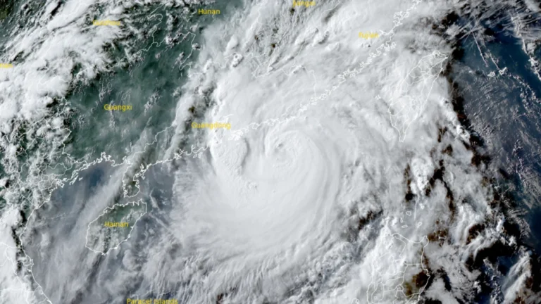
• Typhoon Noul makes landfall in Guangdong, prompting Level II emergency response across southern China

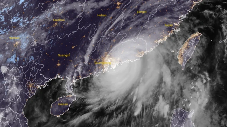
    Typhoon Noul made landfall in Huidong County, Huizhou City, China’s Guangdong Province, at 03:50 HKT (19:50 UTC on July 25) on July 26, 2026, as a severe typhoon with 10-minute maximum sustained winds of 149-165 km/h (93-103 mph). The storm prompted Chinese authorities to raise the national emergency response for major meteorological disasters to Level 2, while more than 700 000 people were relocated across Guangdong. Rail services were suspended, hundreds of flights were canceled, and the central government allocated CNY 100 million (USD 14.8 million) to support post-typhoon recovery and reconstruction.
  • Hurricane Fausto moving toward Hawaiʻi, dangerous surf forecast

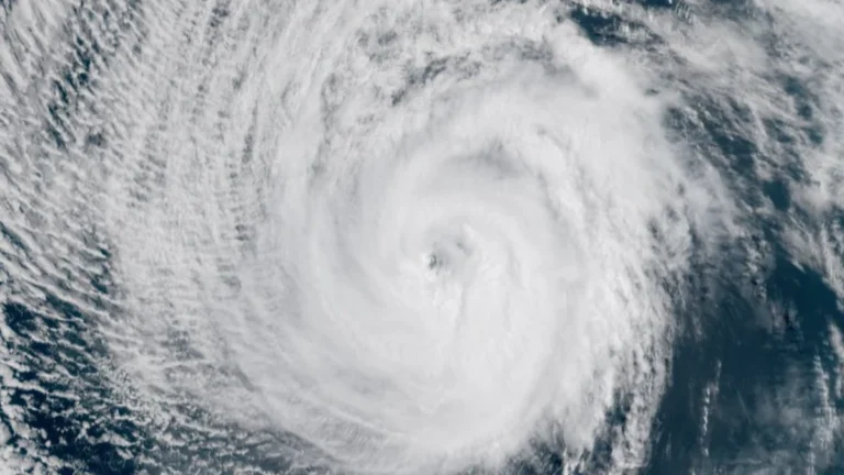
    Dangerous surf generated by Hurricane Fausto is expected to build along east-facing shores of Hawaiʻi starting July 26, 2026, before spreading westward through July 27, with additional hazards including heavy rainfall and damaging winds possible early next week. Forecast details are expected to improve over the coming days as the hurricane approaches.

  • Over 20 000 evacuated as Typhoon Noul approaches Guangdong, up to 600 mm (24 inches) of rain forecast, China

    Typhoon Noul is forecast to make landfall over eastern Guangdong by July 26, 2026, bringing a significant threat of flooding across southern China. More than 20 000 people have been evacuated Guangdon with rainfall totals of 500 to 600 mm (20 to 24 inches) forecast as the storm approaches. Authorities have raised Guangdong’s emergency response for flood and typhoon control to Level III on July 25 as Typhoon Noul approached the province, while activating a Level IV flood emergency response for Jiangxi and Hunan.

  • Tropical Storm Bertha makes landfall in St Bernard Parish, Louisiana, heads toward upper Texas coast

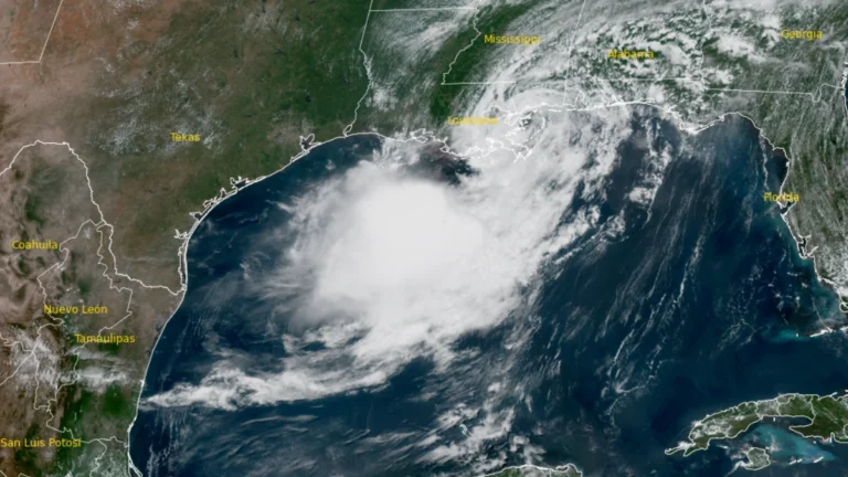
    Tropical Storm Bertha made landfall at approximately in St. Bernard Parish, Louisiana at approximately 13:50 CDT (18:50 UTC)on July 22, 2026, with maximum sustained winds of 72 km/h (45 mph). Storm surge of up to 1 m (3 feet), rainfall totals of 25 to 100 mm (1 to 4 inches) with isolated amounts reaching 150 mm (6 inches), and isolated flash flooding remain possible across portions of the central and western Gulf Coast through July 24.

  • State of Emergency declared for West Virginia after historic flooding

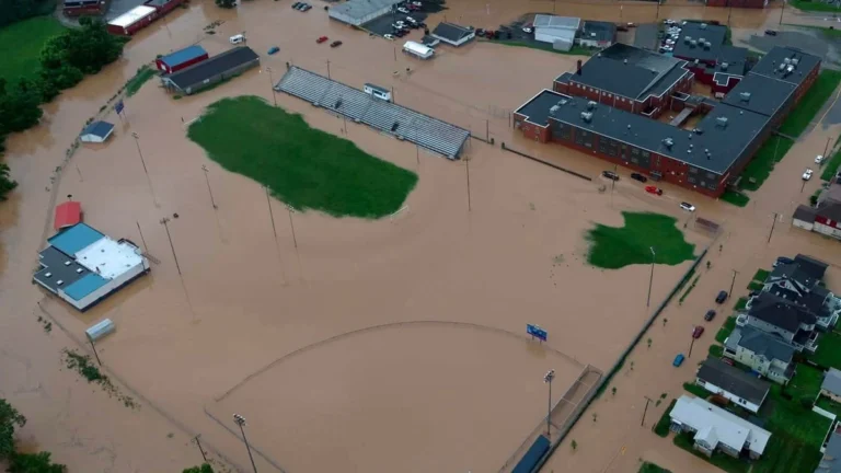
    Historic flooding in Upshur County and widespread impacts from severe thunderstorms prompted West Virginia Governor Patrick Morrisey to declare a State of Emergency for all 55 counties on July 21, 2026. The Sand Run stream gauge near Buckhannon rose to record levels, reportedly reaching major flood stage for the first time on record. Meanwhile, torrential rainfall totals of up to 127 mm (5 inches) in less than six hours caused flash flooding, infrastructure damage, and multiple road closures.

  • Four tornadoes confirmed in central Pennsylvania, including EF2 in Huntingdon County

    Four tornadoes touched down across central Pennsylvania on July 18, 2026, as a line of severe thunderstorms crossed the region, according to National Weather Service damage surveys. The tornadoes included one EF2, two EF1s, and one EF0, producing damage in Huntingdon, Clearfield, Jefferson, and Clarion counties. Despite considerable damage to forests, farms and other structures, no injuries or fatalities were reported.

  • Tropical Storm Bertha brings flash flood and storm surge threat from Florida to Louisiana

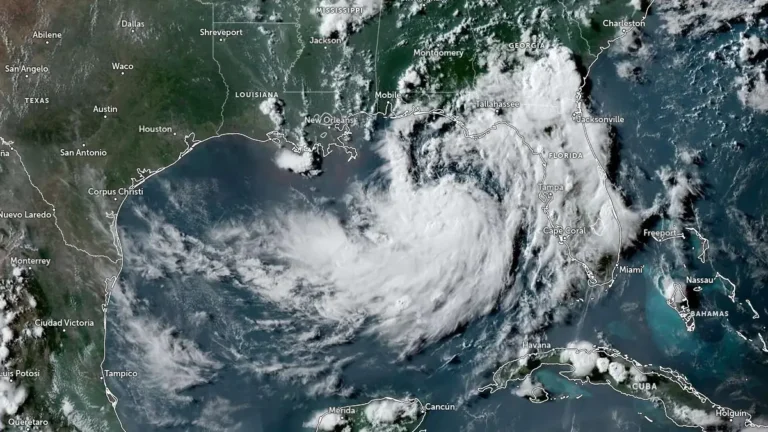
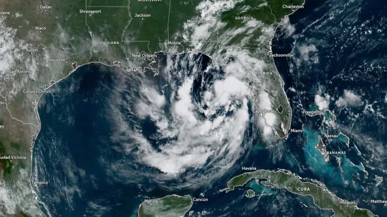
    Tropical Storm Bertha, the second named storm of the 2026 Atlantic hurricane season, formed over the northeastern Gulf at 19:00 CDT on July 20, 2026 (00:00 UTC on July 21) and strengthened to 85 km/h (50 mph) by 06:00 UTC. A Tropical Storm Warning and Storm Surge Watch are in effect along sections of the northern Gulf Coast, where heavy rainfall, flash flooding, coastal inundation, dangerous surf, and rip currents were forecast from western Florida into southern Louisiana.

  • Tropical Storm and Storm Surge watches expanded from Florida to Louisiana as Gulf depression strengthens

    Tropical Depression Two became better organized over the northeastern Gulf of Mexico on July 20, 2026, prompting the National Hurricane Center (NHC) to expand the Tropical Storm Watch from the Florida Panhandle westward to southeastern Louisiana and issue a Storm Surge Watch for parts of the northern Gulf Coast. The depression had maximum sustained winds of 55 km/h (35 mph) at 15:00 UTC and is expected to become a tropical storm later today, followed by gradual strengthening through Tuesday.

  • Enhanced risk of severe thunderstorms issued for parts of the Northeast, Mid-Atlantic, and Lower Great Lakes on July 18

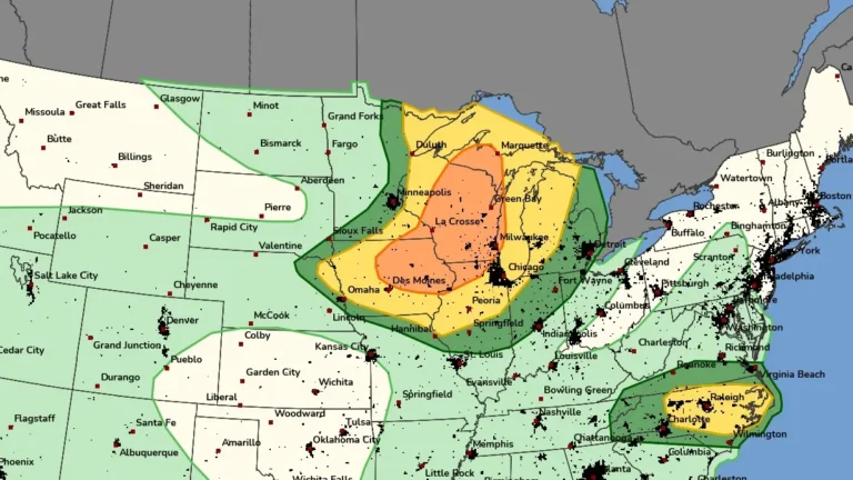
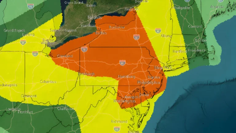
    An enhanced risk of severe thunderstorms has been issued for portions of the Northeast, Mid-Atlantic, and Lower Great Lakes on Saturday, July 18, 2026, as an unusually strong upper-level storm system brings the threat of widespread damaging winds, large hail, and several tornadoes through the afternoon and evening.