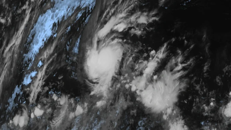
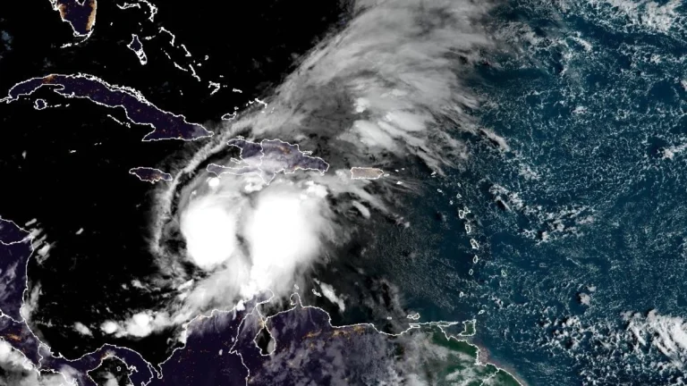
• Long-track tornado touches down near Montezuma Creek, San Juan County, Utah

    A long-track tornado was confirmed northeast of Montezuma Creek in San Juan County, Utah, between 12:30 and 13:05 MDT on September 13, 2025, about 10–13 km (6–8 miles) northeast of Montezuma Creek and 35 km (22 miles) southeast of Blanding. The National Weather Service issued a tornado warning for southeastern Utah and western Colorado.

  • At least one dead as record rainfall strikes Tokyo, Japan

    At least 1 person died while another was injured as record rainfall triggered severe flooding across Tokyo and the Kanto region, Japan on September 11, 2025. Evacuation orders were issued as the over 6 000 homes had their power knocked by the storm, as transport disruptions affected over 100 000 people.

  • Tropical Storm Mario forms, heavy rainfall forecast for southern Mexico

    Tropical Storm Mario formed at 15:00 UTC on September 12, 2025, just off the coast of Mexico, prompting the government of Mexico to issue a Tropical Storm Watch from Lazaro Cardenas to Punta San Telmo. At the time of formation, the center of Mario was located 65 km (40 miles) SSW of Zihuatanejo and 95 km (60 miles) SSE of Lazaro Cardenas, Mexico.

  • Rainfall keeps lahar hazard active at Fuego volcano after initial flows, Guatemala

    Weak to moderate lahars descended from Fuego volcano, Guatemala, at 19:17 LT on September 10, 2025, moving through Barranca Ceniza and into the Zarco and Mazate rivers, tributaries of the Achíguate River. The National Institute of Seismology, Volcanology, Meteorology and Hydrology (INSIVUMEH) reported that conditions remain favorable for additional lahars on the southwestern flanks.