Shallow M6.1 earthquake hits east of the Kuril Islands
A shallow earthquake registered by the USGS as M6.1 hit east of the Kuril Islands at 06:48 UTC on August 25, 2025. The agency is reporting a depth of 10 km (6.2 miles).

I'm a dedicated researcher, journalist, and editor at The Watchers. With over 20 years of experience in the media industry, I specialize in hard science news, focusing on extreme weather, seismic and volcanic activity, space weather, and astronomy, including near-Earth objects and planetary defense strategies. You can reach me at teo /at/ watchers.news.
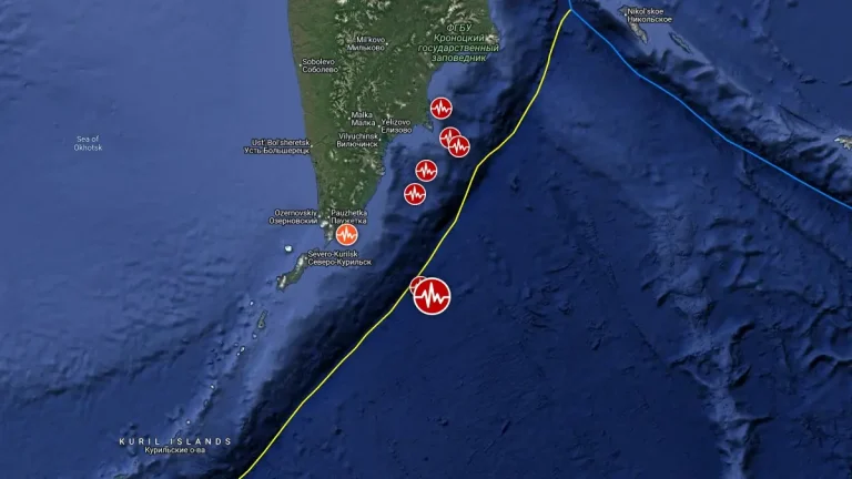
A shallow earthquake registered by the USGS as M6.1 hit east of the Kuril Islands at 06:48 UTC on August 25, 2025. The agency is reporting a depth of 10 km (6.2 miles).
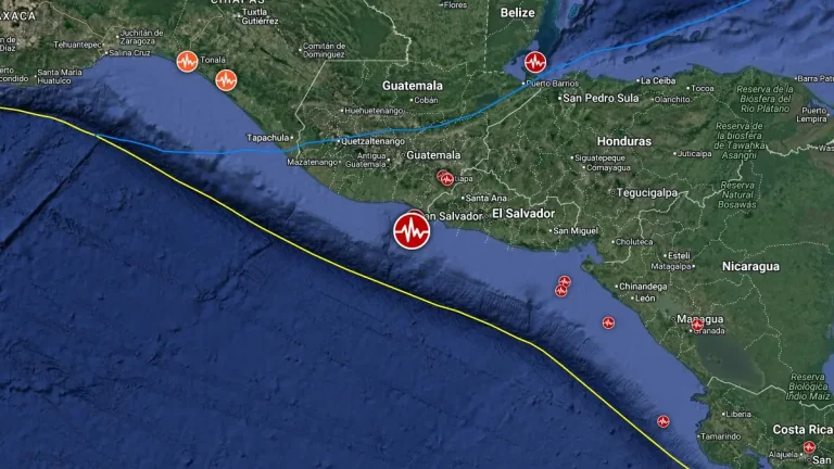
A strong and shallow earthquake registered by the USGS as M6.0 hit off the coast of Guatemala and El Salvador at 09:14 UTC on August 23, 2025. The agency is reporting a depth of 10 km (6.2 miles).
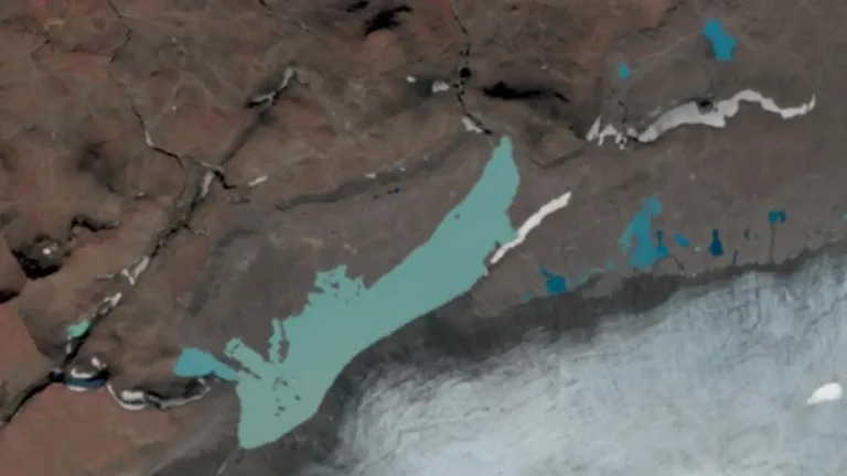
The Icelandic Meteorological Office reported a glacier flood in Hafrafellslón, west of Langjökull glacier, on August 22, 2025, with rising water levels measured in Hvítá River above Húsafell.

New activity/unrest was reported for 7 volcanoes from August 13 to 19, 2025. During the same period, ongoing activity was reported for 20 volcanoes.
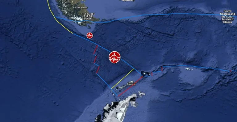
A very strong earthquake registered by the USGS as M7.5 hit southern Drake Passage at 02:16 UTC on August 22, 2025. The agency is reporting a depth of 10.8 km (6.7 miles). EMSC is reporting the same magnitude and depth.
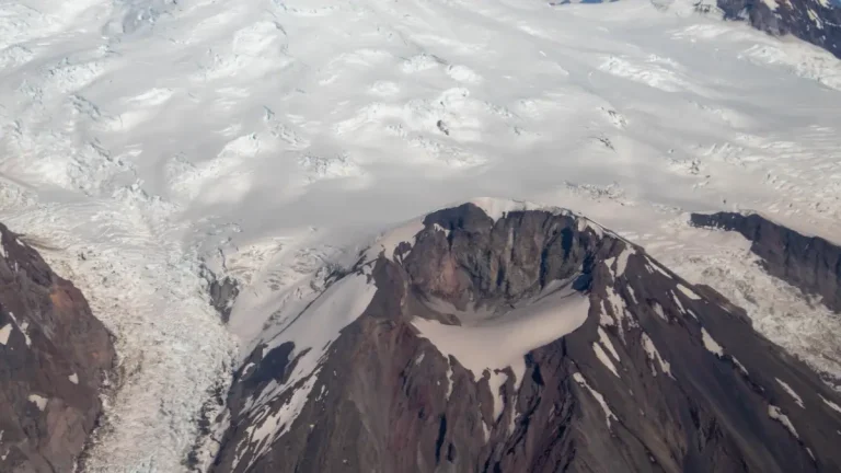
The Alaska Volcano Observatory lowered the Volcano Alert Level for Mount Spurr to Normal and the Aviation Color Code to Green at 10:07 AKDT (18:07 UTC) on August 20, 2025, following a gradual decline in unrest and the absence of ground deformation since March 2025.
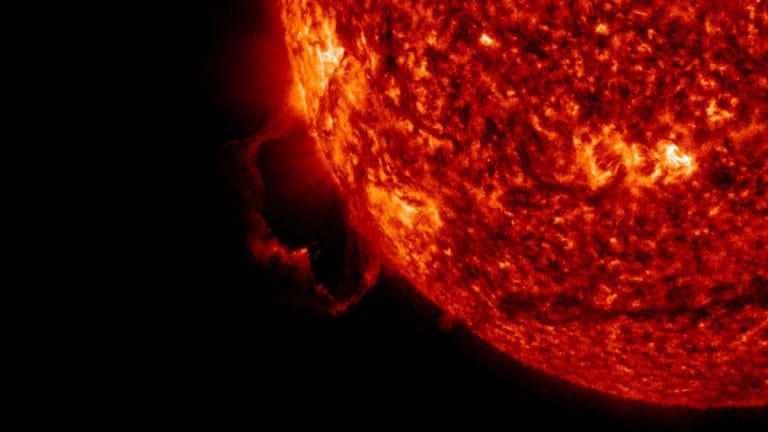
A large coronal mass ejection (CME) was produced by a prominence eruption off the Sun’s southeast limb at 04:30 UTC on August 20, 2025. The CME is not Earth-directed, and solar activity is forecast to remain at very low to low levels, with a slight chance for M-class flares in the coming days.
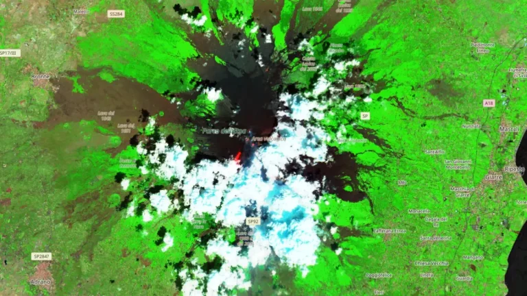
New lava flow from Mount Etna’s summit is advancing along the southern flank, reaching an elevation of about 2 270 m (7 450 feet). The most advanced front is now located about 2 km (1.24 miles) from the Altamontana trail, a major access route used for monitoring and hiking, following effusion that began on August 9, 2025.
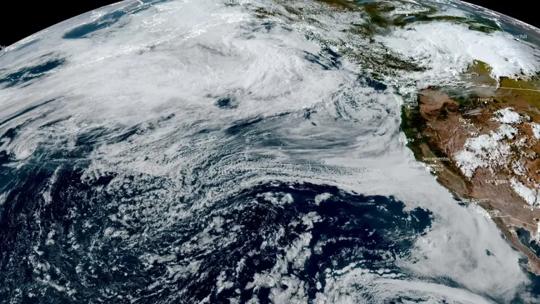
An unusually strong summer atmospheric river made landfall over the Pacific Northwest late on August 14, 2025, reaching AR 3 along the Washington coast and producing 75–200 mm (3–8 inches) of rain across parts of western Washington.
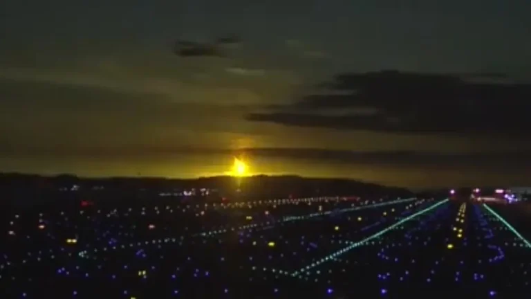
A bright fireball lit up the night sky over southern Japan at 23:08 JST (14:08 UTC) on August 19, 2025, releasing an estimated 1.6 kilotons of energy as it disintegrated over the Pacific Ocean southeast of Kyushu.