Gabrielle becomes second hurricane of 2025 Atlantic season, swells affecting Bermuda, U.S. East Coast, and Atlantic Canada
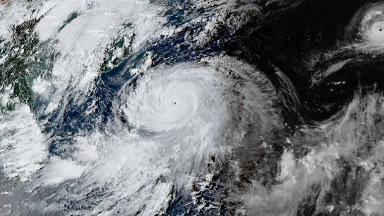
Tropical Storm Gabrielle intensified into a hurricane on September 21, 2025, becoming the second hurricane of the 2025 Atlantic hurricane season after Erin. The storm is forecast to undergo rapid strengthening and could become a major hurricane early this week as it passes east of Bermuda. Swells and rip currents are already affecting Bermuda, the U.S. East Coast, and Atlantic Canada.