
In 2002 a magnitude 7.9 quake on the Denali Fault shoved the ground about 14 feet sideways under the Trans-Alaska Pipeline, but engineers had designed Teflon sliders for the pipe nearly 30 years earlier, and no oil spilled.
On November 3, 2002, the M7.9 Denali Fault earthquake ruptured about 340 km (211 miles) of central Alaska and displaced the ground beneath the Trans-Alaska Pipeline by roughly 4.3–5.8 m (14–19 feet), depending on how the distributed rupture is measured. The pipe slid across low-friction supports and flexed through its zigzag alignment; it did not rupture and no oil escaped.
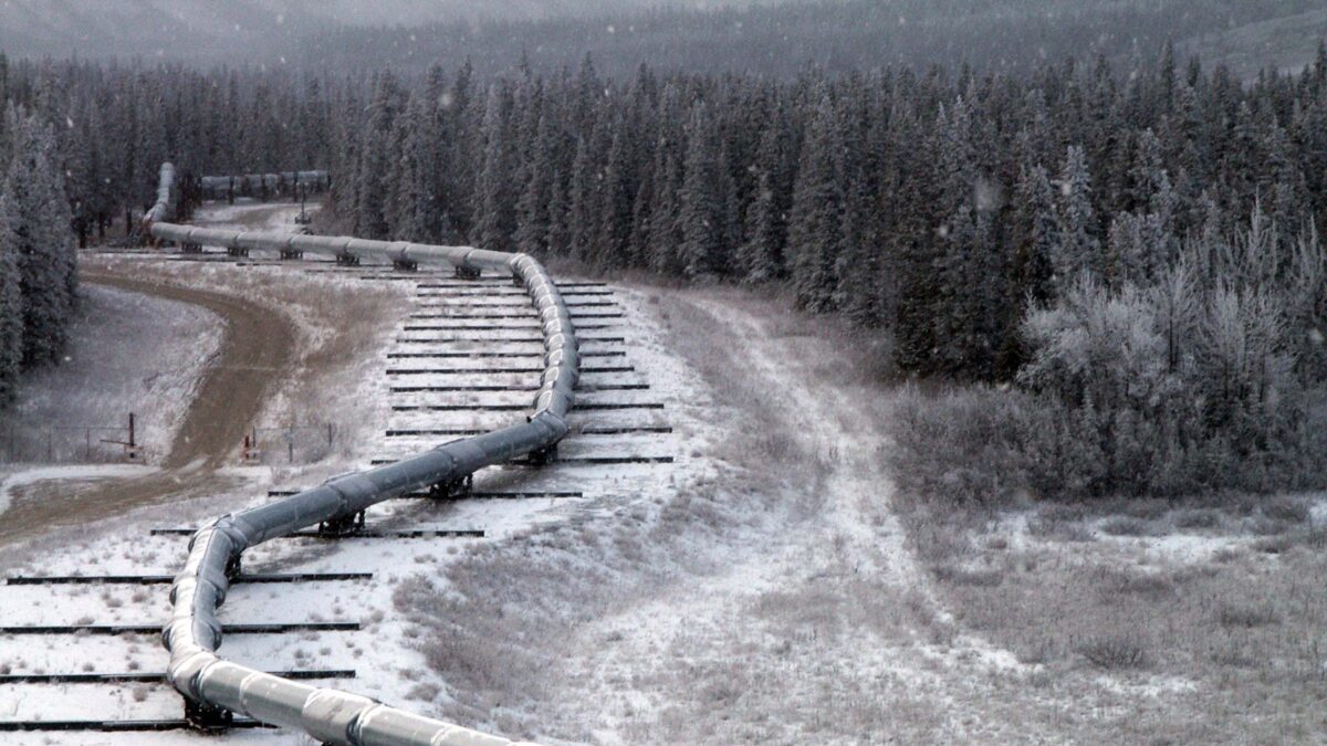
The Trans-Alaska Pipeline on its sliding supports at the Denali Fault crossing, after the 2002 earthquake. Credit: US Geological Survey (public domain), via Wikimedia Commons.
That outcome was not the product of a last-minute intervention. Nearly 30 years earlier, geologists and engineers had mapped the Denali Fault within a 579 m (1 900-foot) corridor and designed the crossing for an M8.0 earthquake with as much as 6.1 m (20 feet) of horizontal displacement and 1.5 m (5 feet) of vertical displacement. The 2002 earthquake came close to that design case.
The pipeline still sustained damage and remained shut for about 66 hours while crews inspected and repaired its supports. The absence of a spill resulted from several defenses working together: geological mapping, a deliberately flexible crossing, earthquake monitoring, rapid shutdown, and field inspection.
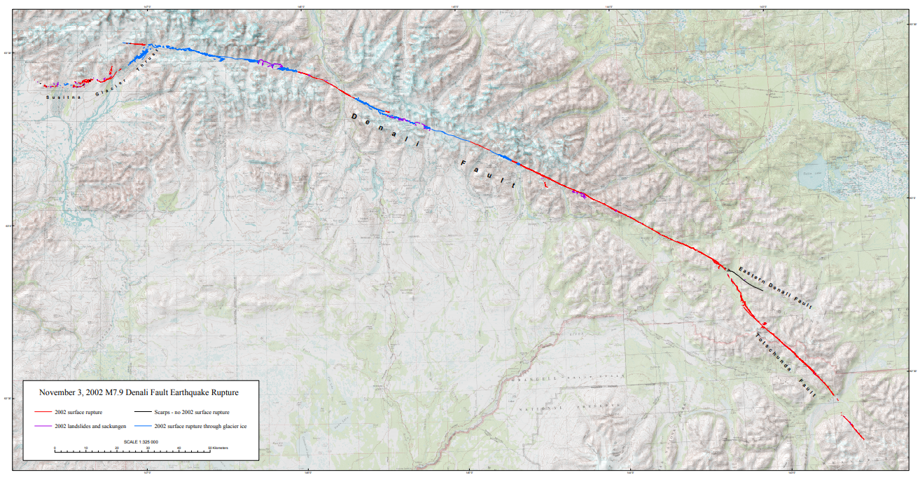
A 340 km rupture in about 90 seconds
The earthquake began at 22:12:41 UTC on November 3, 2002 (13:12:41 AKST), at a depth of about 4.2 km (2.6 miles) in the Alaska Range. Its epicentral region was about 145 km (90 miles) south of Fairbanks.2, 11
The rupture began with thrust movement on the previously unrecognized Susitna Glacier Fault, continued eastward as right-lateral strike-slip motion on the Denali Fault, and then turned onto the Totschunda Fault. It crossed the pipeline and reached the eastern end of the rupture roughly 90 seconds after the earthquake began. Maximum horizontal displacement elsewhere along the system reached about 8.8 m (29 feet).
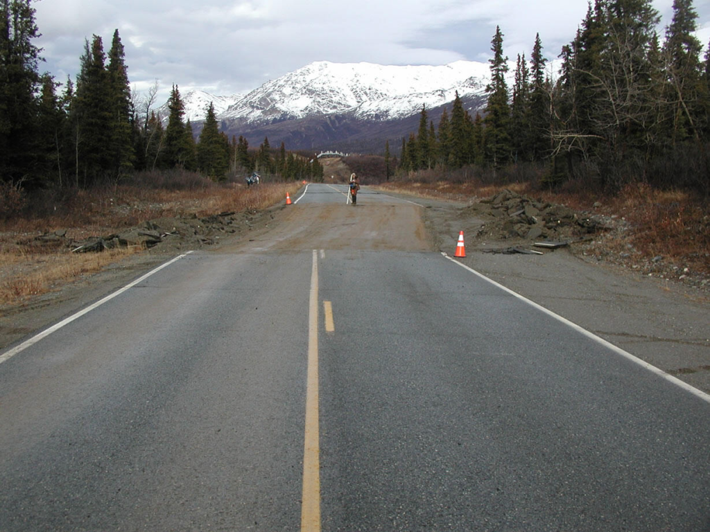
The earthquake was the strongest recorded in Alaska’s interior and one of the largest strike-slip earthquakes documented in North America. Its remote location limited the human toll: no deaths were reported, although the shaking triggered thousands of landslides, damaged the Northway Airport runway and offset parts of the Richardson Highway.
Ten days earlier, the M6.7 Nenana Mountain earthquake had ruptured a section of the Denali Fault west of the later mainshock. It is now regarded as a foreshock. Alyeska employee Hillary Schaefer later recalled finding evidence that the pipeline had already shifted on its supports, including fresh polytetrafluoroethylene—better known by the trade name Teflon—on the crossbeams.
The crossing was designed for the fault
The Trans-Alaska Pipeline System carries crude oil for 1 287 km (800 miles) from Alaska’s North Slope to the marine terminal at Valdez. The steel pipe has an outside diameter of 1 219 mm (48 inches), and the system entered service in 1977.
During its design in the early 1970s, studies by the U.S. Geological Survey, Woodward-Lundgren and Associates, Alyeska Pipeline Service Company and others identified the active Denali Fault along the proposed route. Because the exact location of a future surface break could not be known, the special crossing covered a corridor about 579 m wide rather than a single surveyed line.
Aboveground sections of the pipeline were already arranged in a zigzag to absorb thermal expansion and contraction. Inside the fault corridor, engineers removed rigid restraints and placed the pipe on low sleepers fitted with Teflon-surfaced shoes. Those shoes could move along long horizontal steel beams with a friction coefficient of about 0.1, allowing the pipe to slide rather than forcing the steel to absorb the full ground displacement at one point.
The nearest anchors were placed outside the specially designed zone. “They wanted the pipe to have freedom to move as necessary where the fault crossed the pipeline corridor,” Alyeska engineering supervisor Mike Malvick later said.
The USGS estimated that the geological studies and special engineering cost about $3 million in the 1970s. Its 2003 fact sheet said a rupture could easily have exceeded $100 million in lost revenue, repairs and environmental cleanup, without adjusting either figure to present-day dollars.1
The pipeline survived because it could move
When the fault moved, the angle between the rupture and the pipeline placed the steel pipe in compression. The zigzag shortened and bowed into a broad arc while the shoes moved across their beams. The pronounced curve visible in post-earthquake photographs was therefore evidence of the pipe accommodating the movement, not of the line tearing open.
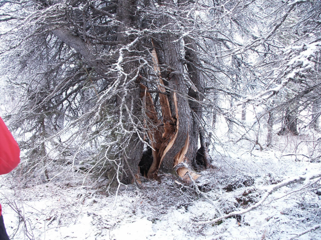
The design did not make the installation immune to damage. Strong shaking and rapid pipe movement bent two vertical support members, damaged eight intermediate supports and five shoes, tripped nine anchors and displaced several sliding shoes. About 100 insulation modules were also damaged. The pressurized steel pipe itself remained intact.
Liquefaction and sand boils appeared at several locations. Crews excavated a buried remote gate valve after settlement raised concern about its smaller sealant lines, but Alyeska reported that the valve and associated pipe were undamaged.
A 66-hour shutdown and field inspection
The pipeline’s earthquake monitoring system identified areas requiring inspection, and controllers brought the system into a safe shutdown. Aerial reconnaissance began almost immediately, with crews reaching the Denali Fault zone within hours and sending photographs back before sunset.
Alaska also brought original design specialists Jim Maple and Doug Nyman back to Alaska to help assess the crossing. Temporary timber cribbing supported sections near damaged hardware while crews prepared for aftershocks and restored the support system.9
Operations resumed after approximately 66 hours and 33 minutes, once inspection confirmed that the pipeline had not leaked. About one month later, an internal inspection with an instrumented “smart pig” found no pipe deformation, increased strain, or curvature changes beyond acceptable limits in the buried sections examined near the rupture.
Why official sources report 14 and 18 feet
The horizontal-offset figure is not uniform across the record. The March 2003 USGS fact sheet reported about 4.3 m (14 feet) of horizontal and 0.76 m (2.5 feet) of vertical displacement beneath the pipeline. Alyeska’s detailed 2022 retrospective gives about 4.0 m (13 feet), while its current earthquake summary gives 5.5 m (18 feet).
Peer-reviewed reconnaissance described about 5.8 m (19 feet) of right-lateral movement distributed across several en echelon step-overs at the pipeline crossing. That distributed deformation helps explain why a measurement of the principal fault offset and a measurement across the wider rupture zone can produce different totals. The defensible summary is therefore about 4.3–5.8 m (14–19 feet) horizontally and 0.6–0.8 m (2–2.5 feet) vertically—not one undisputed number.
Even the upper estimate remained close to the 6.1 m (20-foot) horizontal displacement used for the original crossing design. The earthquake did not reproduce every design assumption exactly, but it subjected the system to a near-design-level combination of permanent ground movement and violent shaking.
What the earthquake proved
The Denali crossing is sometimes reduced to a story about Teflon sliders, but the successful outcome depended on a chain of decisions. Geologists identified and bounded the fault hazard; engineers accepted that the ground would move and gave the pipe space to follow it; monitors initiated a focused response; and crews verified the pressure boundary before restarting the system.
The earthquake also demonstrated a broader principle in seismic design: where permanent movement cannot be prevented, controlled flexibility can be safer than rigid resistance. It was, as Alyeska engineer Elden Johnson later described it, “Mother Nature’s pop quiz”—one delivered 25 years after the pipeline entered service.
References:
1 Haeussler, P. J., Schwartz, D. P., Dawson, T. E., Stenner, H. D., Lienkaemper, J. J., Cinti, F., Montone, P., Sherrod, B., & Craw, P. (2004). Surface rupture of the 2002 Denali Fault, Alaska, earthquake and comparison with other strike-slip ruptures. Earthquake Spectra, 20(3), 565–578. https://doi.org/10.1193/1.1775797
2 Hall, W. J., Nyman, D. J., Johnson, E. R., & Norton, J. D. (2003). Performance of the Trans-Alaska Pipeline in the November 3, 2002 Denali Fault earthquake. In Advancing Mitigation Technologies and Disaster Response for Lifeline Systems (pp. 522–534). American Society of Civil Engineers. https://doi.org/10.1061/40687(2003)54
3 Nyman, D. J., Johnson, E. R., & Roach, C. H. (2003). Trans-Alaska Pipeline emergency response and recovery following the November 3, 2002 Denali Fault earthquake. In Advancing Mitigation Technologies and Disaster Response for Lifeline Systems (pp. 576–586). American Society of Civil Engineers. https://doi.org/10.1061/40687(2003)59

Rishav Kothari is Editor-in-Chief of The Watchers, where he runs the newsroom and covers earthquakes, volcanoes, severe weather and space weather.
