
1958 Lituya Bay rockslide of 30 million cubic meters stripped forest to 524 meters up an Alaska slope; two died, Howard Ulrich and his son survived
The July 9, 1958 Lituya Bay megatsunami in southeast Alaska stripped forest from a mountainside 524 m (1 720 feet) above sea level after an earthquake-triggered rockslide crashed into Gilbert Inlet. The extraordinary height marked the water’s run-up on a slope, not a wave of that height traveling through the bay; two people died, while Howard Ulrich and his 7-year-old son survived aboard a fishing boat lifted by the wave.
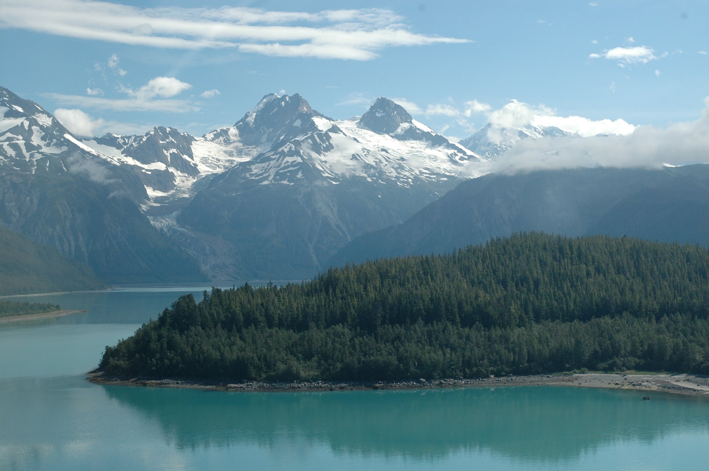
The July 9, 1958 Lituya Bay megatsunami began at about 22:16 local time, when a powerful earthquake ruptured the Fairweather Fault near Lituya Bay. The Alaska Earthquake Center assigns the earthquake a magnitude of 7.8, while some later scientific reconstructions, including González-Vida et al. (2019), use Mw8.3. Those different values should not be collapsed into an unexplained magnitude range. The fault passes through the narrow inlets at the head of the bay, where the shaking destabilized the northeast wall of Gilbert Inlet.
USGS geologist Don J. Miller (1960) estimated that about 30 million m³ (40 million cubic yards) of rock broke free from the mountainside. The slide scar extended to roughly 915 m (3 000 feet) above sea level. Material entering the inlet displaced an enormous volume of water and forced a surge up the opposite slope, over the spur separating Gilbert Inlet from the main arm of Lituya Bay. Miller measured the highest line of forest destruction at 524 m (1 720 feet), while estimating that water continued over the ridge at an elevation of about 530 m (1 740 feet).
Those figures describe related but different evidence. The 524 m level is the trimline, the upper boundary where the wave removed or overturned trees and left the slope exposed. The approximately 530 m figure is Miller’s reconstruction of how far water reached beyond that boundary. Run-up is the elevation reached when moving water climbs land above the reference sea level; it is not the height of the wave as it travels across open water. The distinction matters because later accounts of Lituya Bay have often presented the extraordinary hillside elevation as though a vertical wall of water that high had moved the length of the bay.
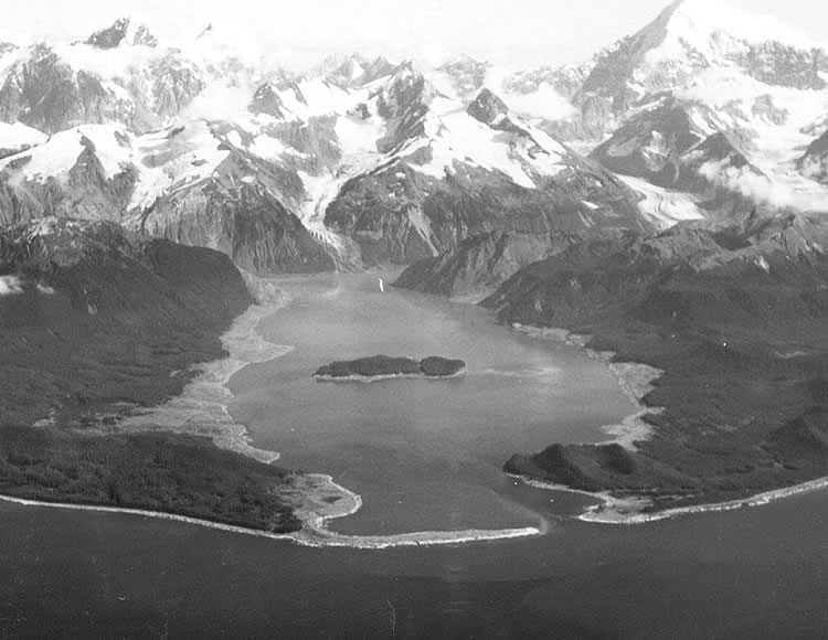
Miller saw the aftermath from an aircraft on July 10 and returned to examine the damage. The light-colored scars along the shoreline marked ground stripped of forest, soil and vegetation. He compared photographs, surveyed the destruction boundary and examined displaced timber and boulders. The almost bare rock opposite the slide supplied the clearest physical evidence of the water’s extreme rise, while the varying trimline around the bay helped reconstruct its movement after leaving Gilbert Inlet.
Forest destruction extended along both shores, although its height changed sharply with the shape of the coastline. Miller mapped approximately 10 km² (4 square miles) of forest damage between the shoreline and the upper trimline, and estimated that at least 13 km² (5 square miles) were inundated. At Fish Lake, near the bay entrance, the water reached approximately 1.1 km (3 600 feet) inland from the high-tide shoreline. The pattern showed that the surge did not simply spread uniformly: it crossed, reflected from and climbed different slopes as it moved through the confined basin.
Eyewitness observations supplied the chronology that the damaged landscape alone could not establish. Howard Ulrich was aboard the Edrie, anchored in a cove on the southern shore, with his 7-year-old son. After the earthquake woke him, he watched avalanches near the head of the bay. He then heard a crash and saw water rise in Gilbert Inlet. In his account reproduced by Miller, the wave formed after the shaking had begun, a sequence consistent with the rockslide being the immediate source of the enormous water displacement.

From the Edrie, Ulrich estimated the wave at about 30 m (100 feet) high near the center of the bay and 15–23 m (50–75 feet) as it approached his boat. These were eyewitness estimates, not instrumental measurements. The anchor would not release, so Ulrich let out the remaining chain and started the engine. The chain snapped as the boat rose with the wave; the vessel was carried toward the shore and then drawn back toward the center of the bay, but remained afloat. Both father and son survived.
The water remained hazardous after the main wave passed. Ulrich described irregular waves about 6 m (20 feet) high and a surface choked with floating timber and ice. The Edrie eventually left the bay through its narrow entrance at about 23:00 LT. His observations help separate the enormous localized run-up opposite Gilbert Inlet from the lower, though still destructive, wave that propagated through the outer bay.
William and Vivian Swanson were aboard the Badger, anchored in Anchorage Cove near the mouth of the bay. The advancing water lifted the vessel and carried it over La Chaussee Spit, the low barrier at the entrance. The boat was wrecked, but the couple escaped in a small skiff and were later rescued. The third vessel, the Sunmore, was overwhelmed; its two occupants, the Wagners, were lost. The tsunami’s two confirmed fatalities were therefore distinct from three other earthquake-related deaths near Khantaak Island reported by the Alaska Earthquake Center.
Miller’s investigation also changed his interpretation of the wave’s source. He initially considered displacement on the Fairweather Fault the most plausible cause, but the newly exposed slide scar in Gilbert Inlet, the timing of the wave and the distribution of damage led him to identify the rockslide as the major, possibly sole, generator. The water’s force was concentrated opposite the slide before propagating through the bay, a pattern fundamentally different from the broad seafloor displacement that produces many earthquake-generated ocean tsunamis.
González-Vida et al. (2019) revisited that physical explanation with the Landslide-HySEA numerical model, reconstructing the bay’s topography and bathymetry and coupling the motion of landslide material to the motion of the water. The model also reproduced important features elsewhere: a second run-up area near Mudslide Creek, inundation around Cenotaph Island and the extension of flooding inland toward Fish Lake.
The result did not eliminate uncertainty about every detail of the slide. The authors found that reproducing the observed destruction required a credible reconstruction of the initial failure and suitable choices for friction and the relative densities of the slide and water. Their shallow-water model captured major inundation and run-up patterns, but could not resolve every three-dimensional detail of the violent impact, including complex vertical flow and the behavior of material as it entered the inlet. Its success is evidence that the reconstructed landslide mechanism can account for the observed damage, not a direct measurement of the slide’s speed or a unique solution to its internal motion.
Lituya Bay had produced giant waves long before 1958. Miller documented the October 27, 1936 event, when the highest trimline stood about 149 m (490 feet) above sea level, and identified older evidence associated with events around 1874 and 1853–1854. The earlier causes were not all established with the same confidence. Those traces showed that the bay’s shape and steep surrounding slopes had created dangerous conditions repeatedly, rather than the 1958 earthquake being the only occasion on which a large wave swept its shores.
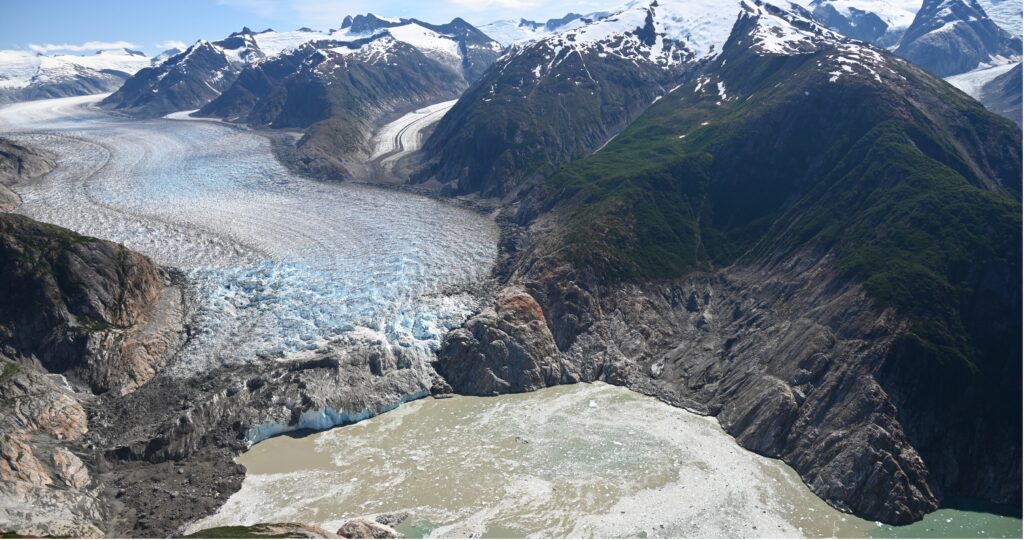
The record is again relevant to contemporary Alaska research. On August 10, 2025, a landslide above South Sawyer Glacier entered Tracy Arm and produced a tsunami with a run-up measured at 481 m (1 578 feet), according to Shugar et al. (2026). The researchers estimated that more than 64 million m³ of material failed and identified retreat of the glacier as an important preconditioning factor. Unlike the 1958 Lituya Bay slide, the Tracy Arm event was not documented as being triggered by a major local earthquake; the comparison concerns the ability of large slope failures to displace water rapidly in steep-sided fjords.
The two cases also show what measurements after a disaster can establish and what remains difficult before one occurs. Field trimlines, survivor testimony, satellite observations and numerical models can constrain the path and maximum reach of a wave. Predicting when a steep slope will fail is a separate problem, as is calculating its future speed, volume and entry geometry before that failure takes place. In narrow bays, those unknowns govern how a landslide’s energy transfers into the water and where the resulting tsunami climbs highest.
References:
1 Miller, D. J. (1960). Giant waves in Lituya Bay, Alaska. U.S. Geological Survey Professional Paper 354-C, 51–86. DOI: 10.3133/pp354C
2 González-Vida, J. M., Macías, J., Castro, M. J., Sánchez-Linares, C., de la Asunción, M., Ortega-Acosta, S., & Arcas, D. (2019). The Lituya Bay landslide-generated mega-tsunami – numerical simulation and sensitivity analysis. Natural Hazards and Earth System Sciences, 19, 369–388. DOI: 10.5194/nhess-19-369-2019
3 Shugar, D. H., Barnhart, K. R., Berdahl, M., Caplan-Auerbach, J., Ekström, G., Fathian, A., Geertsema, M., Hicks, S. P., Higman, B., Jensen, E. K., Karasozen, E., Lynett, P. J., Lyons, J. J., Monahan, T., Roe, G. H., Svennevig, K., Toney, L., Van Wyk de Vries, M., & West, M. E. (2026). A 481 m-high landslide-tsunami in a cruise ship-frequented Alaska fjord. Science, 392(6803), 1142–1153. DOI: 10.1126/science.aec3187

I’m a science journalist and researcher at The Watchers, contributing to the Epicenter edition, where I cover peer-reviewed scientific research and emerging discoveries across Earth and space sciences. With a background in astronomy and a passion for environmental science, I’ve worked in shark and coral conservation in Fiji, conducting reef and shark-behavior research, contributing to mangrove restoration, and earning PADI Open Water and Coral Reef Certifications. I bring a blend of scientific rigor and storytelling to illuminate the discoveries shaping our planet and beyond.
