
Powerful winter storm hits U.S., leaving at least 13 people dead and over 3 million without power, U.S.
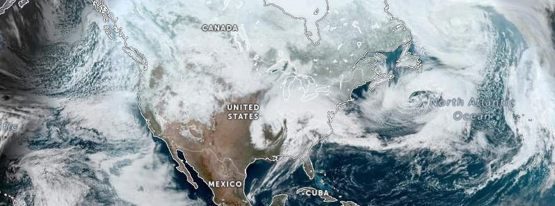
Image credit: NOAA/GOES-16, Zoom Earth, The Watchers. Acquired at 17:40 UTC on March 3, 2023
A powerful winter storm swept across the U.S. over the past couple of days, causing death and destruction in multiple states. At least 13 people lost their lives as severe weather, high winds, and flooding hit the South and Midwest. At the same time, winter-weary Northeast and Midwest residents were digging out from heavy snowfall. Thousands of businesses closed, flights were canceled, and more than 1.2 million customers — or approximately 3 million people, were left without power.
- The latest NWS forecast warns of hazardous road conditions due to snow and ice, as well as an elevated risk of fire in the Southern High Plains. Coastal rain and higher-elevation snow are expected in California and the Pacific Northwest, while multiple low pressure areas will move across the U.S. through Tuesday.
Three people in Alabama, two in Tennessee, and one each in Mississippi, Arkansas, and California lost their lives due to the storm, while five weather-related deaths were reported in Kentucky.
Heavy snowfall in the Northeast and upper Midwest caused travel disruption, with hundreds of businesses closed and many flights canceled. The National Weather Service (NWS) warned of possible coastal flooding in Massachusetts and Rhode Island, with some areas of New Hampshire and Maine forecast to see as much as 45 cm (18 inches) of snow, accompanied by strong winds that could cause power outages. Utility customers in Kentucky, Tennessee, and Michigan were still without power as of Saturday afternoon, March 4, 2023.
In the upper Midwest, Detroit’s Metropolitan Wayne County Airport was briefly closed due to heavy snowfall, while some areas experienced blizzard conditions with snowfall approaching 7.6 cm (3 inches) per hour. The storm knocked out power to more than 130 000 customers in Michigan, causing further misery for residents who had already been without electricity for up to seven days due to ice storms the previous week.
Meanwhile, residents of California were also hit by the storm earlier in the week, with some stranded in their homes due to up to 3 m (10 feet) of snow.
In the Southern US, Alabama, Louisiana, Kentucky, Arkansas, and Texas suffered the most damage. Tornadoes reportedly caused damage to homes and businesses, and at least four people were killed by falling trees. Winds of nearly 130 km/h (80 mph) were recorded in the Fort Worth suburb of Blue Mound, Texas, with the roof of an apartment building in Hurst blown away. In southwest Arkansas, a couple was temporarily trapped in the bathroom of their mobile home while a tornado passed through, causing major damage.
Southern Missouri and northern Arkansas also experienced heavy rain and flooding, while Minnesota and Wisconsin were hit by freezing fog. According to the NWS, North and South Dakota and Minnesota could see up to 25 cm (10 inches) of snow and 72 km/h (45 mph) wind gusts through Monday.
More than 210 000 customers or about 500 000 people were still without power as of 07:50 UTC on March 6. The worst is in Kentucky, with 129 000 customers without power, followed by Michigan with 40 000, Tennessee with 19 000, and California with 15 000.
According to the latest NWS forecast, a developing storm system will create an area of rain and heavy snow over parts of the Upper Mississippi Valley and Upper Great Lakes on Sunday evening into Monday morning, March 6.
Along the rain/snow line, rain/freezing rain pockets will develop over the region, creating hazardous road conditions. On Monday, rain and snow will continue over the Great Lakes and Ohio Valley, with the rain and snow moving into parts of the Mid-Atlantic by Monday evening into Tuesday. There will also be a region of rain/freezing rain along the rain/snow line over the Mid-Atlantic. On Tuesday, light snow showers will continue over parts of the Northeast.
Meanwhile, an area of upper-level energy will move onshore over the Pacific Northwest and slowly expand eastward to the Northern Plains by Tuesday evening, producing coastal rain and higher-elevation snow over Pacific Northwest and California through Tuesday afternoon. Snow will also develop over parts of the Northern Intermountain Region, Great Basin, and Northern/Central Rockies through Tuesday, resulting in reduced visibility and hazardous driving conditions.
Multiple areas of low pressure will move along a stationary front extending from the Southwest to the Southern High Plains through Tuesday, resulting in an Elevated and Critical Risk of fire weather over the Southern High Plains from Sunday into Tuesday. Strong wind, low humidity, and dry fuels have contributed to the areas of Elevated and Critical Risk of fire weather, according to the NWS.
References:
1 At least 12 dead after winter storm slams South, Midwest – CBS – March 4, 2023
2 Short Range Forecast Discussion – NWS Weather Prediction Center College Park MD – 249 PM EST Sun Mar 05 2023
I'm a dedicated researcher, journalist, and editor at The Watchers. With over 20 years of experience in the media industry, I specialize in hard science news, focusing on extreme weather, seismic and volcanic activity, space weather, and astronomy, including near-Earth objects and planetary defense strategies. You can reach me at teo /at/ watchers.news.
Commenting rules and guidelines
We value the thoughts and opinions of our readers and welcome healthy discussions on our website. In order to maintain a respectful and positive community, we ask that all commenters follow these rules.