
Danielle becomes the first Atlantic hurricane of the season
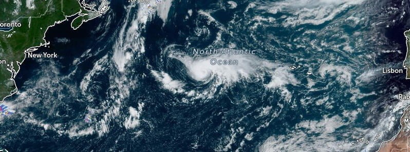
Featured image: Hurricane "Danielle" at 15:20 UTC on September 2, 2022. Credit: NOAA/GOES-East, Zoom Earth, The Watchers
Danielle became the first Atlantic hurricane of the season on September 2, 2022, after a remarkably long streak with no hurricane activity in the basin. This is the latest calendar year first Atlantic hurricane since Humberto on September 11, 2013.
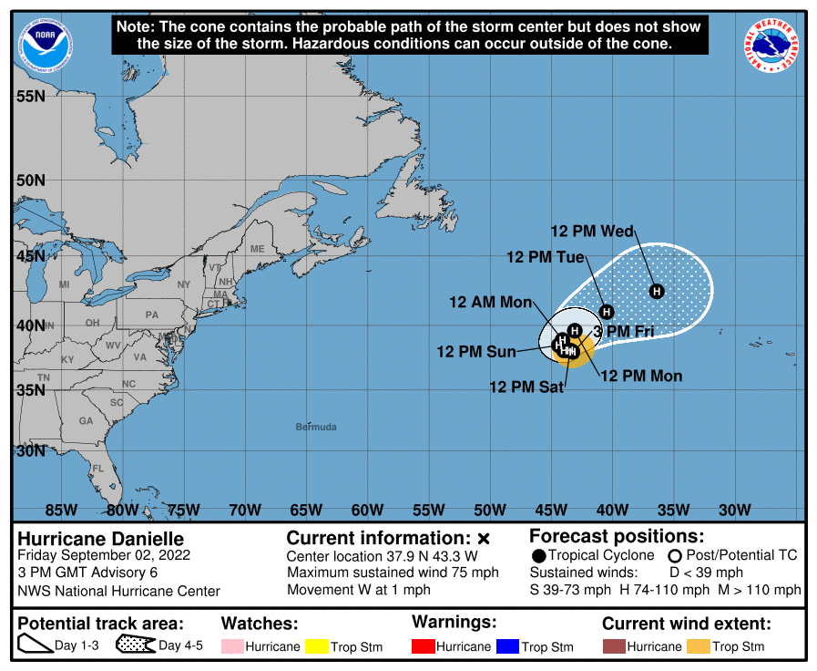
At 15:00 UTC on September 3, Danielle was located about 1 425 km (885 miles) W of the Azores.
It had maximum sustained winds of 120 km/h (75 mph), minimum central pressure of 992 hPa and was moving W at 2 km/h (1 mph).1
The hurricane is forecast to meander over the open Atlantic during the next couple of days, then slowly turn toward the northeast early next week.
Some additional strengthening is forecast during the next couple of days.
There are currently no hazards affecting land.
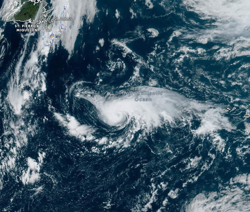
A ragged eye is evident in conventional satellite imagery, and deep convection surrounds much of the northern and western portions of the circulation, NHC forecaster Reinhart noted.2
“Atmospheric and oceanic conditions appear generally favorable for some additional strengthening during the next couple of days. The hurricane will meander over 27 °C sea surface temperatures in an environment of light to moderate deep-layer shear.
“Danielle is a higher-latitude storm, and so there is the potential for some mid-level dry air entrainment that could briefly disrupt the cyclone’s organization. The latest intensity guidance consensus still favors some additional strengthening through Sunday.”
“After 72 h, weakening is expected to commence as Danielle gains latitude and moves over cooler waters while it encounters more deep-layer shear within the mid-latitude westerlies,” Reinhart said.
“Although the 12-hr motion of Danielle has been an easterly drift, the hurricane appears to have become nearly stationary this morning. The cyclone will likely continue to meander over the central Atlantic during the next couple of days under the influence of a blocking high pressure ridge. This feature is forecast to weaken by early next week, which should allow Danielle to begin moving northeastward by 72 h and accelerate deeper into the mid-latitudes on days 4 to 5. “
References:
1 BULLETIN – Hurricane Danielle Advisory Number 6 – NWS National Hurricane Center Miami FL – 300 PM GMT Fri Sep 02 2022
2 Hurricane Danielle Discussion Number 6 – NWS National Hurricane Center Miami FL – 300 PM GMT Fri Sep 02 2022
I'm a dedicated researcher, journalist, and editor at The Watchers. With over 20 years of experience in the media industry, I specialize in hard science news, focusing on extreme weather, seismic and volcanic activity, space weather, and astronomy, including near-Earth objects and planetary defense strategies. You can reach me at teo /at/ watchers.news.
Commenting rules and guidelines
We value the thoughts and opinions of our readers and welcome healthy discussions on our website. In order to maintain a respectful and positive community, we ask that all commenters follow these rules.