
Extremely dangerous coastal surge expected as Hurricane “Agatha” makes landfall in Oaxaca, Mexico
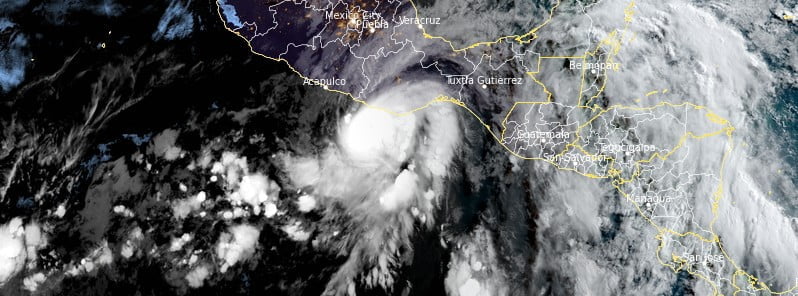
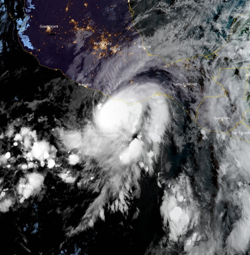
Featured image: Hurricane "Agatha" at 12:30 UTC on May 30, 2022. Credit: NOAA/GOES-East, RAMMB/CIRA, The Watchers
Hurricane “Agatha” – the first named storm and the first hurricane of the 2022 Pacific hurricane season – is forecast to make landfall in the state of Oaxaca, Mexico this afternoon or evening (LT), May 30, 2022.
- Extremely dangerous coastal flooding from storm surge, accompanied by large and destructive waves, is expected near and the east of where Agatha makes landfall.
- Life-threatening hurricane-force winds are expected in portions of the hurricane warning area in Oaxaca, Mexico, starting midday and continuing through this evening. Tropical storm conditions have already begun along the coast of Oaxaca and will spread eastward within the warning area through today and tonight.
- Heavy rains associated with Agatha will continue over portions of southern Mexico through Tuesday. This will pose a threat of potentially life-threatening flash flooding and mudslides.
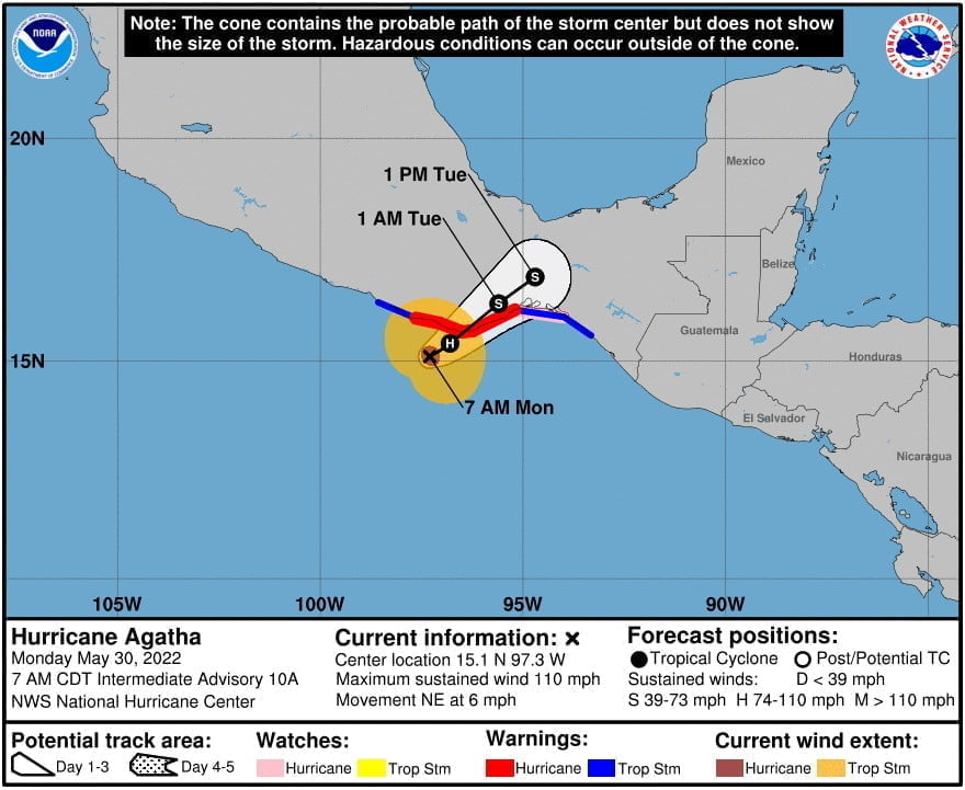
A Hurricane Warning is in effect for Salina Cruz to Lagunas de Chacahua and a Hurricane Watch for Salina Cruz eastward to Barra De Tonala. A Tropical Storm Warning is in effect for Salina Cruz eastward to Boca de Pijijiapan; and Lagunas de Chacahua westward to Punta Maldonado.
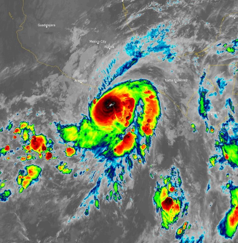
At 12:00 UTC on May 30, the center of Hurricane “Agatha” was located about 110 km (65 miles) SW of Puerto Angel, Mexico.1
Its maximum sustained winds were 175 km/h (110 mph) and minimum central pressure 964 hPa.
Agatha is moving toward the northeast near 9 km/h (6 mph), and this general motion is expected to continue through Tuesday.
On the forecast track, the center of Agatha will make landfall in the state of Oaxaca, Mexico, this afternoon or this evening (LT).
Little change in strength is expected today before Agatha reaches the coast of Oaxaca.
Rapid weakening is expected after landfall, and Agatha is forecast to dissipate over southeastern Mexico by late Tuesday.
Hurricane-force winds extend outward up to 40 km (15 miles) from the center and tropical-storm-force winds extend outward up to 150 km (90 miles).
“Agatha has another 12 hours or so to take advantage of warm 29 °C (84 °F) waters,” NHC forecaster Berg said at 09:00 UTC today.2
“However, the hurricane doesn’t seem to have been able to benefit from the waters during the previous 12 hours, and it’s not entirely clear if it will strengthen before landfall.
“One potential negative influence is the nearby coastal mountains of southern Mexico, which are likely to disrupt the low-level circulation of the relatively small hurricane. Nearly all of the intensity models show Agatha weakening immediately, but the NHC forecast will maintain a steady intensity up until landfall.”
References:
1 Hurricane Agatha – Intermediate Advisory Number 10A – NWS National Hurricane Center Miami FL EP012022 – 700 AM CDT Mon May 30 2022
2 Hurricane Agatha – Discussion Number 10 – NWS National Hurricane Center Miami FL EP012022 – 400 AM CDT Mon May 30 2022
I'm a dedicated researcher, journalist, and editor at The Watchers. With over 20 years of experience in the media industry, I specialize in hard science news, focusing on extreme weather, seismic and volcanic activity, space weather, and astronomy, including near-Earth objects and planetary defense strategies. You can reach me at teo /at/ watchers.news.
Commenting rules and guidelines
We value the thoughts and opinions of our readers and welcome healthy discussions on our website. In order to maintain a respectful and positive community, we ask that all commenters follow these rules.