
Remnants of Ida and Nora bring dangerous flash flood threats to U.S.
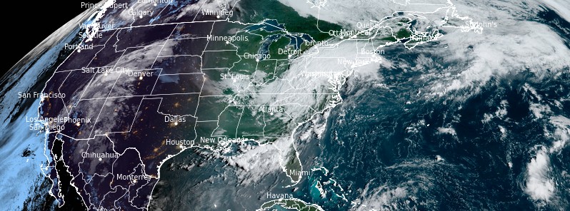
Image credit: NOAA/GOES-East, RAMMB/CIRA, TW. Acquired at 12:50 UTC on September 1, 2021
As the remnants of Tropical Cyclone "Ida" move into the northeast U.S., potentially life-threatening flash flooding is possible Wednesday into early Thursday, September 1 and 2, 2021, across portions of the Mid-Atlantic to Southern New England. In addition, there will be a threat of tornadoes in the Mid-Atlantic on Wednesday. A threat of flash flooding will also exist across the southwest U.S. as moisture from the remnants of Nora remain.
Tropical Depression Ida is forecast to slowly weaken and become a Post-Tropical Cyclone by Thursday morning, September 2 and move off the Northeast Coast.1
However, what's left of Ida2 will continue to produce heavy rain along the path into Thursday, prompting the Weather Prediction Center (WPC) to issue a High Risk of excessive rainfall from the northern Mid-Atlantic/Northeast through Thursday morning.
The associated heavy rain is likely to create widespread areas of flash flooding, including areas that don't normally experience flash floods.
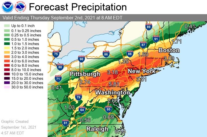
"Lives and property are in great danger through Thursday morning from the northern Mid-Atlantic/Northeast," NHC forecaster Ziegenfelder noted.
Furthermore, the Storm Prediction Center (SPC) has issued an Enhanced Risk of severe thunderstorms over parts of the Mid-Atlantic through Thursday morning. The hazards associated with these thunderstorms are frequent lightning, severe thunderstorm wind gusts, hail, and a few tornadoes.
What was once Ida will move from the Mid-Atlantic into New England by Thursday morning then move into the Canadian Maritime Provinces by Friday, September 3.


U.S. radar image acquired at 13:10 UTC on September 1, 2021. Credit: NWS
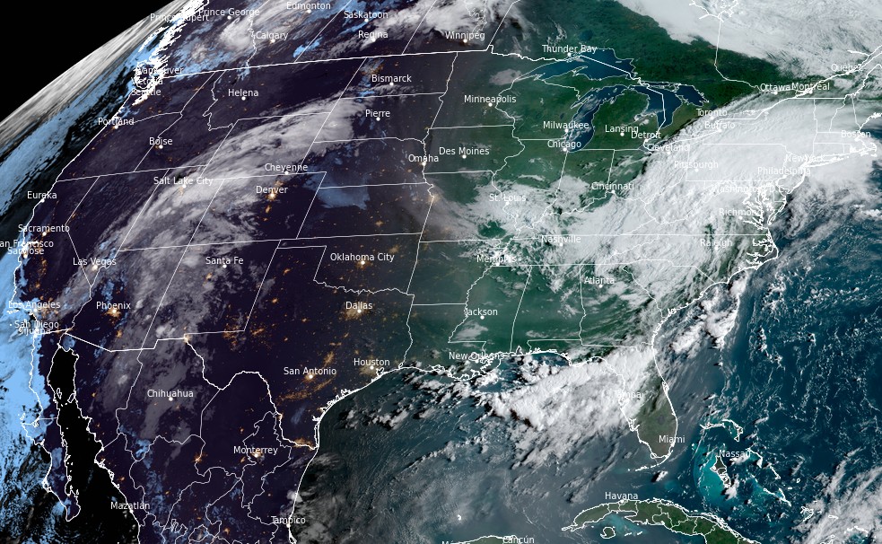
Image credit: NOAA/GOES-East, RAMMB/CIRA, TW. Acquired at 12:50 UTC on September 1, 2021
In addition, moisture associated with what was once Tropical Cyclone "Nora"3 will move over the Southwest into parts of the Great Basin and Central/Southern Rockies on Wednesday into Thursday, producing thunderstorms.
Therefore, the WPC has issued a Slight Risk of excessive rainfall with these thunderstorms. The associated heavy rain will create mainly localized areas of flash flooding, with urban areas, roads, and small streams the most vulnerable through Thursday morning.
References:
1 Short Range Forecast Discussion – NWS Weather Prediction Center College Park MD – 352 AM EDT Wed Sep 01 2021
2 Articles tagged "hurricane ida" – The Watchers
3 Hurricane "Nora" hits Mexico with very heavy rains, leaving at least 1 person dead – The Watchers
The Watchers team and our contributors bring the latest on extreme weather, earthquakes, volcanic eruptions, space weather, and all things science. We're all about making sense of the natural world and keeping you informed on what’s happening. Got a tip or a question? Hit us up using the form at newstips!
Commenting rules and guidelines
We value the thoughts and opinions of our readers and welcome healthy discussions on our website. In order to maintain a respectful and positive community, we ask that all commenters follow these rules.