
Veniaminof volcano alert level raised after sensors detect small explosion, Alaska
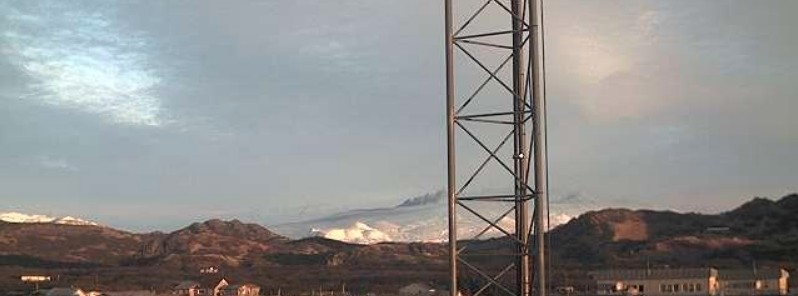
Image credit: Perryville NW FAA webcam
The Alaska Volcano Observatory (AVO) has raised the Volcano Alert Level to Watch and the Aviation Color Code to Orange for Veniaminof volcano at 18:04 UTC on March 4, 2021. The last time this volcano erupted was in 2018 (VEI 1).
According to Volcano Observatory Notice for Aviation (VONA) issued by AVO at 18:04 UTC, regional infrasound sensors detected a small explosion at Veniaminof volcano at 14:13 UTC (05:13 LT).
Satellite and webcam views indicated low-elevation (< 3 km / 10 000 feet a.s.l.) ash emissions heading in the SSE direction, and minor ash deposits are visible at the volcano.
As a result, AVO has raised the Aviation Color Code to ORANGE and the Volcano Alert Level to WATCH.
The local seismic data remains offline due to an outage of a satellite link at Port Heiden. However, the AVO continues to monitor Veniaminof with satellite and webcam data and remote infrasound, seismic and lightning networks.
Eruptive activity at the volcano usually consists of minor ash emissions, lava fountaining, and lava flows from the small cone in the summit caldera.
Ash emissions are typically confined to the summit crater, but larger events can result in ashfall in nearby communities and drifting airborne ash.
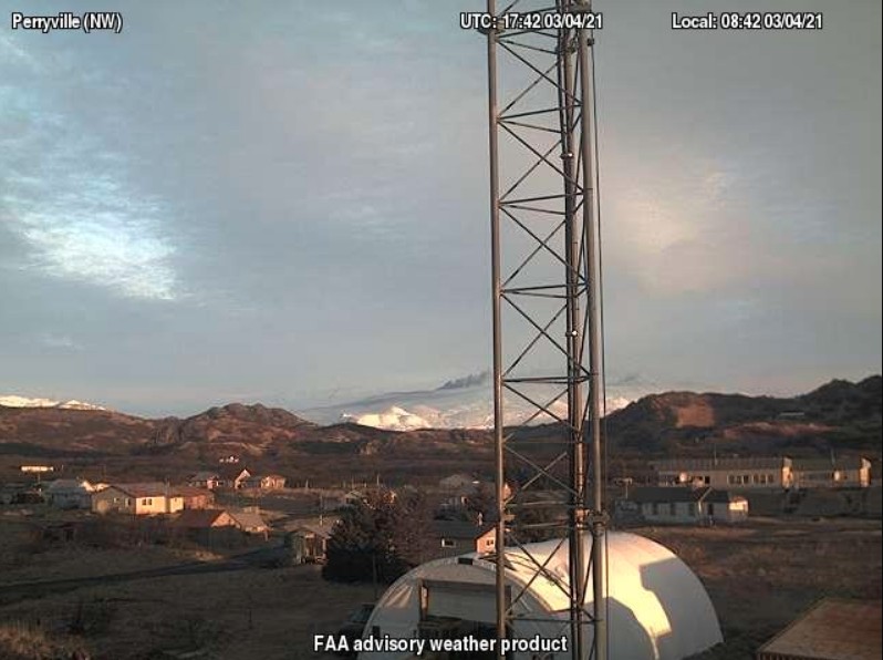
Mount Veniaminof with ashy eruption plume, March 4, 2021. Photo from the FAA Perryville NW webcamera.
Geological summary
Veniaminof, on the Alaska Peninsula, is truncated by a steep-walled, 8 x 11 km (5 x 6.8 miles), glacier-filled caldera that formed around 3 700 years ago. The caldera rim is up to 520 m (1 706 feet) high on the north, is deeply notched on the west by Cone Glacier, and is covered by an ice sheet on the south.
Post-caldera vents are located along a NW-SE zone bisecting the caldera that extends 55 km (34 miles) from near the Bering Sea coast, across the caldera, and down the Pacific flank.
Historical eruptions probably all originated from the westernmost and most prominent of two intra-caldera cones, which rises about 300 m (984 feet) above the surrounding icefield. The other cone is larger, and has a summit crater or caldera that may reach 2.5 km (1.5 miles) in diameter, but is more subdued and barely rises above the glacier surface.
I'm a dedicated researcher, journalist, and editor at The Watchers. With over 20 years of experience in the media industry, I specialize in hard science news, focusing on extreme weather, seismic and volcanic activity, space weather, and astronomy, including near-Earth objects and planetary defense strategies. You can reach me at teo /at/ watchers.news.
Commenting rules and guidelines
We value the thoughts and opinions of our readers and welcome healthy discussions on our website. In order to maintain a respectful and positive community, we ask that all commenters follow these rules.