
Hurricane “Lorenzo” – Hurricane and Tropical Storm Warnings issued for the Azores
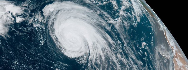
Featured image: Hurricane "Lorenzo" at 15:30 UTC on September 30, 2019. Credit: NOAA/GOES-East
Hurricane "Lorenzo," once record-breaking Category 5 hurricane, maintains its strength as it heads toward the Azores and the United Kingdom. Hurricane and Tropical Storm Warnings are now in effect for the Azores. Lorenzo is expected to bring hurricane and tropical-storm-force winds to the Azores beginning Tuesday night, and these conditions will continue into Wednesday. Large swells generated by Lorenzo will continue to spread across much of the North Atlantic basin during the next few days. These swells will produce life-threatening surf and rip currents.
At 15:00 UTC (11:00 AST) on September 30, Lorenzo's center was located about 1 685 km (1 050 miles) WSW of the Azores. Its maximum sustained winds were 165 km/h (105 mph), placing Lorenzo on the upper edge of Category 2 hurricane.
The system had minimum central pressure of 962 hPa and was moving NNE at 24 km/h (15 mph).
The Portuguese Institute for the Sea and the Atmosphere has issued a Hurricane Warning for the central and western Azores, including the islands of Flores, Corvo, Faial, Pico, Sao Jorge, Graciosa, and Terceira. The Institute has also issued a Tropical Storm Warning for the eastern Azores, including the islands of Sao Miguel and Santa Maria.
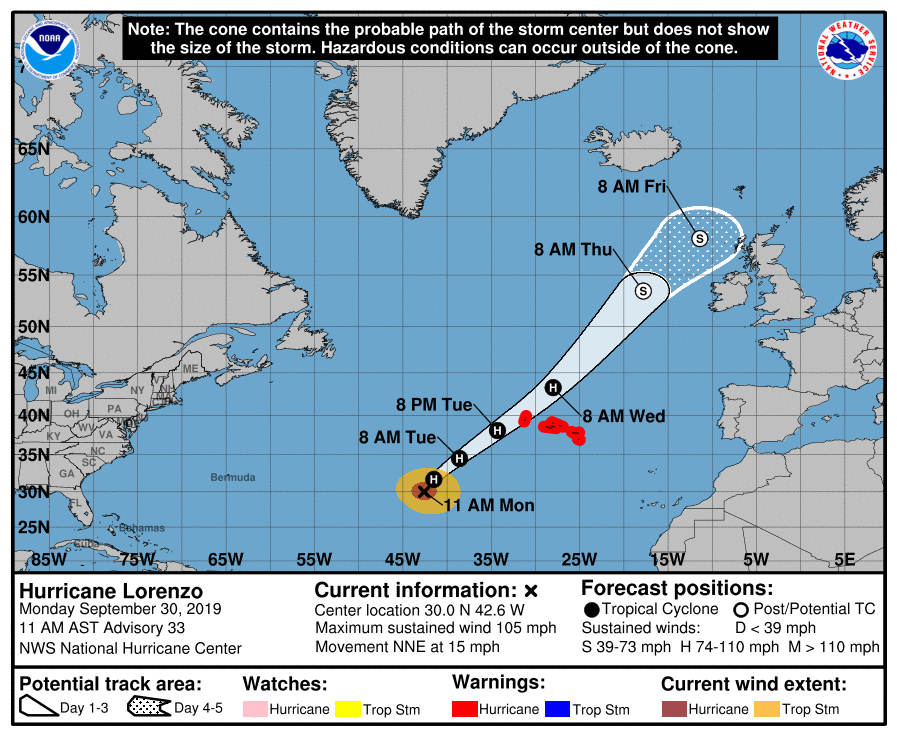
A turn to the northeast is expected later today, with an increasing forward speed tonight through Wednesday, October 2.
On the forecast track, the center of Lorenzo is expected to pass near the western Azores early on Wednesday, while gradually weakening. Lorenzo is expected to transition to an extratropical low by Thursday.
This is a large hurricane, with hurricane-force winds extending outward up to 150 km (90 miles) from the center and tropical-storm-force winds extending outward up to 405 km (255 miles).
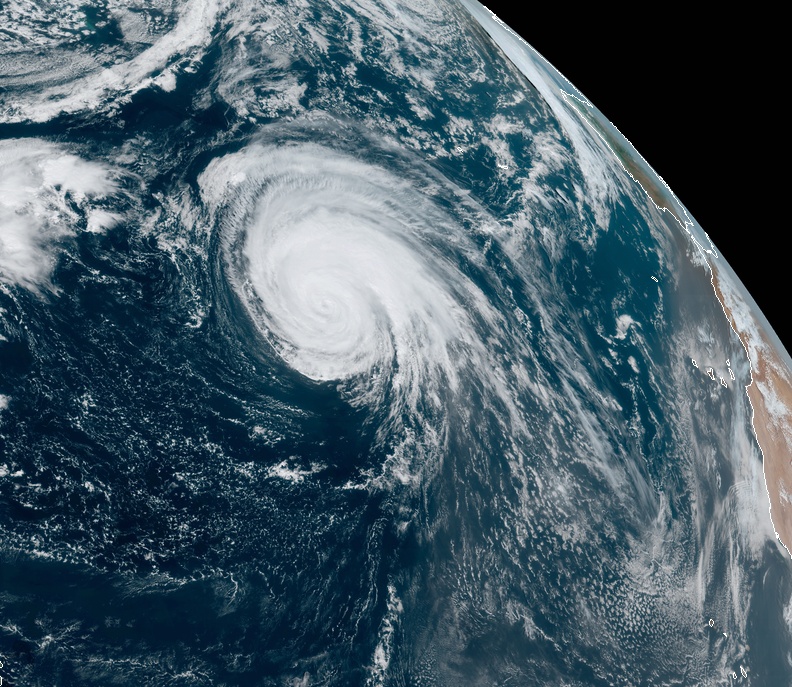
Hurricane "Lorenzo" at 15:30 UTC on September 30, 2019. Credit: NOAA/GOES-East
Hurricane conditions are expected within the hurricane warning area early Wednesday morning, with tropical storm conditions beginning Tuesday night. Tropical storm conditions are expected in the tropical storm warning area by early Wednesday
Lorenzo is expected to produce total rain accumulations of 50 to 100 mm (2 to 4 inches) over much of the western Azores and around 25 mm (1 inch) over the central Azores Tuesday and Wednesday. This rainfall could cause life-threatening flash flooding in the western Azores.
Swells generated by Lorenzo are spreading across much of the North Atlantic basin. These swells are likely to cause life-threatening surf and rip current conditions.
Lorenzo has pushed seasonal Atlantic Accumulated Cyclone Energy over above-average NOAA season threshold definition (e.g., 111 ACE). All that is needed to officially define 2019 as an above-average hurricane season is 1 more named storm (almost a certainty with 2 months to go), CSU meteorologist Dr. Philip Klotzbach said.
Here are some more interesting statistics provided by Dr. Klotzbach:
Lorenzo is now a Category 2 hurricane. It was a major (Category 3+) hurricane for 3.5 days. All of its time as a major hurricane was spent at or east of 45°W. This shatters old Atlantic record of 1.75 days as a major hurricane <=45°W set by Carrie in 1957.
By September 29, Lorenzo has surpassed Humberto for 2nd place for 2019 Atlantic Accumulated Cyclone Energy by a hurricane. However, Dorian will retain the top spot, since Lorenzo will become post-tropical in 4-5 days.
2019 is the 7th Atlantic hurricane season on record with at least 2 Category 5 hurricanes. Other years are 1932, 1933, 1961, 2005, 2007, and 2017. 2019's Category 5 hurricanes are Dorian and Lorenzo.
Lorenzo's central pressure of 925 hPa is the lowest by any Atlantic #hurricane east of 50°W on record. Prior record was 933 hPa by Edouard (1996), Gert (1999) and Igor (2010).
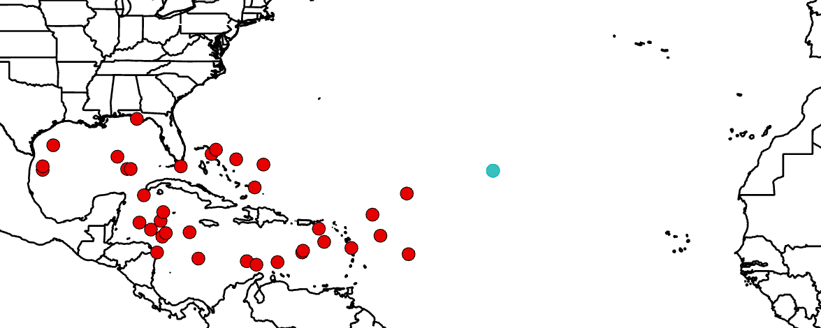
Image credit: Philip Klotzbach
I'm a dedicated researcher, journalist, and editor at The Watchers. With over 20 years of experience in the media industry, I specialize in hard science news, focusing on extreme weather, seismic and volcanic activity, space weather, and astronomy, including near-Earth objects and planetary defense strategies. You can reach me at teo /at/ watchers.news.
Commenting rules and guidelines
We value the thoughts and opinions of our readers and welcome healthy discussions on our website. In order to maintain a respectful and positive community, we ask that all commenters follow these rules.