
Öræfajökull caldera deepens 20 m (65 feet), geothermal heat in the area, Iceland
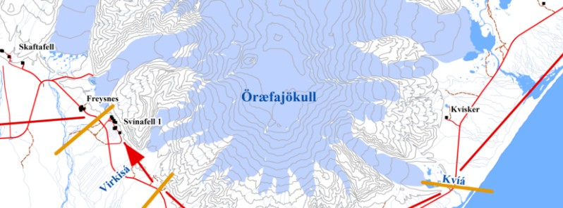
Image credit: Iceland's Department of Civil Protection
On November 17, 2017, a pilot flying over Öræfajökull volcano in Iceland noticed a new ice-caldron within the volcano's caldera. Now, volcanologists say the situation is far from normal.
Volcanologist Ármann Höskuldsson says that the situation at Öræfajökull volcano is far from normal.
The caldera has deepened by 20 meters (65 feet) and crevasses have become larger since it was first spotted, according to 3D image made by Geological Institute of the University of Iceland. In addition, a geothermal heat has been detected in the area.
"We see a greatly increased pattern of fissures around the caldera. It's now more of a drop shape than a circle, lengthening towards the South West," Ingibjörg Jónsdóttir of the University of Iceland told Morgunblaðið today.
The last eruptive episode of this volcano started on August 3, 1727, and ended on May 1, 1728 (± 30 days). It had Volcanic Explosivity Index of 4 (on a scale of 1 – 7) and was responsible for deaths of three people.
Before that, the volcano started erupting on June 5, 1362 (± 4 days) and stopped on October 15, 1362 (± 45 days). This one had Volcanic Explosivity Index of 5 and was Iceland's largest historical explosive eruption. The volcano ejected huge amounts of tephra and destroyed the district of Litla-Hérað by floods and tephra fall. More than 40 years passed before people again settled the area, which became known as Öræfi.
In light of increased activity at the volcano, the Department of Civil Protection in Iceland has created an evacuation plan for the Öræfajökull volcano.
Emergency evacuation plan for Öræfajökull
In the event of a volcanic eruption in Öræfajökull the aim is to have evacuated the area before an eruption starts. If an eruption starts without any warning the following emergency procedures will be followed.
Department of Civil Protection and Emergency Management:
- Ensures that the 112 call centre sends the following text messages to cell phones in the area between Lómagnúpur and Jökulsárlón:
- "Emergency message from the Police. Volcanic eruption is imminent in Öræfajökull. Evacuate to Svínafell 1, Hof 1 or Hnappavellir 1, Höfn or Kirkubæjarklaustur depending on your location."
- Activate the National Crisis Coordination Centre
Police in South Iceland:
- Sends a police cruiser from Kirkjubæjarklaustur to Skaftafell to assist with evacuations.
- Sends a police cruiser from Höfn to Kvísker to assist with evacuations.
- Sends all available resources to assist with the evacuations.
Volunteer rsecue teams:
- ICE-SAR Kyndill at Kirkjubæjarklaustur sets up a roadblock at Lómagnúpur and assists with evacuations.
- ICE-SAR Hornafjörður sets up a roadblock at Jökulsárlón and assists with evacuations.
- ICE-SAR Kári does not have any tasks in this emergency plan.
Ambulances:
- Ambulance from Kirkjubæjarklaustur is stand-by at Hótel Núpar.
- Ambulance from Höfn is stand-by at Hrollaugsstaðir.
Red Cross:
- The chapter at Kirkjubæjarklaustur opens up a mass care centre at Kirkjubæjarklaustur.
- The chapter at Höfn opens up a mass care centre at Höfn
- Opening up mass care centres nearer to the evacuation areas will be considered.
Fire brigades:
- Are stand-by to assist in mass care centres.
- Are stand-by to assist with evacuations.
On scene command:
- On scene command at Kirkjubæjarklaustur activated.
- On scene command at Höfn activated.
- On scene command in Öræfasveit activated, location based on conditions.
Area command:
- At Dynskálar 34, Hella.
Nationa Crisis Coordination Centre:
- Rescue Centre Skógarhlíð, Skógarhlíð 14, Reykjavík.
Instructions for people who are within the evacuation area in the case of an evacuation:
- Taket he quickest route to: Svínafell 1, Hof 1, or Hnappavellir 2
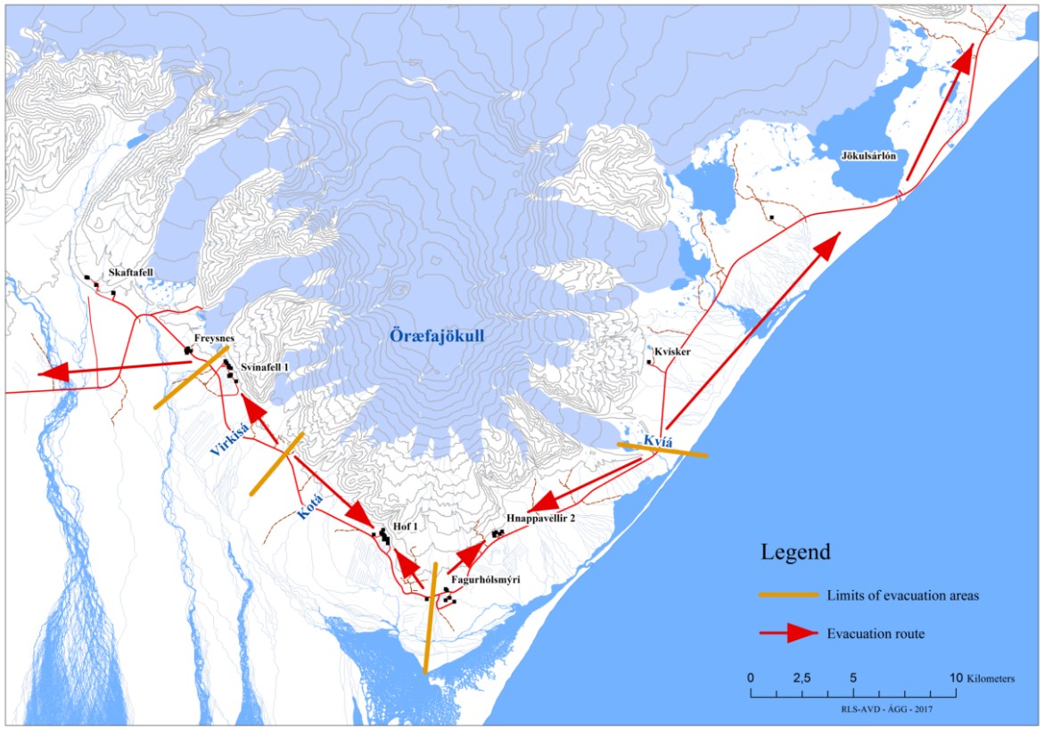
Evacuation plan for Öræfajökull. Credit: Iceland's Department of Civil Protection
- Wait in your car for further instructions
- If volcanic ash / volcanic tephra starts falling you should seek shelter in the nearest building
- Follow further instructions when they are issued
Geological summary
Öraefajökull, Iceland's highest peak, is a broad glacier-clad central volcano at the SE end of the Vatnajökull icecap. A 4 x 5 km (2.5 x 3 miles) subglacial caldera truncates the summit of the dominantly basaltic and rhyolitic volcano. The extensive summit icecap is drained through deep glacial valleys dissecting the SW-to-SE flanks. The largest-volume volcano in Iceland, 2119-m-high (6 962 feet) Öraefajökull was mostly constructed during Pleistocene glacial and interglacial periods.
Holocene activity has been dominated by explosive summit eruptions, although flank lava effusions have also occurred. A major silicic eruption in 1362 CE was Iceland's largest historical explosive eruption. It and another eruption during 1727-28 were accompanied by major jökulhlaups (glacier outburst floods) that caused property damage and fatalities. (GVP).
I'm a dedicated researcher, journalist, and editor at The Watchers. With over 20 years of experience in the media industry, I specialize in hard science news, focusing on extreme weather, seismic and volcanic activity, space weather, and astronomy, including near-Earth objects and planetary defense strategies. You can reach me at teo /at/ watchers.news.
Commenting rules and guidelines
We value the thoughts and opinions of our readers and welcome healthy discussions on our website. In order to maintain a respectful and positive community, we ask that all commenters follow these rules.