
Alert level for Agung volcano raised to 3 (of 4), Bali, Indonesia
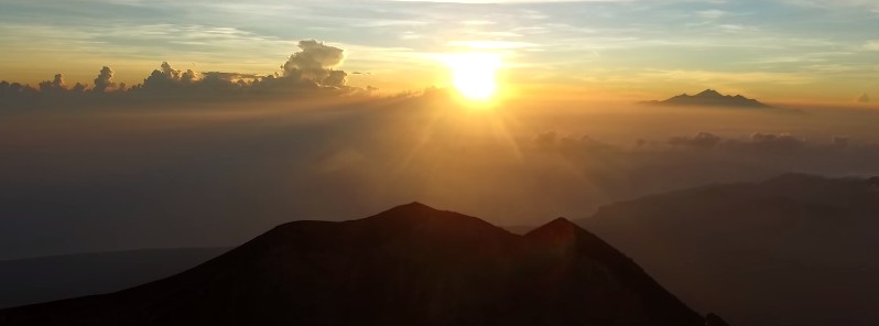
Image credit: Agung Volcano by Jiří Hruška
The Alert Level for Agung volcano in Karangasem district of the Indonesian province of Bali was raised from 2 to 3 (of 4) on September 18, 2017, following a sharp increase in volcanic earthquakes on September 17. Authorities raised the alert to 2 on September 14, after an increase in earthquakes first detected on September 13. The last eruption of this volcano started in February 1963 and ended in January 1964. It was one of the world's largest eruptions of the 20th century, with Volcanic Explosivity Index (VEI) of 5.
Authorities warned communities around Agung and climbers/visitors/tourists not to approach the crater of Mount Agung within 6 km (3.7 miles) or at elevations above 950 m (3 116 feet) above sea level. All community activities within 7.5 km (4.6 miles) to the north, southeast, and south-southwest should stop immediately.
Residents are asked to remain calm while maintaining vigilance and not to trust unverified sources.
The map below shows distaster-prone region of Mount Agung. There are about 80 000 people living in the dangerous area.
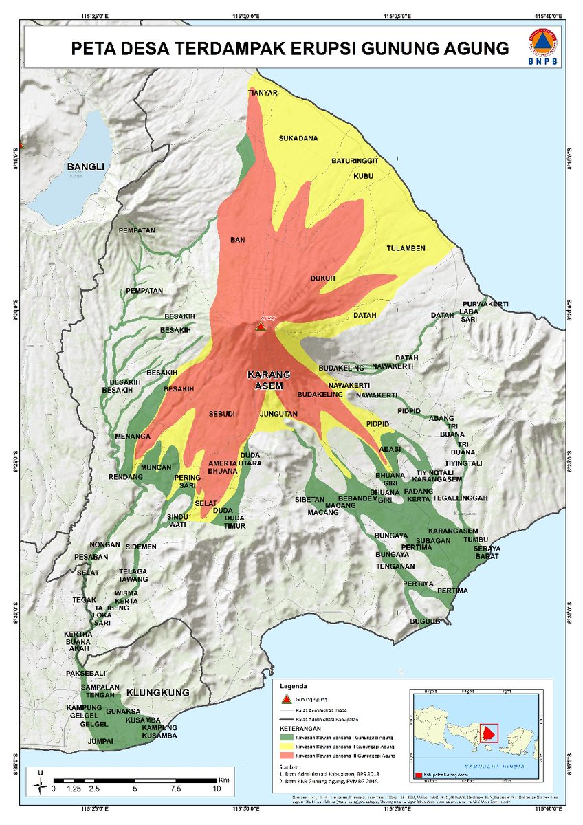
Credit: PNPB, Sutopo Purwo Nugroho
Nearby residents have been told to prepare for evacuation. The Bali Provincial Regional Disaster Management Agency and Karangasem Regency have been told to develop contingency plans for the worst possible scenario of an eruption.
Seismicity at the volcano started rising on September 13 and was followed by a sharp increase on September 15, 16 and especially 17.
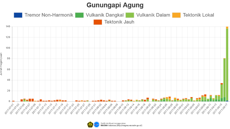
"Actually volcanic tremors have already happened since in the middle of August, 2017 but they then vanished before emerging again and since early in September it has continued to increase," Gede Suantika, the head of volcanic mitigation of the Volcanology and Geological Disaster Mitigation Center of the Geological Agency of the Ministry of Energy and Mineral Resources, said on Sunday.
The last eruptive phase of this volcano started on February 18, 1963, with a column as high as 10 km (32 808 feet), and ended on January 27, 1964. It had Volcanic Explosivity Index (VEI) of 5.
This was one of the world's largest eruptions of the 20th century. It produced voluminous ashfall along with devastating pyroclastic flows and lahars that caused extensive damage and some 1 100 fatalities.
Geological summary
Symmetrical Agung stratovolcano, Bali's highest and most sacred mountain, towers over the eastern end of the island. The volcano, whose name means " Paramount," rises above the SE caldera rim of neighboring Batur volcano, and the northern and southern flanks of Agung extend to the coast.
The 3142-m-high (10 308 feet) summit contains a steep-walled, 500-m-wide (1 640 feet), 200-m-deep (656 feet) crater. The flank cone Pawon is located low on the SE side.
Only a few eruptions dating back to the early 19th century have been recorded in historical time. The 1963-64 eruption, one of the world's largest of the 20th century, produced voluminous ashfall along with devastating pyroclastic flows and lahars that caused extensive damage and many fatalities. (GVP)
I'm a dedicated researcher, journalist, and editor at The Watchers. With over 20 years of experience in the media industry, I specialize in hard science news, focusing on extreme weather, seismic and volcanic activity, space weather, and astronomy, including near-Earth objects and planetary defense strategies. You can reach me at teo /at/ watchers.news.
Commenting rules and guidelines
We value the thoughts and opinions of our readers and welcome healthy discussions on our website. In order to maintain a respectful and positive community, we ask that all commenters follow these rules.