
Alert level for Aoba (Ambae) volcano raised, Vanuatu
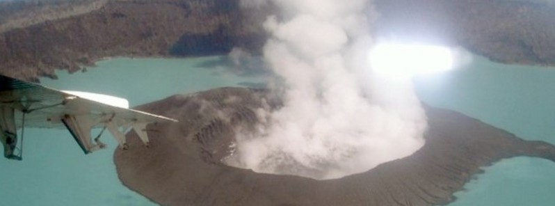
Image credit: Photo by Job Eassau, 2006 (courtesy of Esline Garaebiti, Dept of Geology, Mines, and Water Resources, Port Vila).
Volcanic activity at Aoba volcano, also known as Ambae, continues to increase, the Vanuatu Geohazards Observatory (VGO) reported September 6, 2017, and raised the Volcanic Alert Level for the volcano from Level 2 to Level 3 (on a scale of 0 – 4). This means that the volcano is in a minor eruption state.
At this Alert Level, the volcanic activity is likely to continue to increase or decrease to its normal level of unrest at any time. The area of risk is within 3 km (1.8 miles) around the volcano and areas that expose to trade winds.
With this situation, villages and communities of Ambae Island, especially those in the prevailing trade winds direction can expect volcanic gas, ash falls and acid rain that may cause foliage fumigation hence damage garden crops.
It’s very important that communities, villages, visitors and travel agencies seriously consider this information, VGO warns.
The Alert Level for Aoba was raised to 2 on August 21, 2016, signifying increased unrest. At the time, VGO reminded residents and tourists that hazardous areas were near and around the Manaro lakes.
The last known eruption of this volcano took place in 2011.
The Vanuatu Meteorology and Geohazards Department will continue to closely monitor the volcano. More information will be provided as soon as necessary.
Geological summary
Aoba, also known as Ambae, is a massive 2 500 km3 (600 mi3) basaltic shield volcano that is the most voluminous volcano of the New Hebrides archipelago. A pronounced NE-SW-trending rift zone dotted with scoria cones gives the 16 x 38 km (10 x 23.6 miles) island an elongated form.
A broad pyroclastic cone containing three crater lakes is located at the summit of the Hawaiian-style shield volcano within the youngest of at least two nested calderas, the largest of which is 6 km (3.7 miles) in diameter. Post-caldera explosive eruptions formed the summit craters of Lake Voui (also spelled Vui) and Lake Manaro Ngoru about 360 years ago. A tuff cone was constructed within Lake Voui about 60 years later.
The latest known flank eruption, about 300 years ago, destroyed the population of the Nduindui area near the western coast. (GVP)

Teo Blašković founded The Watchers in 2011 and edited it until 2026, covering seismic and volcanic activity, extreme weather, space weather and near-Earth objects. Articles on this page are his archive.
Published in the last 24 hours
- The storms drenching California this week are fed by a river in the sky, a band of water vapor that can carry up to 15 times the flow of the Mississippi River, and this winter’s near-record El Niño could keep aiming more of them at the West Coast
- Malawi continues Bris AI weather forecasting tests ahead of operational integration Epicenter
- Right about now, Voyager 1 is crossing a line no human-made object has ever reached, a full light-day from Earth, which means a message NASA sends tonight won't arrive until tomorrow night, and the spacecraft's answer won't make it home until the night after that
- G1 geomagnetic storm watch remains in effect as NOAA forecasts Kp 4.67 late on November 17 and early on November 18
